nolefan5311 wrote:VIc,
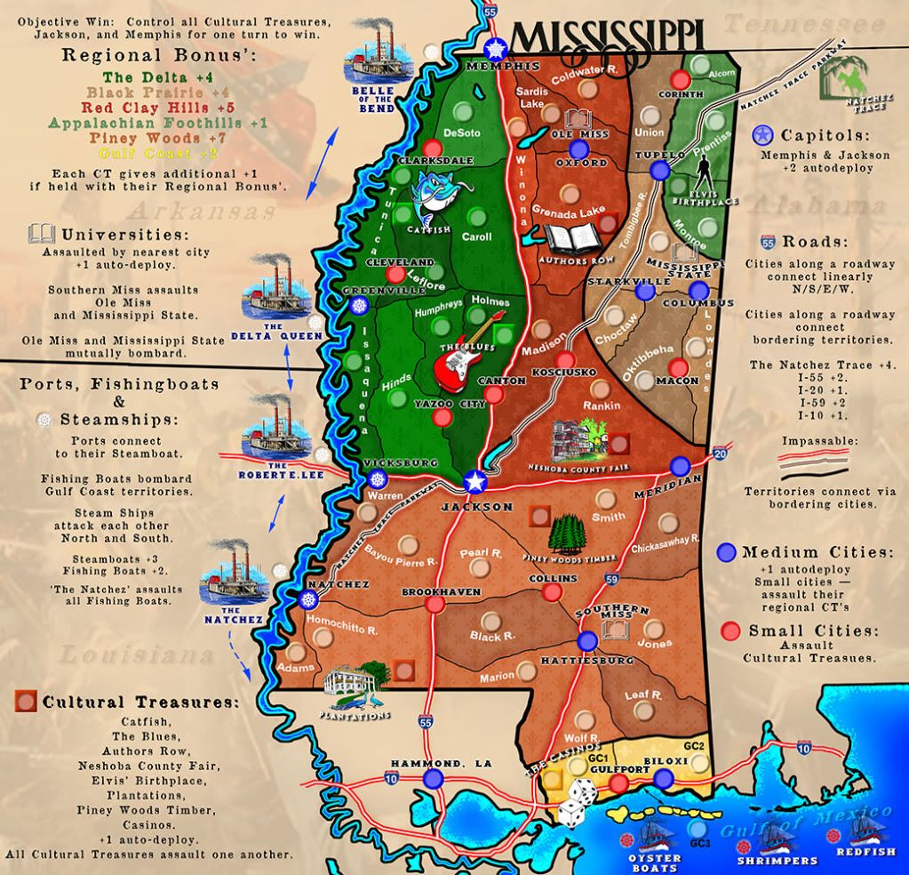
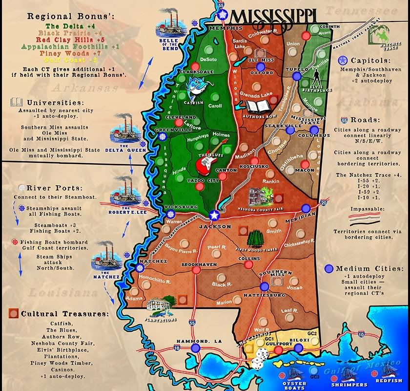
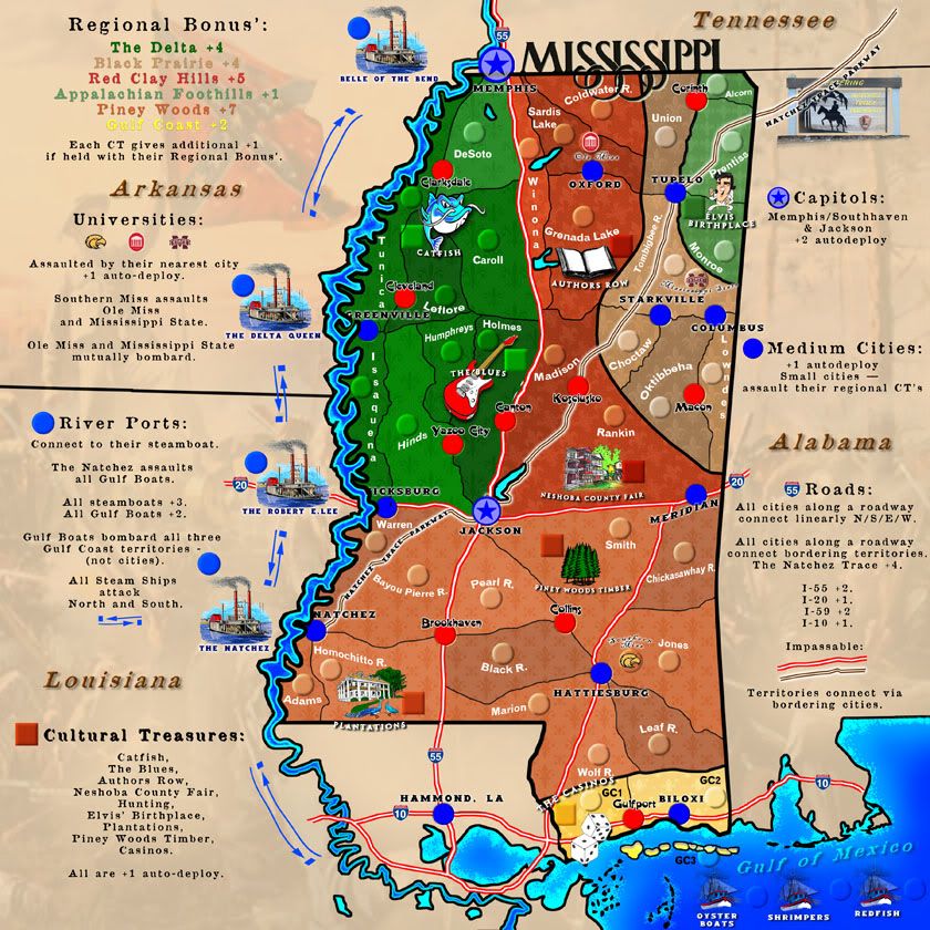
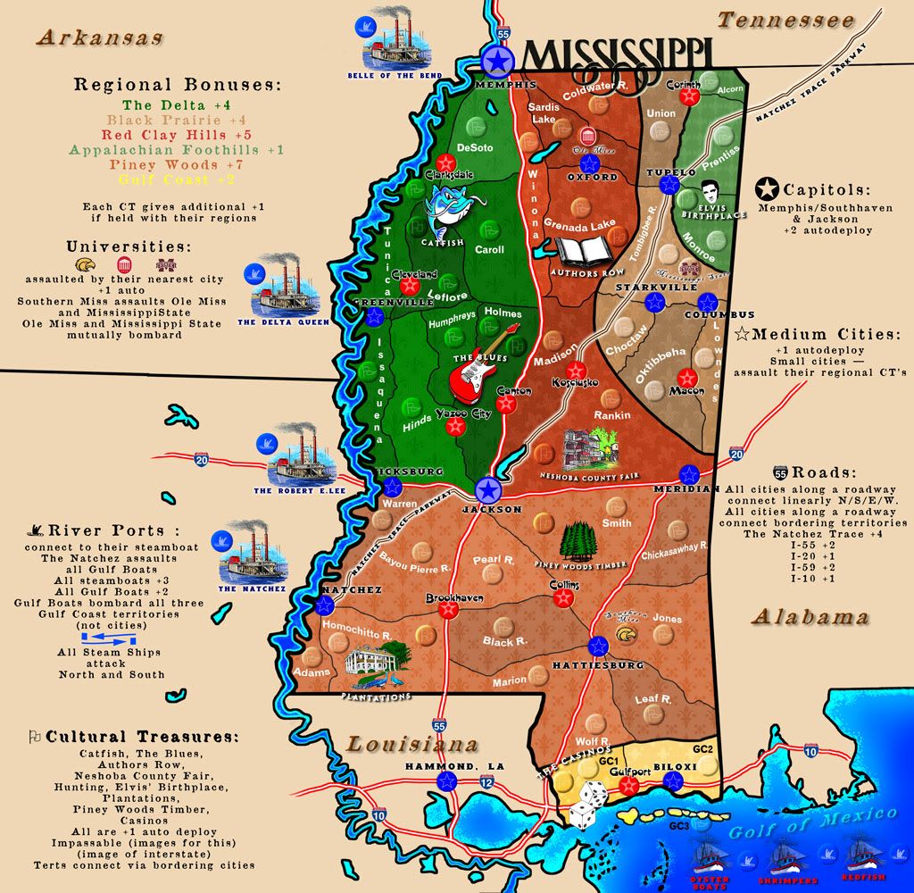
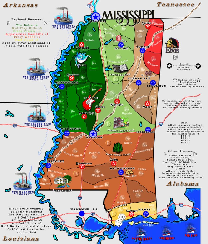
I have a couple of suggestions on some changes before I can begin running the bonus spreadsheets because I'm a little confused on what territories are part of what bonuses: cities like Cleveland, Clarksdale, Canton, Yazoo City, Brookhaven...what bonuses are these a part of? They are obviously not medium sized cities or Capitals, but the font on those cities is different than the normal territories. It needs to be clarified a little.
Done
nolefan5311 wrote:Also, I suggest, for the interstate bonuses, to use the interstate symbol for ALL regions that are included in those bonuses. Take I20 for instance...I'm not sure if Vicksburg, Jackson, and Meridian are all included in that bonus (because I20 runs through all of those cities). Does I55 include Canton, Jackson, Brookhaven, and Hammond, LA? I can't even see the I59 route at all...is this notated anywhere? Honestly, other than the Natchez Trace Pkwy, I would suggest getting rid of the interstate bonuses completely. They aren't specific to Mississippi and I think they just add to the "clutter" and confusion of the bonus system. And Jackson appears to be included in all of them. I'm not saying you HAVE to get rid of them, but as is, it's very confusing.
You raise good points. Here's my rejoinder:
1) "Use the interstate symbol for all regions including in the bonus." If we do that, we lose other bonuses that are important for the gameplay I've designed. The interstate symbol, running through the cities, is clear. Perhaps writing in the legend: "Cities are part of an interstate bonus if they intersect an interstate" would make it crystal.
2) "Does I55 include"...if it intersects with 55, it includes it. If it doesn't, it doesn't.
3) "I can't even see the 59 route"...yes, because we're stupid and never included it.

Will be corrected on the next update.
4) "I would suggest getting rid of the interstate bonuses completely"... the interstates really are important to Mississippi. We don't have many paved roads...and only got interstates under the Katrina evacuation plans of 2006. So I'd really like to keep those. I think they'll make gameplay more enjoyable. We can always cut it out later but if we can keep them in for now, it'd be nice to have unless absolutely necessary. Also, regarding the "clutter," that would go away
if we would actually be granted the supersized status we originally requested and for which we were originally told, "Yes, if you change X and Y," which we did. Then got reneged on.

Sorry, I can't drop this. When the same complaint of "confusion" and "clutter" pop up, and that's the very reason I asked for supersized for to begin with (1) a worthy map (2) with lots to it, rather than just being dumb and big (3) should be granted supsersized, no?
nolefan5311 wrote:The Steamboats I think should border the Fishing Boats, instead of just attacking them. This would facilitate movement across the map.
"Border"? I don't really know what you mean. If you mean, "Move them to the Gulf" that doesn't work because of...wait for it...small space. (See above under #4.) Only ONE steamboat assaults the fishing boats. When it comes to gameplay, this will make it impossible to hole-up in the Gulf and will mean the Gulf player will have two fronts with which to contend. An easy bonus (the Gulf ships) to get, a hard one to keep. Same thing with the Gulf Coast bonus: easy to get, hard to keep, because it can be bombarded by the Gulf ships. Not to mention: steamboats were used on the river (the power of going against the stream). Moreover, we still have them on the river here for the silly tourists.
nolefan5311 wrote:Also, the legend uses the word "Steamships". For consistency, this needs to be changed to Steamboats.
Yep. I blame George Bush.
nolefan5311 wrote:The Appalachian Foothills...the only way to attack in and out of this region is Tupelo > Kosciusko? I know it's only a +1, but it's 8 regions. Was this intentional?
Wrong, but good eye. Tupelo AND Corinth (the red city), which needs to be moved (just noticed this now) so as to make clear that both Tupelo and Corinth are access points, i.e., there are two spots to defend the Foothills.
nolefan5311 wrote:If you add in the cultural treasure, it becomes a +2.
Sort of correct. It's a +1 for the region of the Foothills. Then it's an auto +1 for Tupelo. Then it's an auto +1 for the CT (cultural treasure). Thus, you have 2 spots to defend, only get a +1, but, if you have the cities and the CT as well (which aren't necessary to collect the foothills bonus), you'd have two spots to defend, get +3 total for controlling those regions, but in games with chained or adjacent reinforcements, you can't just overload the checkpoints like you could in unlimited. Even if you played unlimited, there are two check points and would only get, max, +3 bonus and at least a +3 for tert count. That's not much when you have to split it two ways. It works.
nolefan5311 wrote:Similarly, if I'm reading the impassables correctly, the only way into Red Clay Hills continent is via Canton. Kosciusko, Jackson, and Meridian? Seems awfully easy to control those bonuses with the checkpoints.
You're forgetting Southern Miss: it directly assaults both Ole Miss and MSU. You're also forgetting Memphis, which is not placed correctly (again, George Bush). Memphis needs to be moved south, maybe enlarged a bit, in order to "bleed" into two zones: The Delta and Red Clay Hills. Thus, there are 6 regions a player would have as "chokepoints" to control the bonus firmly. It's only worth +5, with the autodeploys, more. But still, very hard to control.
Thanks for taking a serious look at it and offering real suggestions.


](./images/smilies/eusa_wall.gif "Brick wall")

