Page 15 of 19

PostPosted: Sat Dec 15, 2007 6:00 pm
by oaktown
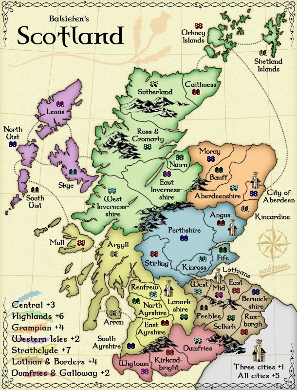
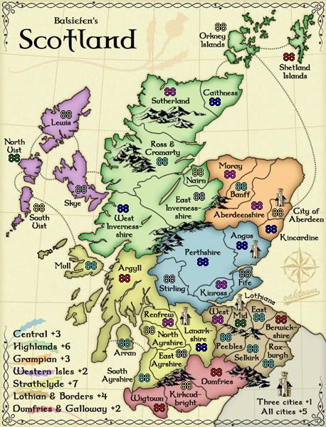
Balsiefen wrote:For army counts, as well as mull, could you put orkney, and north Uist onto the largest islands. (if there isn't space in north uist, could you move it under the territory name so its closer to the island)

Putting the counts on Uist and Orkney might be possible (though tight) on the large map, but next to impossible on the small map... I'd rather the two maps have army counts in the same place.

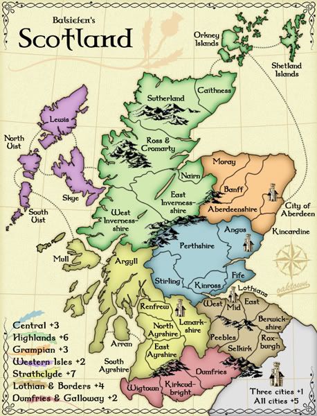
Coleman wrote:I like the mountains in Lothian & Borders most.

Yeah, those are the originals. I think I'll go with the originals, but clean up the few spots that look particularly bad.

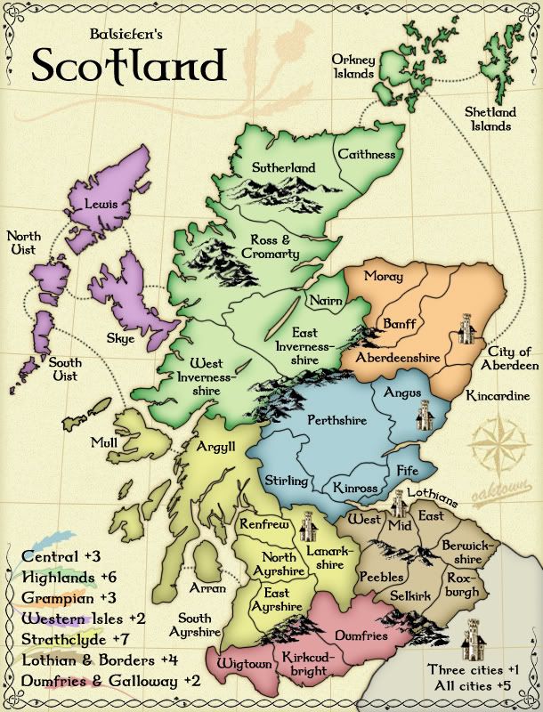
So, it sounds like the colors are mostly settled then? Yes? :-s

PostPosted: Sun Dec 16, 2007 2:55 am
by oaktown
Image
Mountains: I may still touch them up a bit here and there, but this is basically how I like them - I tried to smudge the pixely parts without having to blur the entire layer.

Shetlands: split up accordingly.

Army counts: again, I don't see making them fit in the northern islands or the Uists -especially on the smallmap - unless I really increase the size of the islands, and we taken so many liberties with actual geography as it is that I hate to go there. As they are I don't believe that there is little chance of aplayer being confused as to which count goes where, and I think this option is better than having two and three digit counts on top of borders.

The numbers shown are not a product of the xml - I'll bump the numbers back into position later this week once it seems like we have something that will last.

I'm feeling pretty good about the product we have here, but I'm happy to keep making changes as necessary. :D

PostPosted: Sun Dec 16, 2007 7:53 am
by Balsiefen
Okay, mountains look good and so do army counts. I agree there proberbly isn't enough space and N uist looks a lot better now.

Unless someone can think of anything else, i think we are proberbly ready for ff

PostPosted: Sun Dec 16, 2007 8:34 am
by gimil
forge :D

PostPosted: Sun Dec 16, 2007 8:45 am
by iancanton
Balsiefen wrote:
There are two nagging gameplay conerns raised as of late:
1. Central is undervalued compared to Grampian, but i can't see giving a +4 to a five territory region with three borders... Africa in classic is a +3 with three borders and 6 terits.
2. The two-territory bottleneck in the middle. Hold Sterling and Argyll and nobody can get through.

1. its a hard one. but i reckon, scince it is out of the way in a corner, we can take the gramp bonus down to 3. What do people think?
2. I'm still quite happy witht that, although someone may take all of the lowlands, it would be hard to do that witout someone else taking all of the highlands. Its a gameplay feature, somthing for players to look out for.


2. the highland versus lowland theme that has accidentally emerged from our map seems appropriate for scotland.

1. by comparing with classic africa, we can't award more than a 3 bonus for central and, if we change the region to four borders, then nearly everyone will ignore it in favour of grampian, which is in a more peaceful neck of the woods. that's why i favour a bonus of only 3 for grampian.

ian. :)

PostPosted: Sun Dec 16, 2007 9:05 am
by iancanton
Balsiefen wrote:Unless someone can think of anything else, i think we are proberbly ready for ff


the small green and blue map below shows our north uist to be two islands: north uist and benbecula. for accuracy, we can redraw north uist as two islands visually (with only north uist being named on the map) but, for gameplay, keep them as one territory. we can do this only if we put the army count in the sea and not on the island.

http://www.scotland-inverness.co.uk/uists.htm

once north uist has been redrawn, i believe all of the islands will be their proper shape and i can't think of any other significant changes to make.

i'm happy with the look of the colours and mountains, so final forge beckons.

ian. :)

PostPosted: Sun Dec 16, 2007 11:12 am
by Balsiefen
Right-ho, split N uist graphicly and down gramp bonus to 3. Anything else?

PostPosted: Sun Dec 16, 2007 11:41 am
by yeti_c
yeti_c wrote:
Also - the mountains in the middle of the singular territories - could you slightly move them away from the borders - as they might confuse people?

Do they? Perhaps not - what do you think!?

C.


You didn't reply to this?

C.

PostPosted: Sun Dec 16, 2007 4:42 pm
by oaktown
Large and small maps...
Image
Image

• North Uist has been split, though I have exaggerated the distance from South Uist so nobody confuses the territories.
• Grampian is down to +3.

:?: I dropped the army counts from this update so I can get back to lining up coordinates, but in looking back does everybody agree that this map will work without army circles? Since all of the counts are going to be on solid, light colors I think they are entirely readable.

yeti_c wrote:Also - the mountains in the middle of the singular territories - could you slightly move them away from the borders - as they might confuse people?

Sorry not to have replied, yeti, but your concern was not ignored. If you look at the past two or three updates you'll see that I have been gradually creeping the mountains away from the borders up north. I think the borders are pretty clear in this version.

My to do list: re-align coordinates large and small; give a touch of grunge texture to the thistle to match the background.

PostPosted: Sun Dec 16, 2007 4:47 pm
by yeti_c
oaktown wrote:
yeti_c wrote:Also - the mountains in the middle of the singular territories - could you slightly move them away from the borders - as they might confuse people?

Sorry not to have replied, yeti, but your concern was not ignored. If you look at the past two or three updates you'll see that I have been gradually creeping the mountains away from the borders up north. I think the borders are pretty clear in this version.


Subtly done... I'd not noticed... but now I look back and compare - I see that you don't lie!!

Looks good for me... a bit more space makes those territories that bit clearer - nice work...

C.

PostPosted: Mon Dec 17, 2007 5:31 am
by Balsiefen
Agreed, some nice work all round oaktown

I dropped the army counts from this update so I can get back to lining up coordinates, but in looking back does everybody agree that this map will work without army circles? Since all of the counts are going to be on solid, light colors I think they are entirely readable.


Yep, this map doesn't really need circles. In a way i think they would spoil the view.

*We're going to have to finish this soon, i'm running out of colours for the front page :wink: , I've already been through Coral, aqua and maroon

PostPosted: Mon Dec 17, 2007 7:55 pm
by oaktown
Image

The army numbers are placed as a result of running the xml through through the checker... I have not re-aligned the small numbers yet. Let me know if anything looks off.

Also: somebody with better color vision should tell me if the leaves in the legend suggest the color of the regions. They aren't meant to be exact matches, or else they'd be too light to be seen in the legend; rather, it should give the reader a key to which bonus goes with which region on the map.

A few other minor changes to this version... softened the grey of England a bit, and gave the thistle, compass, and my logo a noise mask so the background color comes through as grunge, just as I had done earlier to the rest of the background.

PostPosted: Mon Dec 17, 2007 9:52 pm
by gimil
All your concerns and changes above:


PERFECT :)

PostPosted: Mon Dec 17, 2007 11:56 pm
by oaktown
Image
Re-aligned the small map. A bit tight in places, but everything stays off the borders in two digits. Three digit counts will hit some borders, but won't hit other numbers.

PostPosted: Tue Dec 18, 2007 1:21 am
by yeti_c
Perhaps tweak the "Lothians & Borders" legend colour...

It looks too - er - fruity... for the dull colour of the actual continent!!

C.

(All others are spot on)

PostPosted: Tue Dec 18, 2007 3:58 pm
by oaktown
Balsie - as of this friday I'll be away from my computer for two weeks. I'll check in regularly, but I won't be able to do much in the way of updates.

Happy Holidays everybody!

PostPosted: Tue Dec 18, 2007 4:00 pm
by Balsiefen
Okay, lets try to get grapics finished before then.

-make the borders leaf slightly darker.

Is there anything else anyone wants?

PostPosted: Wed Dec 19, 2007 2:15 am
by oaktown
Image
Balsiefen wrote:-make the borders leaf slightly darker.

Done and done. Also cleaned up a smudge on the border.

Balsiefen wrote:Is there anything else anyone wants?

Ditto that. Throw it at me.

PostPosted: Wed Dec 19, 2007 6:11 am
by iancanton
oaktown wrote:
Balsiefen wrote:Is there anything else anyone wants?

Ditto that. Throw it at me.


final forge! i want to play this map.

ian. :)

PostPosted: Wed Dec 19, 2007 6:48 am
by yeti_c
Perfect.

C>

PostPosted: Wed Dec 19, 2007 6:37 pm
by Balsiefen
Shall we forge?

PostPosted: Wed Dec 19, 2007 6:38 pm
by yeti_c
I reckon...

C.

PostPosted: Wed Dec 19, 2007 8:47 pm
by AndyDufresne
              Final Forge


---The Scotland Map has reached the ‘Final Forge’ Stage. I've revived this thread from the pits of the Foundry Furnace (okay, maybe not) and have examined the contents. Nearly every major concern has been addressed. If there are any other current concerns, please make your voice heard. If after a reasonable amount of time there has not been any objection or protest, the map will be deemed finished with the 'Foundry Brand' of approval and will be submitted for live play. As long as there is still discussion or posts that have yet to be commented on, the map will remain in Final Forge until said discussion has reached the conclusion that the map has reached its final and polished version.

Post questions and concerns if any.


--Andy

PostPosted: Thu Dec 20, 2007 2:15 am
by yeti_c
Grats boys...

C.

PostPosted: Thu Dec 20, 2007 2:32 am
by Balsiefen
Thank you :D