Austria
Map Name:Austria
Mapmaker(s):Minister X
Number of Territories:TBD
Special Features:TBD
What Makes This Map Worthy of Being Made: Austria is the most recognizable country in Europe which does not yet have a CC map.
Map Image:

European country-sized and larger areas (current and historical) with CC maps: Ancient Greece, Austro-Hungarian Empire, Balkan Peninsula, Baltic Crusades, Baltic States, BeNeLux, British Isles, Celtic Nations, Cyprus, Czecho Slovak Fragmentation, England, Europa, Europe, Europe 1914, France, France 1789, France 2.1, Germany, Holy Roman Empire, Iberia, Iceland, Ireland, Italy, Luxembourg, Macedonia, Magyarország, Malta, Napoleonic Europe, Netherlands, Nordic Countries, Portugal, Rail Europe, San Marino, Slovakia, Unification Germany, Unification Italy, Wales, WWII Eastern Front, WWII Europe, WWII Poland, WWII Western Front, and Yugoslavia.
WHY NOT AUSTRIA? Of the unmapped countries of western and central Europe, Austria is probably the most populous and famous, with the most historical significance.
Anyway... that's my excuse.
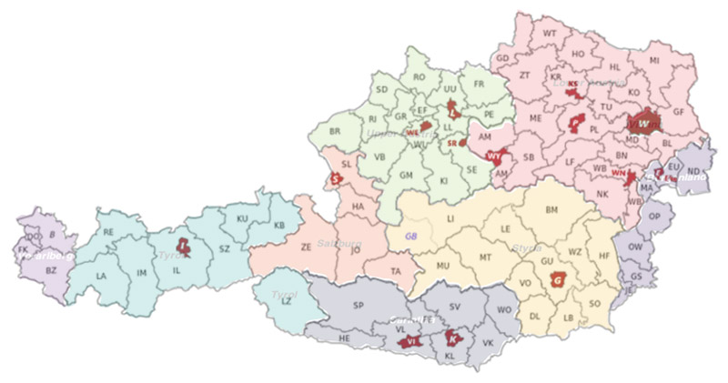
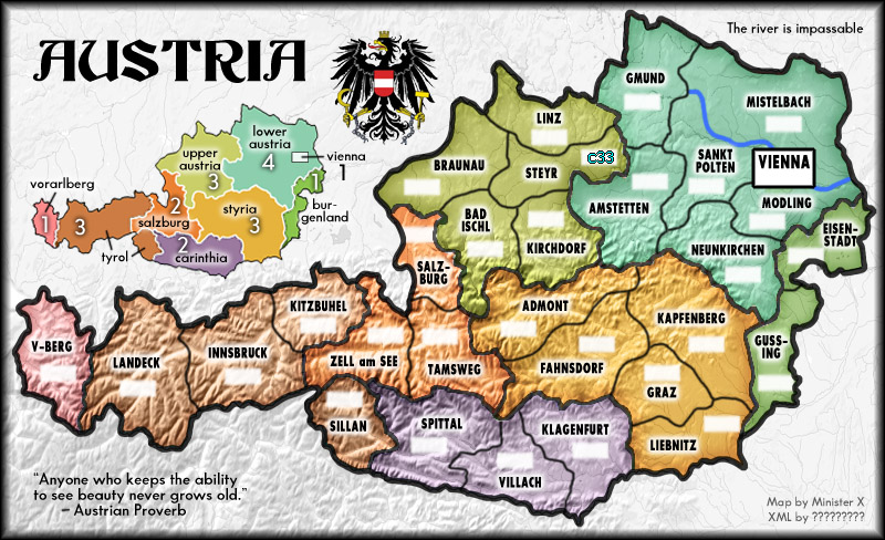
The map I've posted above shows eight "states" divided up into 79 "districts" and 15 "statutory cities". If all of these were used as terts this could be a huge map. By combining districts and ignoring all cities except perhaps Vienna and Innsbruck (with an air connection?) this could be made a quite small map (in terms of terts).
Austria is mountainous and the alpine areas occupy rather distinct parts of the country:

This presents both a challenge and an opportunity. I could simply place impassable mountain chains anywhere I wanted in that brown area or I could divide the country into two main areas, mountains and plains (or highlands and lowlands) and somehow devise different rules for each part. For instance, in the alpine region there would be some sort of penalty for crossing a border or some sort of delay in reaching the other side. I'd ask all of you who are much more familiar than I with the current state of XML to provide some creative ideas.
SHOULD I MAKE A MAP OF AUSTRIA AND RIGHT A TERRIBLE CC GEOGRAPHIC INJUSTICE? If so, small or large? With special rules or more standard?
Mapmaker(s):Minister X
Number of Territories:TBD
Special Features:TBD
What Makes This Map Worthy of Being Made: Austria is the most recognizable country in Europe which does not yet have a CC map.
Map Image:

European country-sized and larger areas (current and historical) with CC maps: Ancient Greece, Austro-Hungarian Empire, Balkan Peninsula, Baltic Crusades, Baltic States, BeNeLux, British Isles, Celtic Nations, Cyprus, Czecho Slovak Fragmentation, England, Europa, Europe, Europe 1914, France, France 1789, France 2.1, Germany, Holy Roman Empire, Iberia, Iceland, Ireland, Italy, Luxembourg, Macedonia, Magyarország, Malta, Napoleonic Europe, Netherlands, Nordic Countries, Portugal, Rail Europe, San Marino, Slovakia, Unification Germany, Unification Italy, Wales, WWII Eastern Front, WWII Europe, WWII Poland, WWII Western Front, and Yugoslavia.
WHY NOT AUSTRIA? Of the unmapped countries of western and central Europe, Austria is probably the most populous and famous, with the most historical significance.
Anyway... that's my excuse.
The map I've posted above shows eight "states" divided up into 79 "districts" and 15 "statutory cities". If all of these were used as terts this could be a huge map. By combining districts and ignoring all cities except perhaps Vienna and Innsbruck (with an air connection?) this could be made a quite small map (in terms of terts).
Austria is mountainous and the alpine areas occupy rather distinct parts of the country:

This presents both a challenge and an opportunity. I could simply place impassable mountain chains anywhere I wanted in that brown area or I could divide the country into two main areas, mountains and plains (or highlands and lowlands) and somehow devise different rules for each part. For instance, in the alpine region there would be some sort of penalty for crossing a border or some sort of delay in reaching the other side. I'd ask all of you who are much more familiar than I with the current state of XML to provide some creative ideas.
SHOULD I MAKE A MAP OF AUSTRIA AND RIGHT A TERRIBLE CC GEOGRAPHIC INJUSTICE? If so, small or large? With special rules or more standard?
