Map Name: Mississippi Magnolia
Mapmaker(s): Vicfontaine, "Deep Throat" Game Designer wants to be anonymous for now! lol
 Number of Territories:
 78
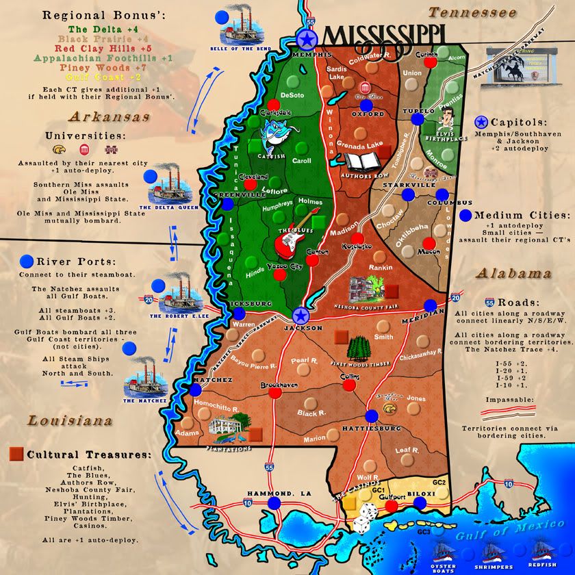
Special Features: multi-level bonuses (multiple regions, autodeploys, additional bonuses within regions, etc.), culture-specific to Mississippi
What Makes This Map Worthy of Being Made: There are no unique Deep South (USA) maps and this one provides that as well as detail into some Mississippi history; gameplay is easy but multi-dimensional with bonuses, attacks, defensive positions, etc.
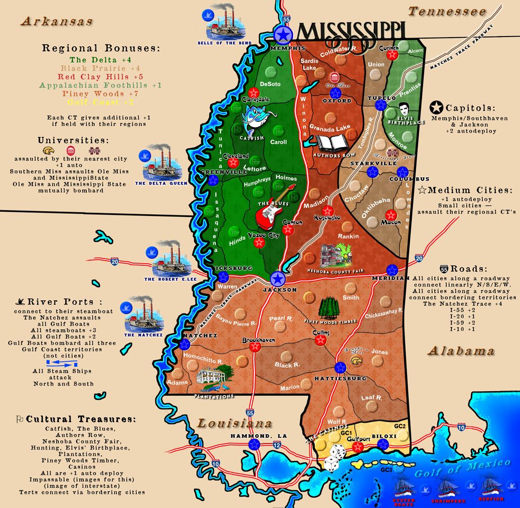
UPDATE AS OF APRIL 22, 2012. This is the 840x840 size as requested by Koontz. Based on this image size, I request again my original supersize stamp. Picture this size with 150 troops on a spot. It'll get pretty crowded very quickly. Plus, it looks a bit too intimidating and crowded in this smaller size.
WHAT STILL MUST BE DONE:
1) Continue cleaning fonts
2) Alter (perhaps) the ghosted images, though we're quite satisfied with them as is. They are very faint in both areas: the regional bonuses in the gameplay area and in the non-gameplay, surrounding states area.
3) The possibility of an objective win: I like this. Don't know what it would be, but perhaps holding the Universities or all the Cultural treasures, plus the Capitol of Jackson.
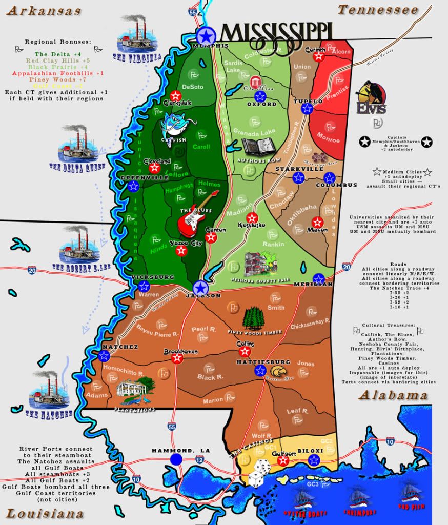
(Older Version:)
(update #3)
(update #2)
ORIGINALS (hand-drawn):
- Click image to enlarge.
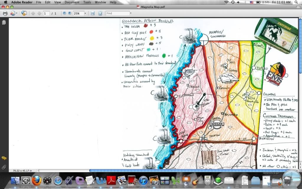
- Click image to enlarge.
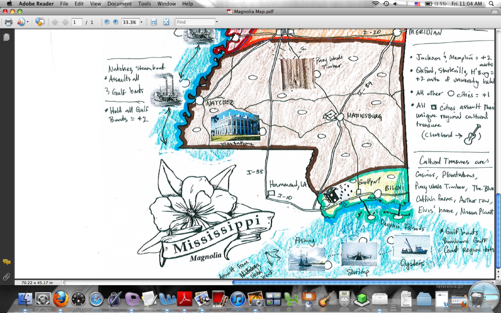
The territories are created by the infrastructure (Interstates, state highways, and the historic "Natchez Trace" roadway). The map includes unique cultural icons of Mississippi (history, major tourist attractions), and bonuses are plenty and varied and are based on cultural treasures, waterways, ecological regions, and major, medium, and small cities. Attack routes are "whatever is adjacent to" with, again, all roads serving as dividing lines.
Attacks are made over impassables through cities. Thus, cities sitting on I-55 connect their adjoining terts. Universities (Ole Miss, Mississippi State [MSU], University of Southern Mississippi [USM] are accessed via their adjoining cities (so: Oxford gets to Ole Miss, Starkville gets to MSU, and Hattiesburg gets to USM).
Would enjoy some feedback, and would love to see such a versatile map like this join the other terrific CC maps.
http://s1154.photobucket.com/albums/p537/vicfontaine1/?action=view¤t=MagnoliaMap.jpg


