Thanks for the bump up to Gameplay!

natty_dread wrote:Orange on blue is not a good combination. They are opposite colours, which creates a really bright contrast, which also does not translate well into JPG (looks very fuzzy).
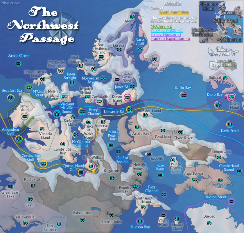
Done: and decided to make the objective route the yellow one.
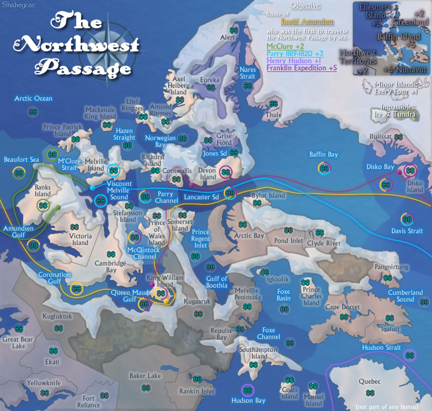
Industrial Helix wrote:I wonder if bringing back the clearer ice might be better because I'm having trouble identifying islands as two islands seem to me to be connected under the ice.
Let's try 75%, does this work?
Industrial Helix wrote:And personally, I still have a hard time reading this map. I think its connecting the numbers with the territories and the names. Perhaps reduce the opacity on the army circles or get rid of them all together.
Dropped to a mere 10%, better? Nix them?
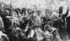
Industrial Helix wrote:Perhaps stretching the map a bit at the expense of the lower left corner would alleviate some congestion in the center. It's already pretty cramped in the middle as it is... do you know for sure that the small map is going to work?
Shrunk left (NWT/ Nunavut), shrunk Victoria island and Baffin, enlarged some smaller islands (Igloolik), messed with some routes (will smooth later). Coronation, Parry, and Lancaster have improved, but not all areas look better. Messy around King William Island. And the water feels patchy again.
And no, I don't think the small map will work as it is right now. I just need to sit down and make it look really smart.
I seem to have forgot this the first time through:
- Click image to enlarge.