Re: Quad Cities Map
No comments? Good. Looks like a promotion here.

Conquer Club, a free online multiplayer variation of a popular world domination board game.
https://www.conquerclub.com/forum/
https://www.conquerclub.com/forum/viewtopic.php?f=358&t=131035
 Very nice.
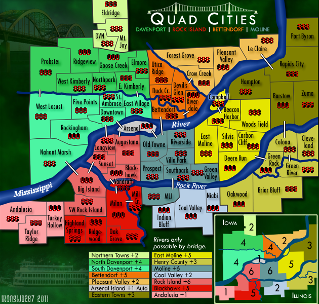
Victor Sullivan wrote:My only quibble is the boxes that have the names of the bonus areas are just not quick-reference friendly, nor does it look aesthetically splendid. Honestly, I'm not really sure what a good alternative would be, though.

thenobodies80 wrote:You could try to add a sort of image to your background, maybe something related with the zone the map shows or just a texture instead of using that green background because your map looks like it's floating on a strange green substance.
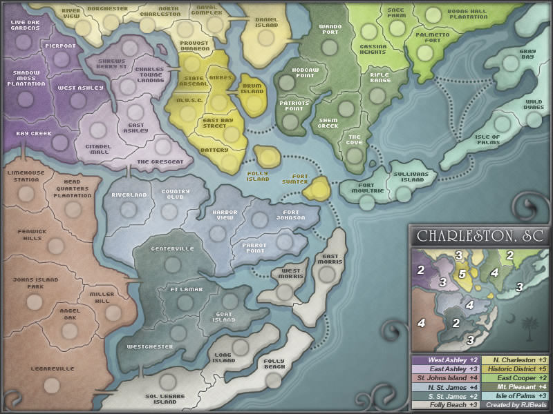
You could also work a bit on river, the water can be improved a bit to look a bit less flat (charleston map is a good example) and the river edges should have softer changes of directions, less "angular".
Did you try to draw thinner creek where they start?
A question, probably a stupid one since the first time i read your map title i thought about one of this, but because there's that empty space between the Mississippi, Big Island and Turkey Hollow?
Isn't rivers and creeks redundant? I think that something like rivers are only passable by bridge is enough. or not?
Your signature is hard to read imo.
Swap the position of armies and name in Campbell.
I tested the map on vischeck, the colors look fine and your good minimap is a nice addition.
Could you please post a version with yellow and orange 888 on the zones with the same colors? I don't think there will be problems since numbers have a black outline, but just to be sure...
On the whole it's a nice map, you're on the right way!
Nobodies
jefjef wrote:Wow. Can't believe I hadn't seen this until now. Nice. Looking forward to conquering the QCA!
The region you are referring to as Nahant Swamp is generally known to the natives/locals as "West End" or "West River Drive" or "Garden Addition". Although a part of the Garden you have in the Rockingham tert. No one I know refers to that area as Nahant Swamp. Guess that is a realtor name for it, like Probstie. (Which is a small 2 pool table - 12 chair bar at the entrance of a Trailer park just before I-280)
Just to the west of the "Nahant" tert (Across the river from Andalusia) is Buffalo, Which in all realty is as much a part of the QCA as Andalusia or Eldridge.
Arsenal should be titled R.I. Arsenal. (Rock Island Arsenal)
I have never heard of Longview tert of Rock Island referred to anything but Downtown R. I.
Ridgeview Park is always just "RidgeView" to the locals.
Just wanted ya to hear from a local.
Keep up the good work!
Joodoo wrote:"Arsenal" looks pretty lonely out on its on bonus zone. Would it be possible if you could make it a starter neutral and autodeploy if a player captures it?
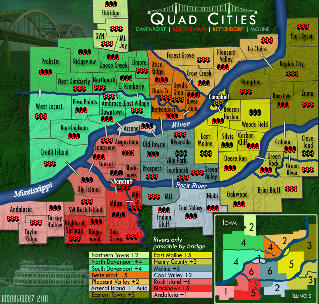
Industrial Helix wrote:Yeah, that texture does a lot for the map. Big improvement.
The thing that really bugs me is the deep jungle green background. It reminds me of the Brazil map or the rainforest in its tone. I imagine the area is quite green, so I see why you chose it, but I think a warmer green might do better. Either straight up green or perhaps an autumn green. Test things out, see which fits.