edbeard wrote:I went through your XML. I did not find any problems. I do suggest you go through it yourself a few times just to be sure. One thing I did not do was enter the XML into the tester which would help you make sure you spelled the name of a territory the same way throughout the XML. You've probably already done it, but if not you need to do it.
A few graphics suggestions:
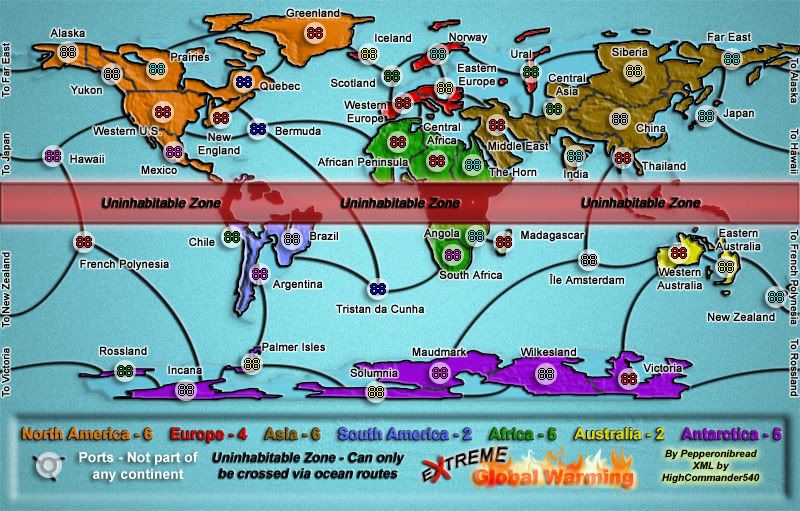
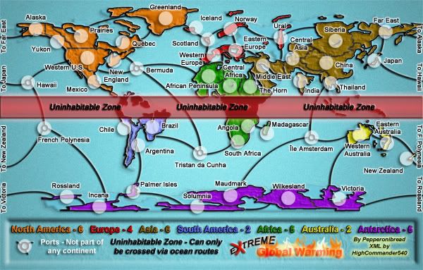
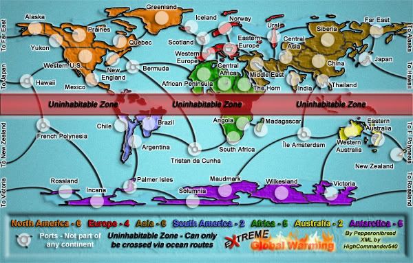
One thing that I found a problem with graphics-wise are a few borders, or non-borders. From Western US to New England if you glance quickly you'll think there is a border there. Maybe you can increase the gap a bit.
I'd say the same is true in Japan, but it's definitely more pronounced in the west us and New england area.
Also, maybe increase the size of the border between Praries and Quebec. the border is quite small and any confusion will be averted with a larger border. you probably could just increase the lower left area of Quebec to make this more clear.
Oh almost forgot, the lake or whatever it is in Siberia, just under the army circle. It looks like you were drawing borders in and the brush strayed off there.
Lol, the XML is good I triple checked it. It will be fine. All territories are in place and as long as they stay in the same place and on't change in size on either one of them it will be fine. If it does I will fix it when I get back I will only be gone for another 5 days at max.