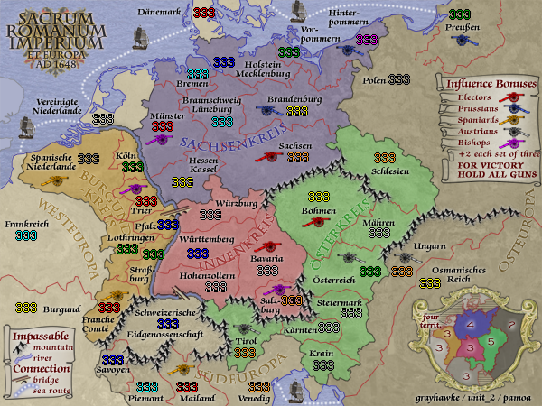
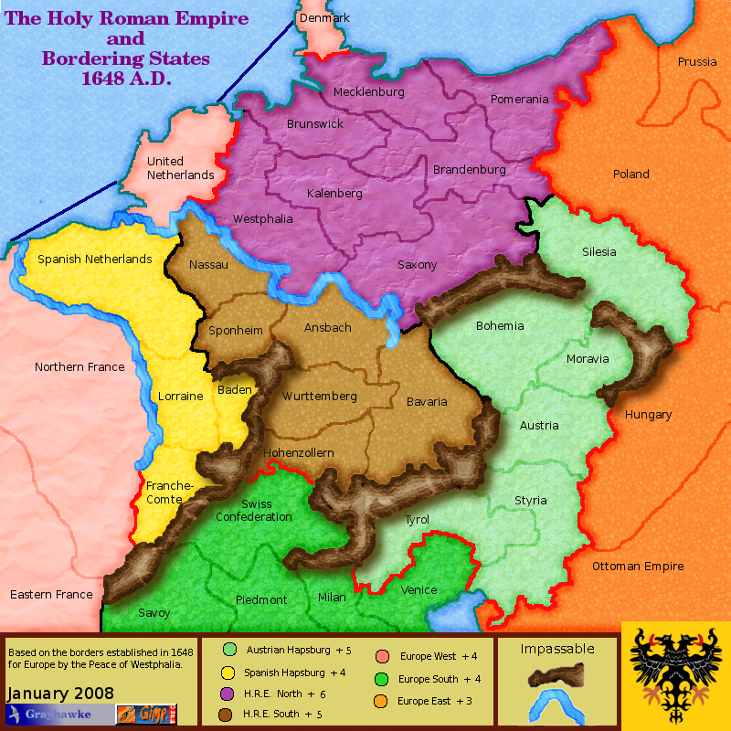
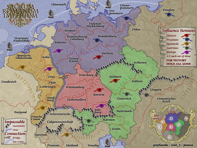
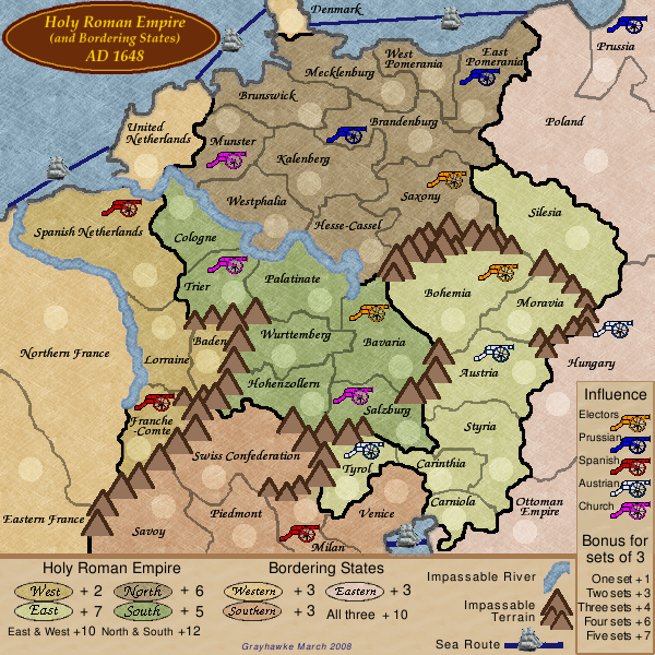
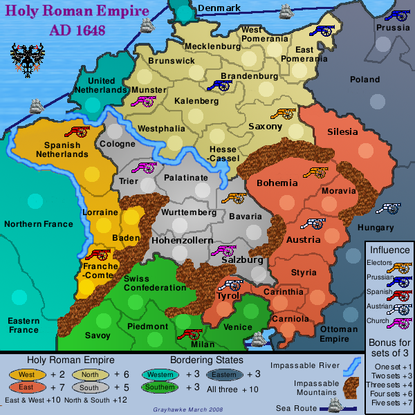
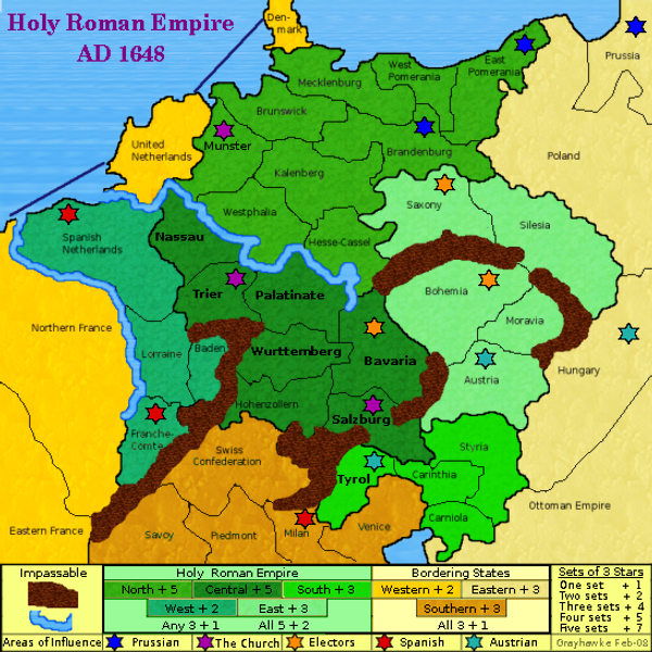
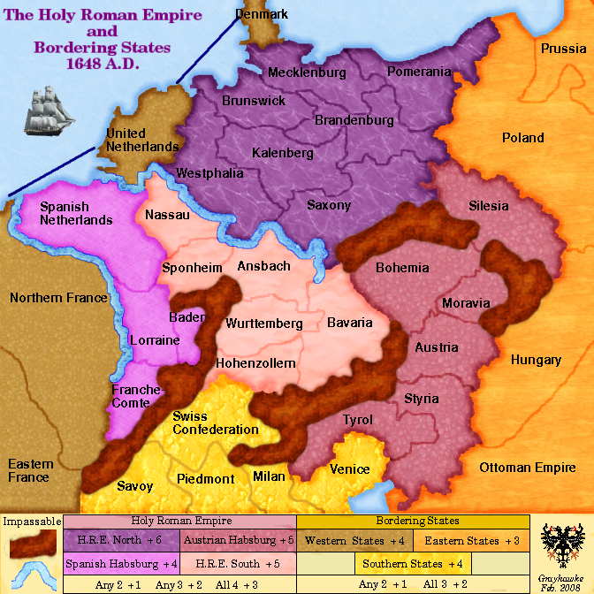
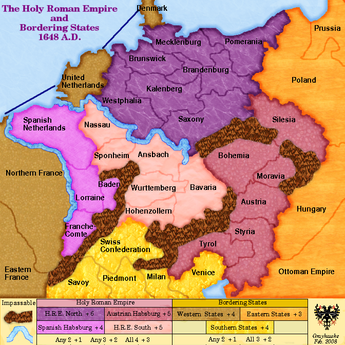
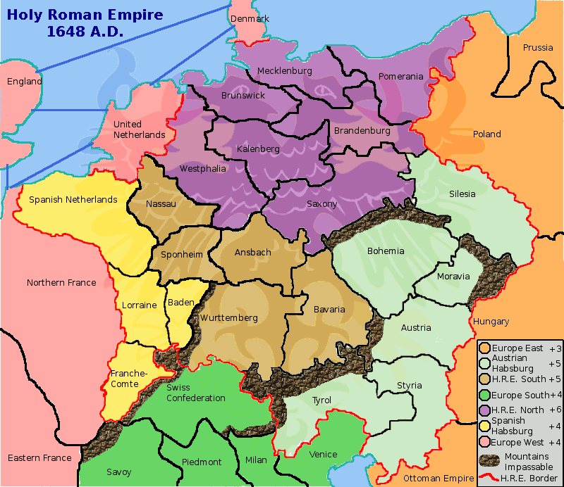
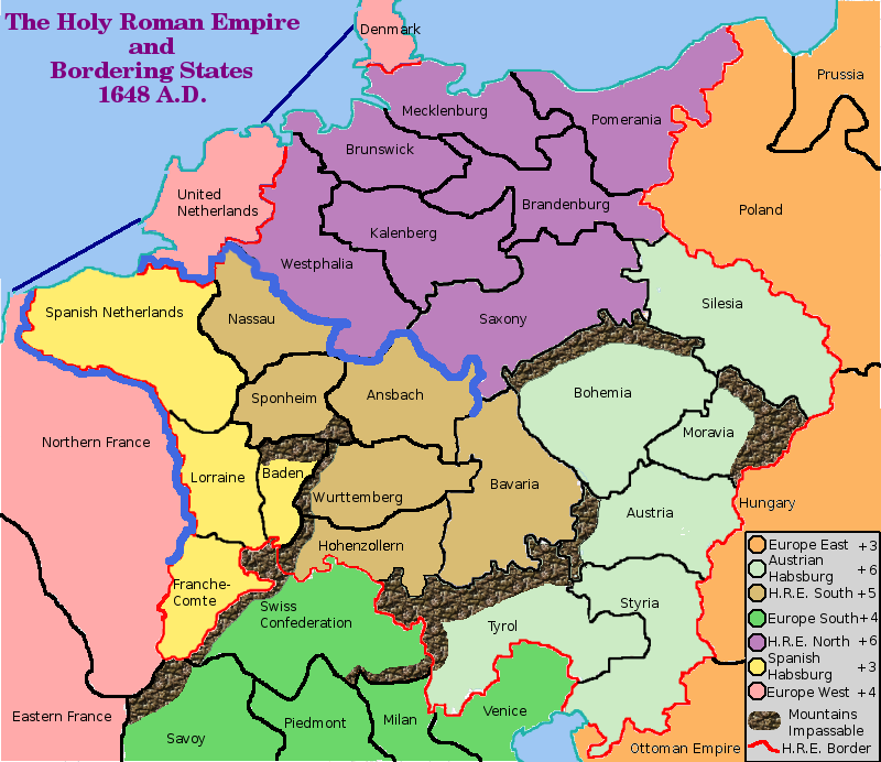
Holy Roman Empire 1648
This map was created by grayhawke in January 2008. Unit_2 joined the conception team in April. I joined in may and take over the thread in august.


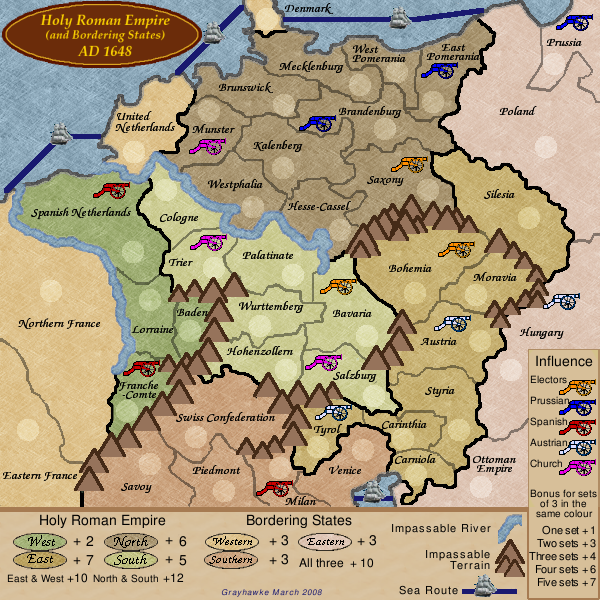
v37 large map new features: river contour, terrain legend position, armies and text position, signatures, influence legend spacing
v37 small map new features: river contour, terrain legend position, armies and text position, signatures, influence legend spacing
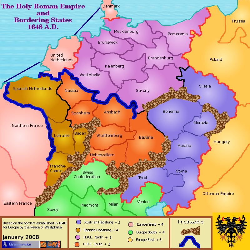
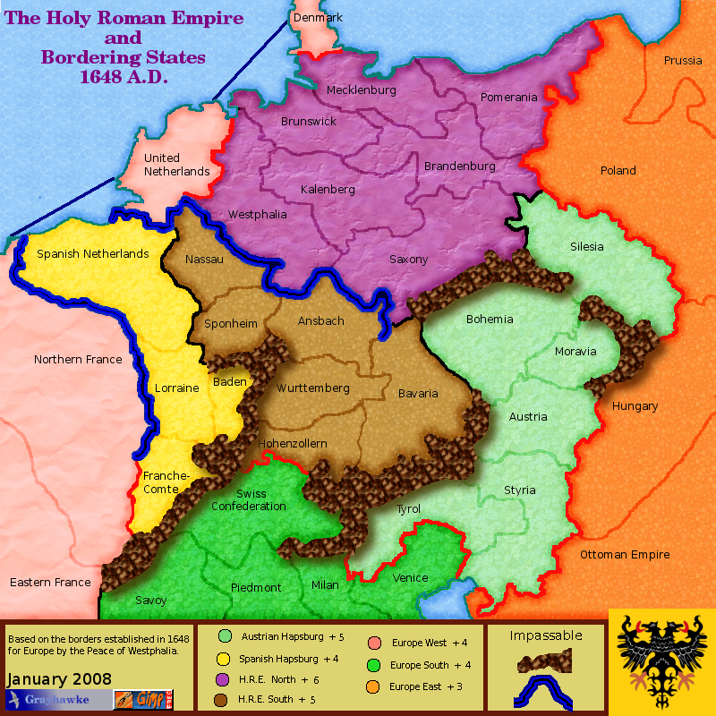
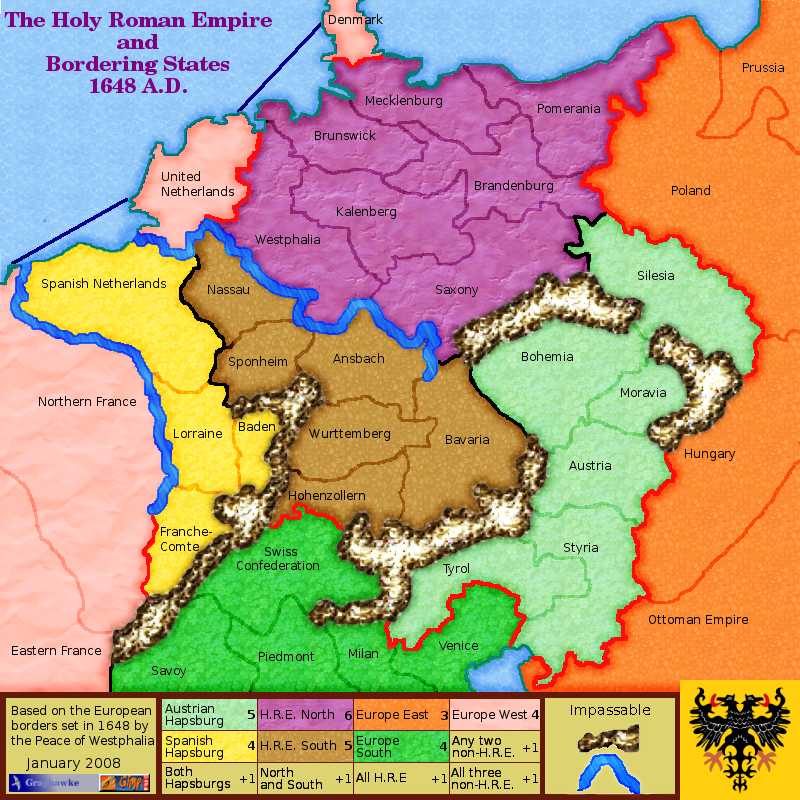
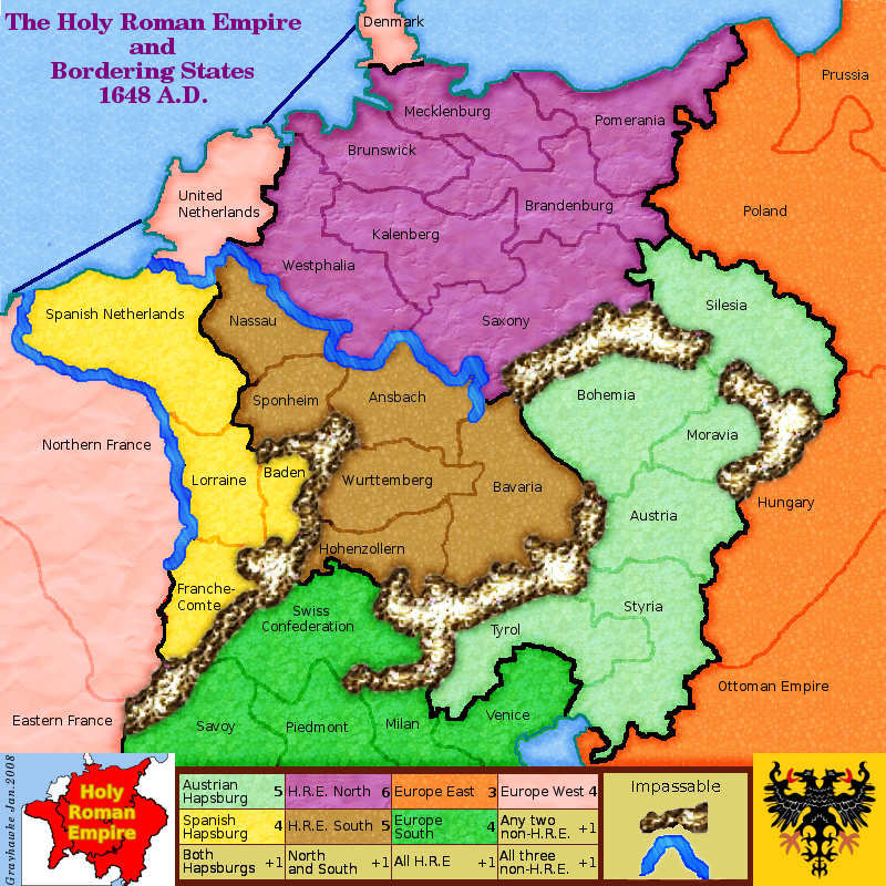
Holy Roman Empire 1648
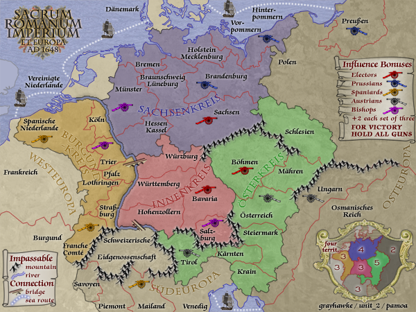
This map is based upon the boundaries set for mainland Europe following the Peace of Westphalia in 1648.
There are 42 territories forming 7 "regions"
Four empire "regions":
- Sachsenkreis...territories=9.....bonus=4
- Burgundkreis...territories=7.....bonus=3
- Innenkreis.... .territories=5.....bonus=3
- Österkreis......territories=8.....bonus=5
Three bordering states "regions"
- Westeuropa....territories=4.....bonus=3
- Südeuropa......territories=5.....bonus=3
- Osteuropa.......territories=4.....bonus=2
Extra bonuses are given for controlling "areas of influence" (from an idea suggested by iancanton). Each such area consists of 3 territories which were controlled by one of the powers of the time; there are 5 such powers giving 15 territories in total for the "areas of influence". A player who controls all 15 wins.
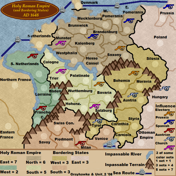
v37 large map new features: river contour, terrain legend position, armies and text position, signatures, influence legend spacing
- Click image to enlarge.
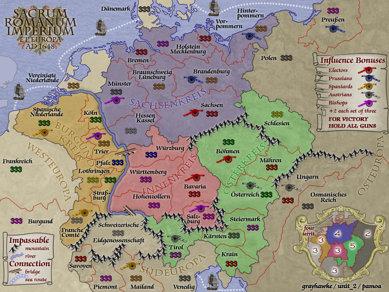
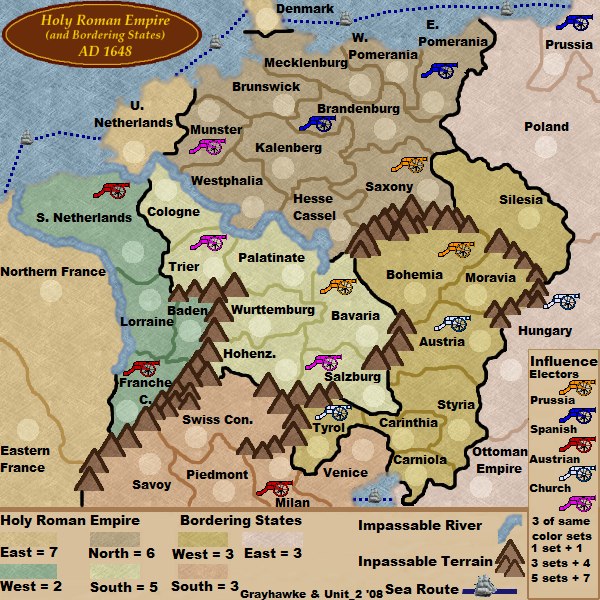
v37 small map new features: river contour, terrain legend position, armies and text position, signatures, influence legend spacing
Quenching data
map name: Holy Roman Empire 1648
link to large image: http://i295.photobucket.com/albums/mm126/pamoa_ch/HRE1648v37e.png
link to small image: http://i295.photobucket.com/albums/mm126/pamoa_ch/HRE1648v37se.png
link to XML file: http://www.fileden.com/files/2008/11/3/2172106/HRE.xml