Re: Route 66: now with corn! (GP, GFX)
Houston, we are go for corn.
Conquer Club, a free online multiplayer variation of a popular world domination board game.
https://www.conquerclub.com/forum/
https://www.conquerclub.com/forum/viewtopic.php?f=358&t=67910

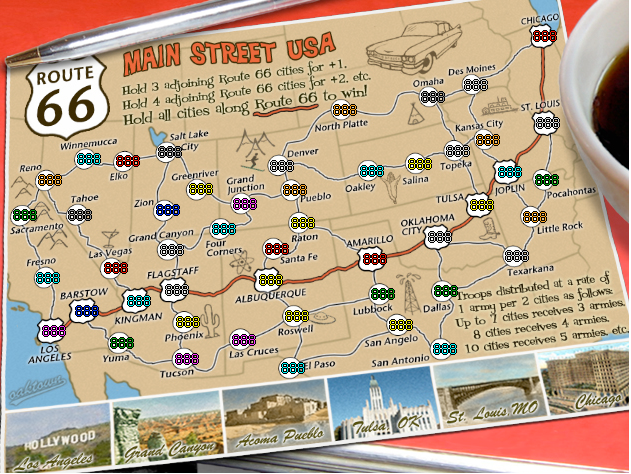
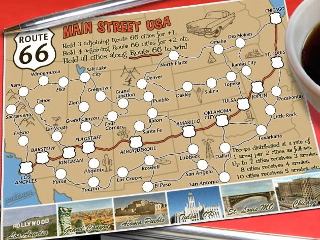
Well, where were you four weeks ago when I suggested the following?perchorin wrote:Jesus people, there's no corn in Kansas! It's Iowa that has the corn, Kansas is a wheat state, doesn't anybody know the difference???
And Wikipedia says there is both wheat and corn (yeah, yeah, I know, Wikipedia, feh). But oaktown says he has seen the corn:ender516 wrote:There's only two things that come from Kansas, steers and queers....
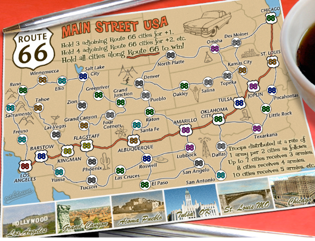
Just kidding, though something agricultural does seem to be missing from the map. What would be more appropriate to Kansas, a steer, a steer's head (longhorn?), or perhaps a cob of corn or sheaf of wheat? Anybody from that area with an opinion?
Now I suppose if you can convince oak that wheat is a better choice, then a few ears of wheat or a sheaf might be more appropriate. Do we need a poll?oaktown wrote:Kansas... I tried to come up with something for kansas earlier and failed. Having driven across Kansas all I remember seeing is corn, followed by miles and miles of more corn. Then you pass through a small town and see more corn.
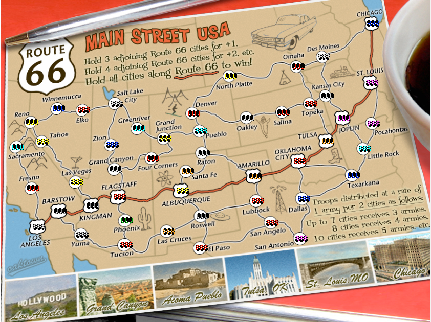
mibi wrote:I think the places depicted at the bottom should instead be places from the song route 66.
Well it goes through St. Louie down to Missouri
Oklahoma City looks oh so pretty.
You'll see Amarillo, Gallup, New Mexico
Flagstaff, Arizona, don't forget Winona,
Kingsman, Barstow, San Bernardino.
And whats up with Acoma? I've been there and don't remember any route 66 near by.


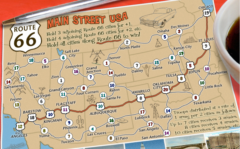
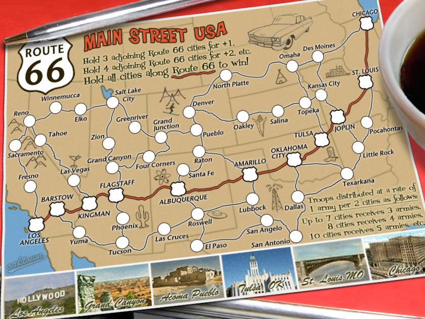
Gilligan wrote:Is anyone else a little annoyed by the fact that Kansas City is in Missouri?
Gilligan wrote:Is anyone else a little annoyed by the fact that Kansas City is in Missouri?
oaktown wrote:Kansas City is in the right place (on the border) on the large map. I can bump it a bit on the small map to get it back where it belongs.
And as noted, Kansas City, Missouri is indeed a larger city than Kansas City, Kansas. Missouri has the Royals and the Chiefs, Kansas has Dorothy and Toto.
oaktown wrote:XML has been checked and corrected. If somebody wants to double check the coordinates please do, because otherwise I'm ready to put this one out of its misery.
XML: http://www.snapdrive.net/files/612537/route.xml
Large: http://i141.photobucket.com/albums/r76/ ... ute19L.jpg
Small: http://i141.photobucket.com/albums/r76/ ... ute19S.jpg
CC map checker: http://www.conquerclub.com/mapmaker/index.php
the.killing.44 wrote:It depends what you're thinking. A fair amount of them are not uniformly placed, but seeing how it's not possible to really "center" them and that they're all in the circles, I'll leave it up to the public and you in particular to decide what's best.
Lobster Crush wrote:In my opinion, the large map coordinates look great. The wonkiness of the numbers in the skewed circles is a little more obvious on the small map. You could increase the size of the circles on the small map to compensate for this, but I think it's fine as it is now.


oaktown wrote:Kansas City is in the right place (on the border) on the large map. I can bump it a bit on the small map to get it back where it belongs.
And as noted, Kansas City, Missouri is indeed a larger city than Kansas City, Kansas. Missouri has the Royals and the Chiefs, Kansas has Dorothy and Toto.