Page 1 of 7
Scandinavia Map

Posted:
Thu Oct 05, 2006 6:08 pmby coup
Okay, we're going to try to develop a Scandinavian map. We have a map to start out from (se further down). I'm going to start to work on this from this weekend. All contributions are welcome... ooh, and its ok for you guys to supply us with good jokes about the swedes in the meantime

BTW: I'm making a scandinavian map only, this means: Norway, Sweden, Denmark and Finland.... baltics and others will not be used. Maybe Iceland, haven't decided yet... Objections?

heres the map you asked me to make
Posted:
Thu Oct 05, 2006 6:10 pmby ttocs
Hi coup, here is the map you asked me to make
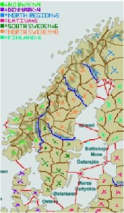
Sorry it is so poorly done, but Im just wondering, will i get credit for coming up with the idea of the map?
;)
Posted:
Fri Oct 06, 2006 2:28 amby coup
If you help me out, we'll both take credit... but right now, thats the least of my concerns... making a map takes time, so, we'll just have to start developing... could you try to use the map on the top and maybe insert borders for me?
Posted:
Fri Oct 06, 2006 2:34 amby Marvaddin
This would be very very difficult. The map in first post is huge, much bigger than it should be, and it has useless names of cities and countries all over it. Edit it would be a hard job...
Posted:
Fri Oct 06, 2006 6:28 amby coup
I know, I know... For now its what we have, but I'll do a job to search for another map or make one myself....
Posted:
Fri Oct 06, 2006 4:06 pmby Mr. K
Marvaddin wrote:This would be very very difficult. The map in first post is huge, much bigger than it should be, and it has useless names of cities and countries all over it. Edit it would be a hard job...
Not really. With the proper tools (for me, photoshop) it would only take as long as it takes to trace an outline to get it done. Then, resize, that should definitely not be a problem.
If you have photoshop, my suggestion would be to open up this picture. Then create a new layer, and on that layer, trace all relevent lines (to seperate land from water, and borders, and anything else you may want). As simple as the old techniques we all learned as kids, and now you've got the Scandanavia looking just the way you want it to look, and you've got an empty canvas to do whatever you want with it and make it look how you want.
Posted:
Fri Oct 06, 2006 5:05 pmby happysadfun
Marvaddin wrote:This would be very very difficult. The map in first post is huge, much bigger than it should be, and it has useless names of cities and countries all over it. Edit it would be a hard job...
I have some spare time. I'll clean it up for you.
Posted:
Fri Oct 06, 2006 5:06 pmby ttocs
sure, i can do it, i'll finish it as soon as i can
Posted:
Fri Oct 06, 2006 5:24 pmby juventino
well.. perhaps a bit childish... but Finland is not scandiniavian.. only sweden, norway and denmark
Posted:
Fri Oct 06, 2006 5:25 pmby juventino
but i liek the idea of a map with my home country =)
perhaps Sweden could be a three part? Gotaland, Svealand and Norrland?
Posted:
Fri Oct 06, 2006 5:29 pmby coup
juventino wrote:well.. perhaps a bit childish... but Finland is not scandiniavian.. only sweden, norway and denmark
check this out, this opinion varies greatly
http://en.wikipedia.org/wiki/Scandinavia
Posted:
Fri Oct 06, 2006 5:40 pmby juventino
well... i dont agree with you.. it is only a linguistic thing.. the "nordic" country hasnt catched on so much.. but culturally only sweden, norway and denmark..
but as you showed.. there are some troubles of what to call it..
but back to the map now.. you are from norway,... we should play this one =)
Posted:
Fri Oct 06, 2006 5:46 pmby coup
I never said I disagread with you, its just that we need to get enough territories.... I just pointed out, that it may not be a definitive answer to the question... Maybe we just make one of Norway, Sweden and Denmark, but myself I've always have included Iceland, but not Finland...
...and of course I'll play it!
Posted:
Fri Oct 06, 2006 5:51 pmby juventino
yes... =) i wonder how it should be to be smartest.. i think it is hard with regions... but i must be done. =)
it would be nice with a new thinking map... new ideas
Posted:
Fri Oct 06, 2006 7:58 pmby happysadfun
coup wrote:I never said I disagread with you, its just that we need to get enough territories.... I just pointed out, that it may not be a definitive answer to the question... Maybe we just make one of Norway, Sweden and Denmark, but myself I've always have included Iceland, but not Finland...
...and of course I'll play it!
I tend to include Finland and Iceland and Greenland also, seeing that they have been in and out of unions and countries together. sometimes i incluse the baltic sea because they share quite a bit of common culture
Posted:
Sun Oct 08, 2006 11:17 pmby ttocs
I think it should just stay to the peninsula and nearby countries so you don't have to many continents, the minimap I made on paint has six continents, which is standard on many maps.
Posted:
Mon Oct 09, 2006 7:23 amby Pedronicus
can there be a made up territory called IKEA?
Posted:
Mon Oct 09, 2006 4:30 pmby happysadfun
Don't forget ABBA and Volvo
Posted:
Mon Oct 09, 2006 8:53 pmby happysadfun
Posted:
Mon Oct 09, 2006 11:35 pmby reverend_kyle
happysadfun wrote: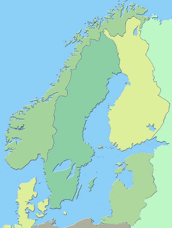
Can I help you by drawing borders for you? I'm wanting to test something that I could put into play with my maps i'm working on,.
Posted:
Tue Oct 10, 2006 12:14 amby reverend_kyle

Theres a nice skeletal for you to use...... I know some countries need merged etc.. but thats up to you the map maker.. if you dont want to use it.. thats cool.. it was more of me experimenting with it.
Posted:
Tue Oct 10, 2006 7:05 amby Scorba
It looks like a large black box to me.
Posted:
Tue Oct 10, 2006 7:41 amby RexRegis
It looks good if you save it and open it on your computer.
I did one with thinner lines if you rather want that...
and also did some coloring... just for fun. tell me if you want them.


Posted:
Tue Oct 10, 2006 8:51 amby reverend_kyle
RexRegis wrote:It looks good if you save it and open it on your computer.
I did one with thinner lines if you rather want that...
and also did some coloring... just for fun. tell me if you want them.
Yours is pretty.
Posted:
Tue Oct 10, 2006 3:20 pmby happysadfun
I am currently adding labels