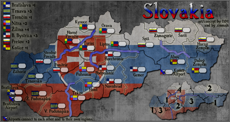
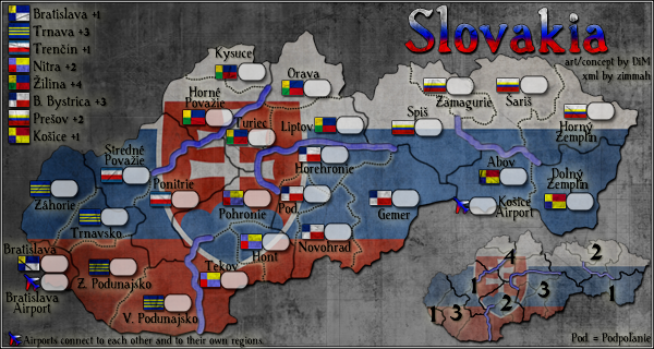
thenobodies80 wrote:Finally, even if I agree, please remove the text in the bottom right corner on the large.

lol, it'd have been so funny if that had gone unnoticed...
It's a shame lackattack converts the images to jpegs, otherwise I'd have steganographized all kinds of weird shit on my map images... like maybe a black&white picture of a huge penis, fight club style.
(for those who don't know, digital steganography (the most common method anyway) basically works by flattening the least significant bit of each colour channel in the image to 0, then using those bits to encode a hidden image within the image, either monochrome or 3-bit rgb - the difference of 1 in a colour value is so minor that the image won't be noticeable with the naked eye, only if you run the image again through a de-steganography script. Sadly, this kind of steganography won't work for jpegs due to the type of compression used for them that tends to scramble the lesser bits of the colours...)