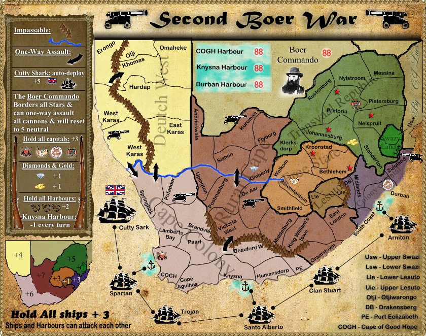
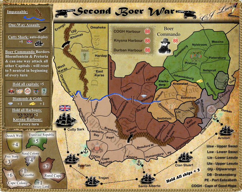
Regions: 65
Neutral: 4 regions start neutral (Cutty Shark = 5, Kimberly and Johannesburg = 5, Boer Commando = 5)
Starting places 61 regions:
2 prayers = 15
3 prayers = 15
4 players = 15
5 players = 12
6 players = 10
7 players = 8
8 players = 7
Continents: 8
Designer: CJ Lues
Experience: First map
Description:This map is of the Second Boer War (or Anglo Boer War) in 11 October 1899 until 31 May 1902 between the British Empire and the Dutch-speaking Boer inhabitants of the two independent Boer republics: the South African Republic (Transvaal Republic) and the Orange Free State.
Latest version 2.2:
- Click image to enlarge.
1.1
http://i1115.photobucket.com/albums/k54 ... rWar-1.jpg
1.2
http://i1115.photobucket.com/albums/k54 ... War2-1.jpg
1.3
http://i1115.photobucket.com/albums/k54 ... Wmap-1.png
1.4
http://i1115.photobucket.com/albums/k54 ... BWmap2.png
1.5
http://i1115.photobucket.com/albums/k54 ... BWmap3.png
1.6
http://i1115.photobucket.com/albums/k54 ... BWmap4.png
2.1
http://i1115.photobucket.com/albums/k54 ... on2Big.png
First of all, it’s my first map (but I have been creating our avatars and signatures for “The A-Team http://www.conquerclub.com/player.php?m ... emaya&so=D ”) so feel free do give a lot of advice!
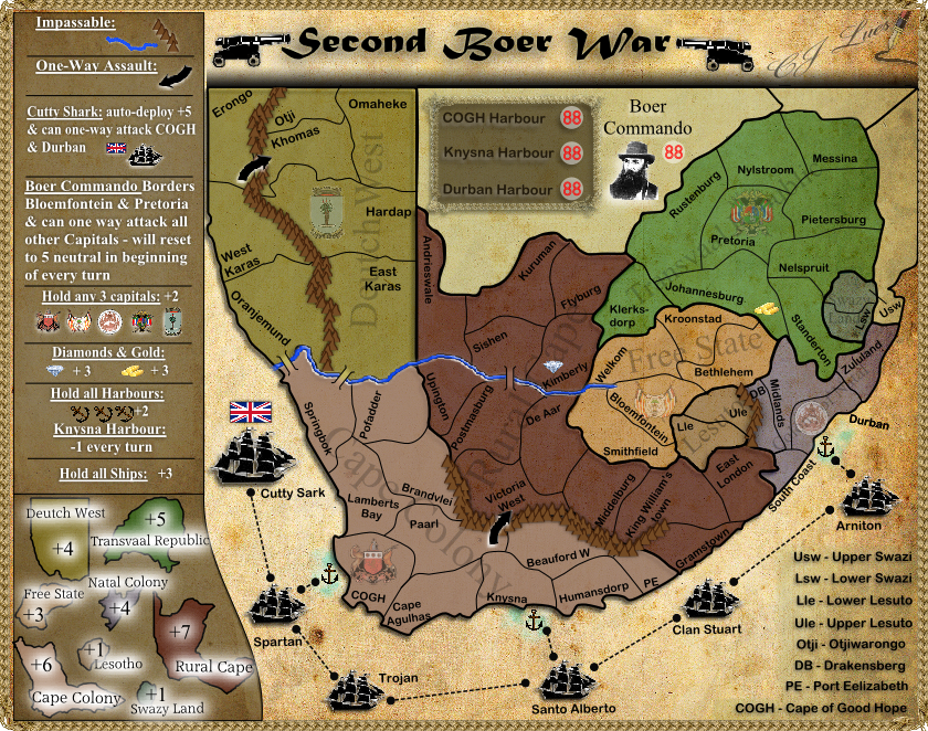
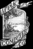
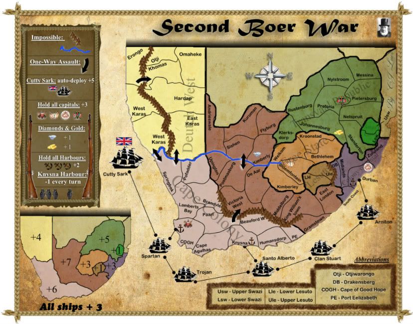
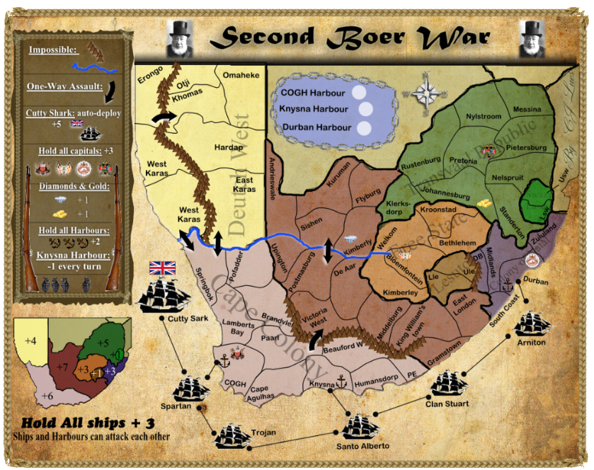
Now for the map itself… It has 65 regains and quite a few bonuses:
8 State bonuses,
a bonus 2 for holding 3 of the capitals (Cape of Good Hope, Bloemfontein, Durban, Pretoria or Hardap)
a bonus 3 for holding all ships,
an auto-deploy of 5 on the Cutty Shark every turn but it will have 5 neutral on it when the game starts (this is to demonstrate the power England had at the time by being able to refresh their armies),
a bonus 3 for the Diamonds in Kimberly and a bonus 3 for the Gold in Johannesburg (witch will be 5 neutral when the game starts to prevent an advantage),
a -1 every turn on Knysna Harbor, because The Knysna Harbor is one of the most dangerous harbors in the WORLD but; a bonus 2 for holding ALL 3 harbors
The Mountains and River are impassable.
The abbreviations are listed in the bottom right corner. The land region names are the real names but, the ship names need some work…?
I think I need some bombarding regions… any suggestions?
Feel free to comment about anything on the map…


