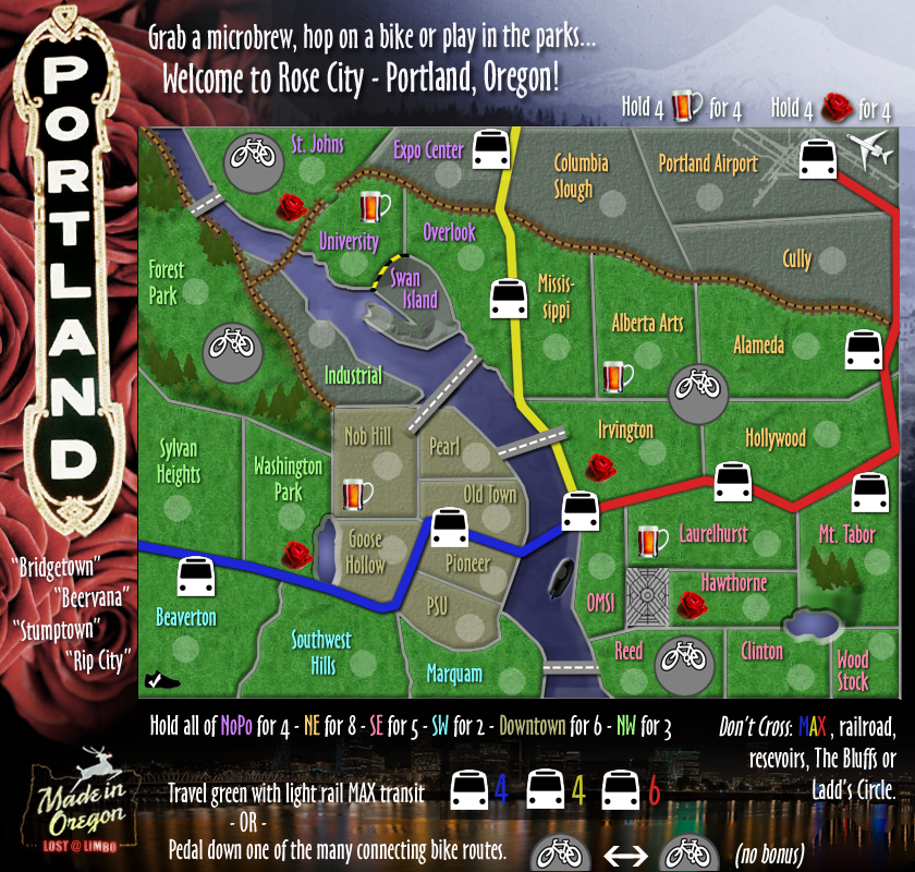
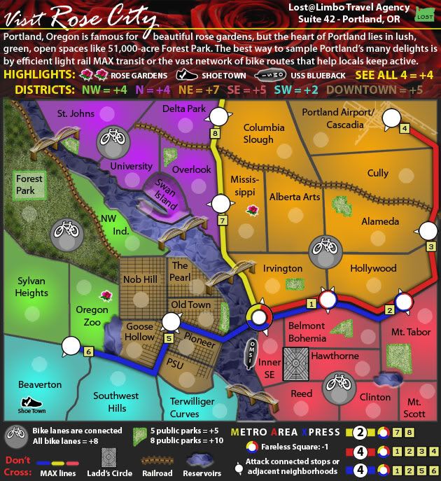
- Click image to enlarge.

Thanks to Victor Sullivan and Ian canton for their help on the XML and ChipV for the handy XML tool.


Moderator: Cartographers

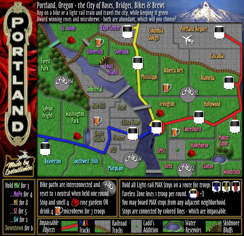
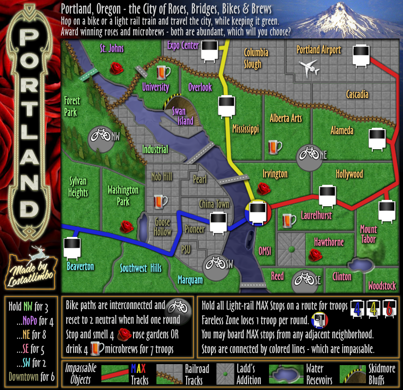


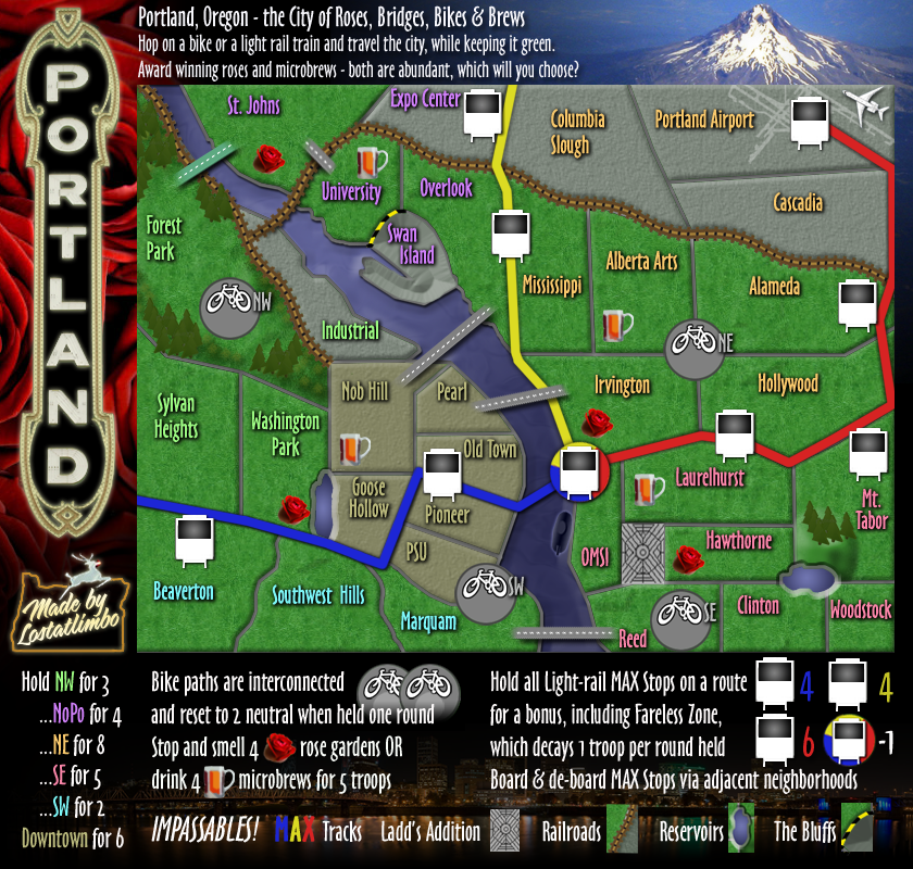
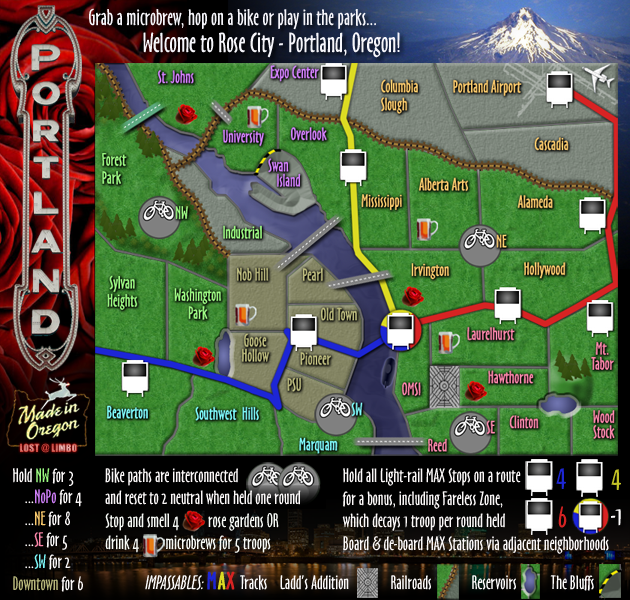


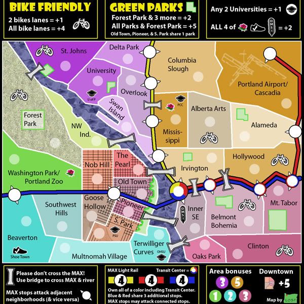
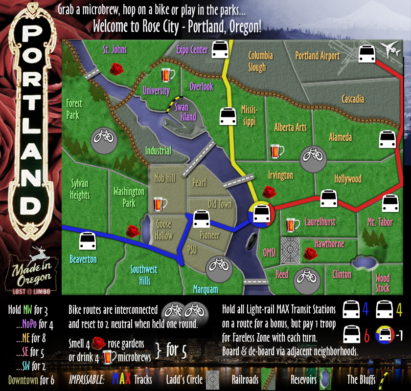
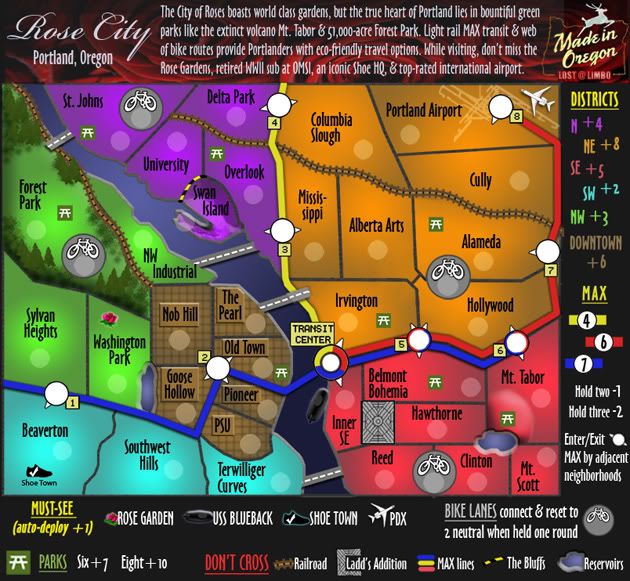
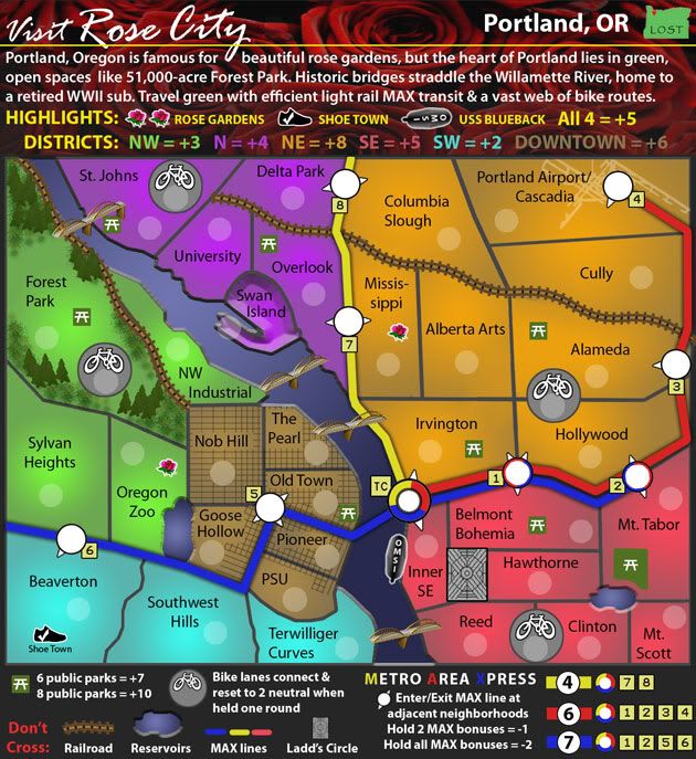
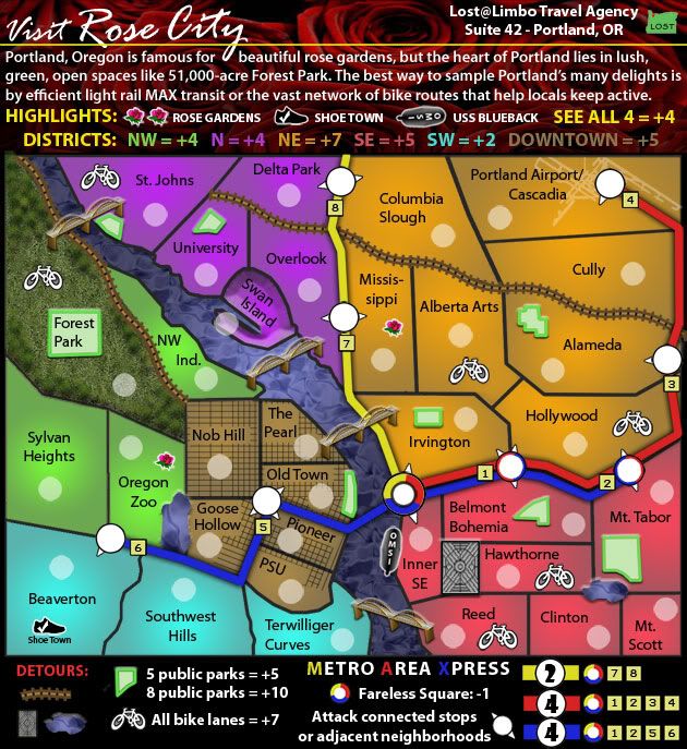
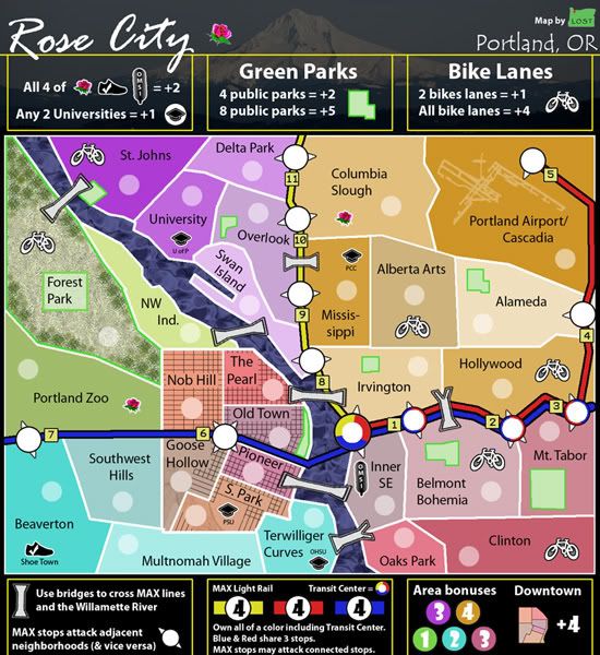
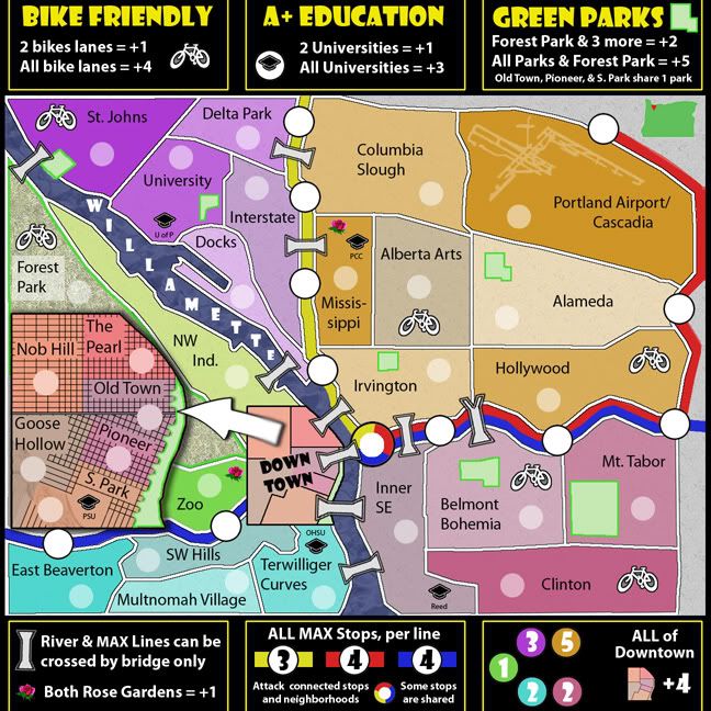
The Zoo is really just a space-friendly stand-in for Washington Park. I might be able to squeeze OMSI into Inner SE, but it would only be decoration. I'm trying to avoid clutter on the map unless it serves a purpose, but I'll try to work it in. Same goes for Powell's. There's just not room for it.Redmond Rules wrote:You need Omsi if you have the Zoo. Docks would be better if it was renamed Swan Island. The Portland Trailblazers should be there somehow even if it's an Icon like your college things on an existing square.
Will think about this more.
Ha - no slight to the Pioneers... L&C is just too far south to fit on this map. I've also neglected Concordia, but the NE quadrant already has 6 territories with potential bonuses.psilotum wrote:Don't forget Lewis and Clark College.
Whooooo Pios!!!
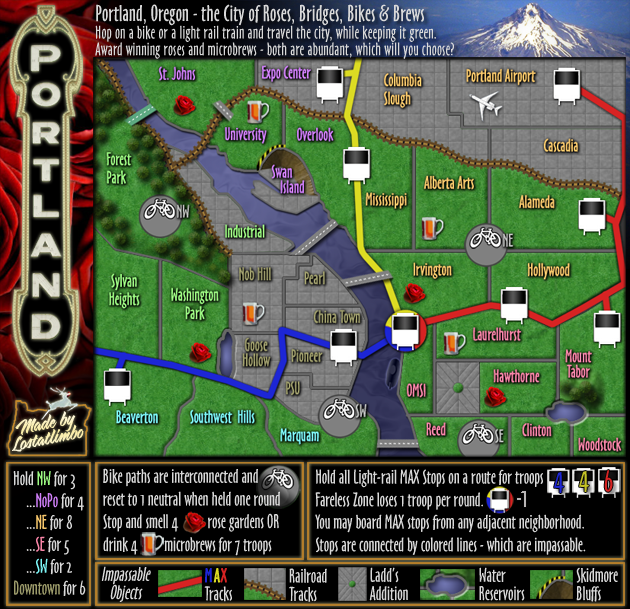
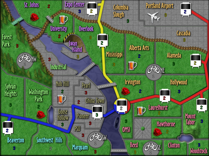
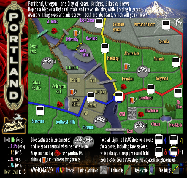
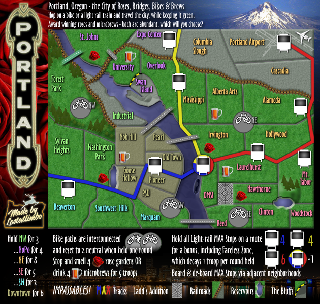
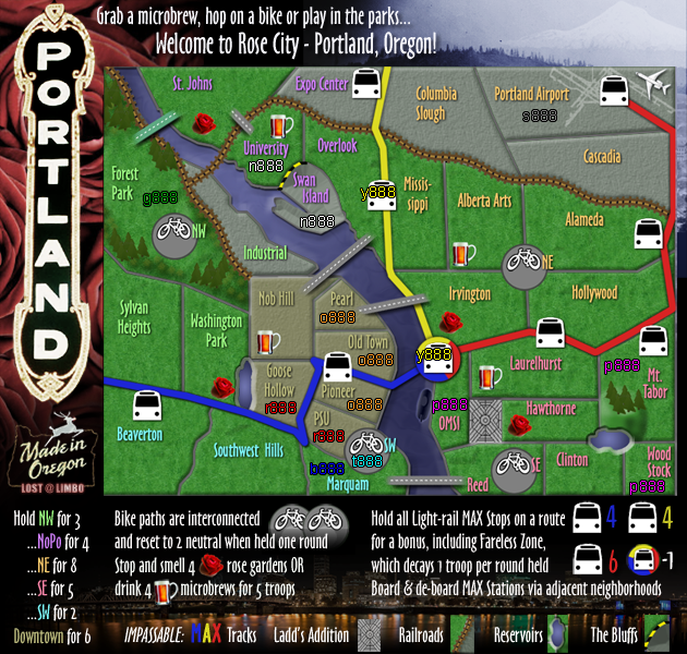
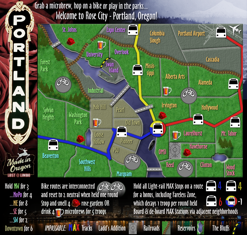
They can attack other adjacent stops and any neighborhood that they touch. I'll have to think of how to make this clearer on the map. Any suggestions?bspride wrote:im just a little confused about the stops...who do they attack? There is no real clear border on those stops
LC is right in the Terwilliger Curves! And inside Portland city limits!lostatlimbo wrote:Ha - no slight to the Pioneers... L&C is just too far south to fit on this map. I've also neglected Concordia, but the NE quadrant already has 6 territories with potential bonuses.psilotum wrote:Don't forget Lewis and Clark College.
Whooooo Pios!!!
Hmmm... check again - the Blue line does go to the Zoo and even to Beaverton. The Red Line and Blue Line each have 6 stops and only 4 are shared between them - including the Rose Garden Transit Center - which is also shared with Yellow.psilotum wrote:It's a little strange (game-play wise) that the entire MAX blue line is part of the red line. I realize this is somewhat accurate considering where you cut off the edge of your map. How about including the blue line stop in Goose Hollow or the Zoo? (I know technically those stops would also include the red line, but for game play it would be better if they didn't.

(cough cough and 2edbeard wrote:I'll come back later (maybe not today) with a proper analysis but one thing I think is important...
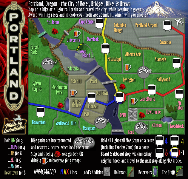
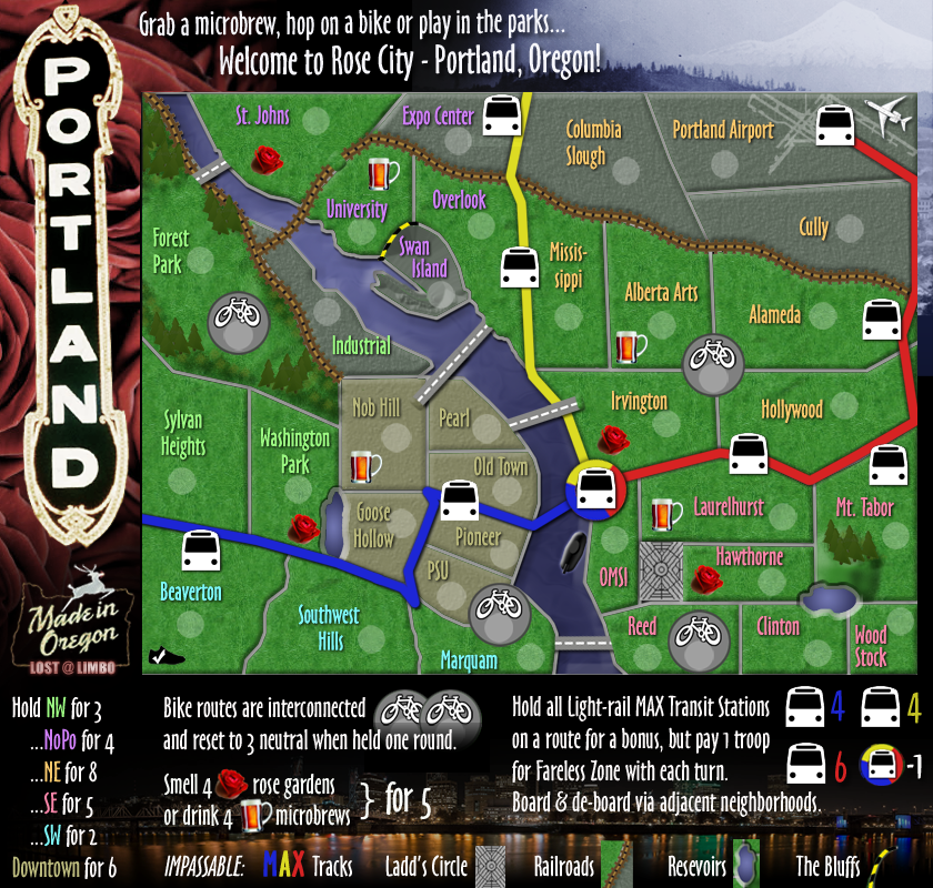
42 territories is much better than 41
42 is divisible by 3, 6, and 7
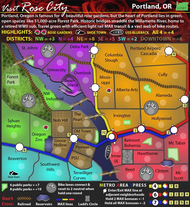
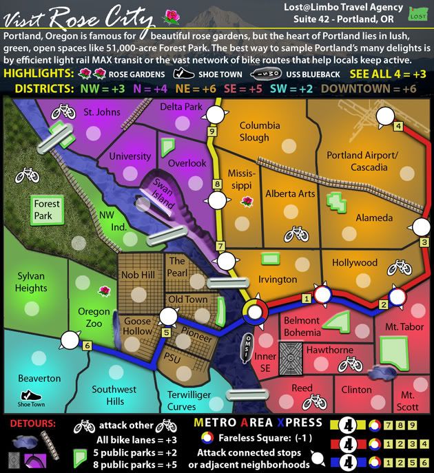
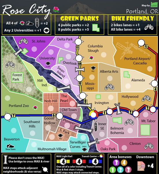
D'oh! Ah, yes. That thin line does help. Perhaps it could be a thick line in a lighter shade? Or perhaps you should still add that Goose Hollow stop.lostatlimbo wrote:Hmmm... check again - the Blue line does go to the Zoo and even to Beaverton. The Red Line and Blue Line each have 6 stops and only 4 are shared between them - including the Rose Garden Transit Center - which is also shared with Yellow.psilotum wrote:It's a little strange (game-play wise) that the entire MAX blue line is part of the red line. I realize this is somewhat accurate considering where you cut off the edge of your map. How about including the blue line stop in Goose Hollow or the Zoo? (I know technically those stops would also include the red line, but for game play it would be better if they didn't.
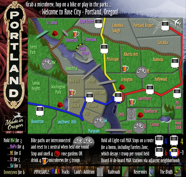
*I added a thin, connecting line between these two - does that help visually to connect the Zoo with the Transit Center?

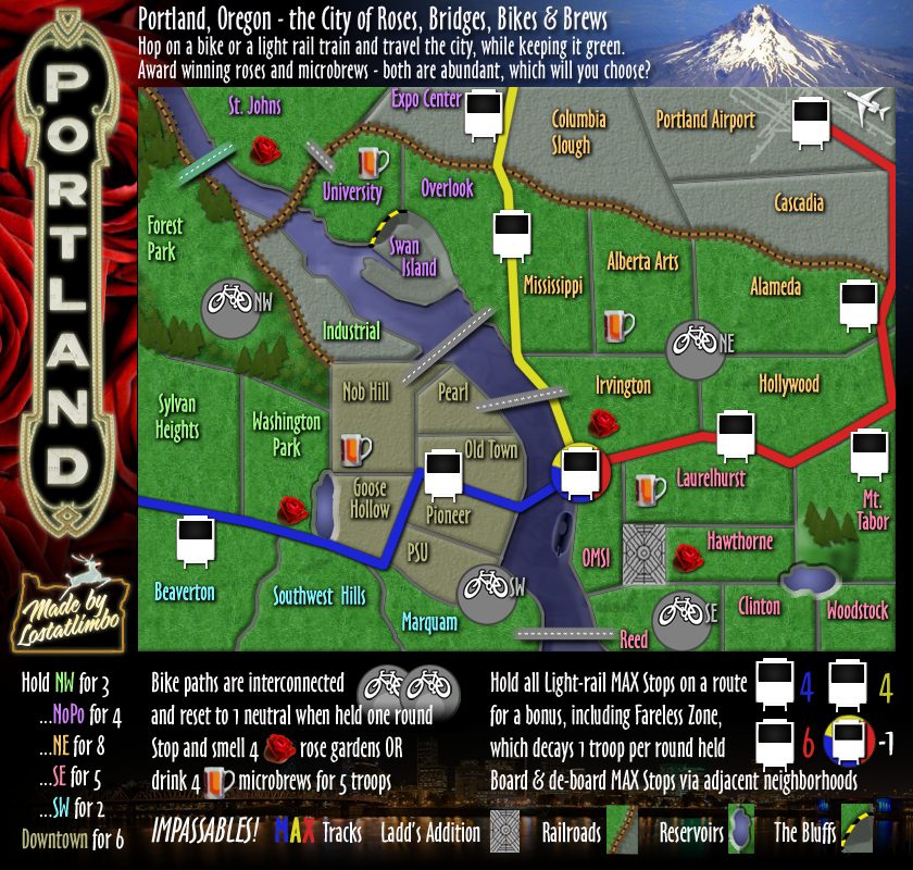
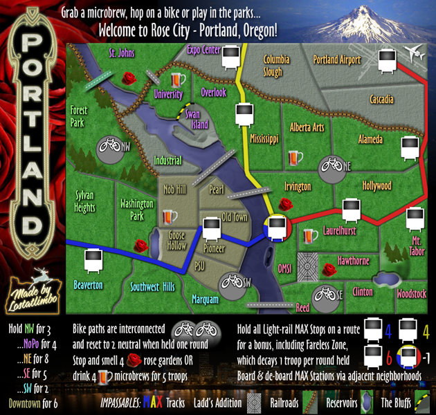
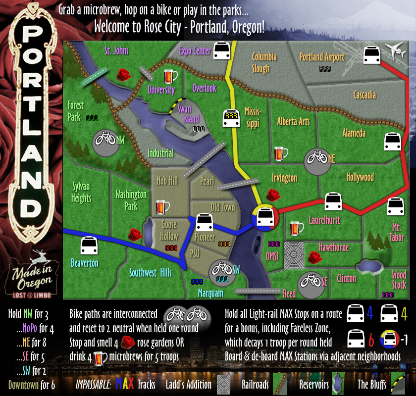
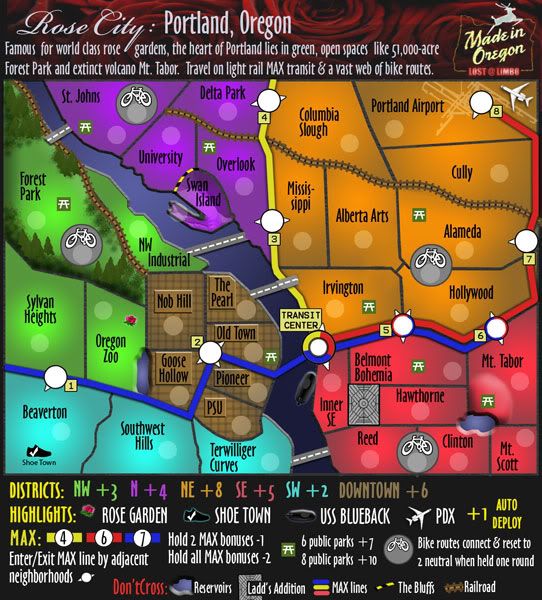
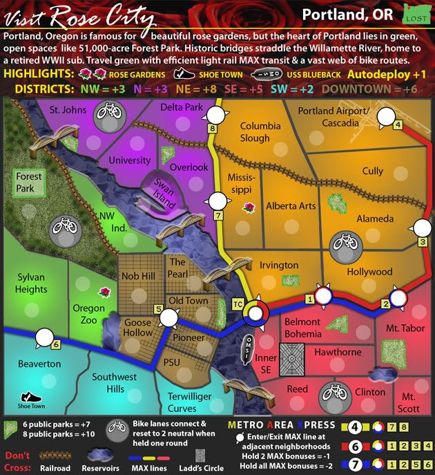
For future reference, please could you add an updated image to the end of the thread, where you've posted an update, as well as on the first post. It makes the development much easier to follow, and will help people to tie comments to particular versions.lostatlimbo wrote:Third Draft posted.

Done!MrBenn wrote:...please could you add an updated image to the end of the thread, where you've posted an update...
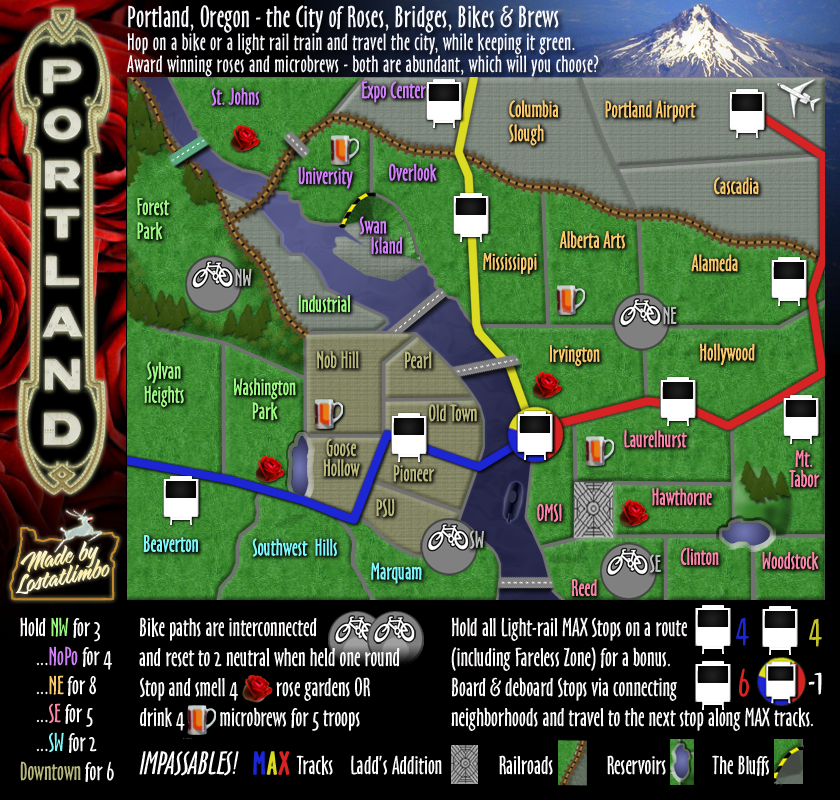
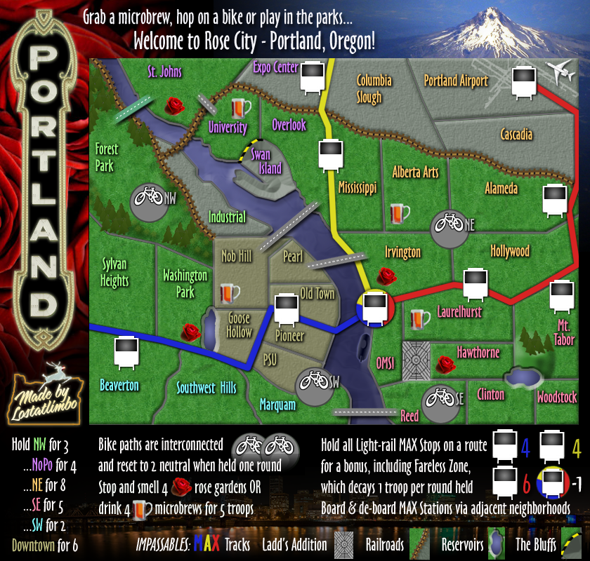
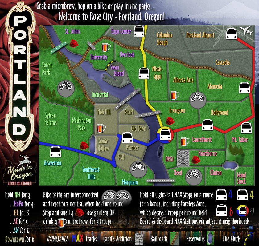
Thanks!ReluctantCynic wrote:I think the third draft is a significant improvement. And I really like the whole concept - the map is great, gameplay should be interesting, and there are enough unique twists to make strategy lively (without an overwhelming number of options to worry about).
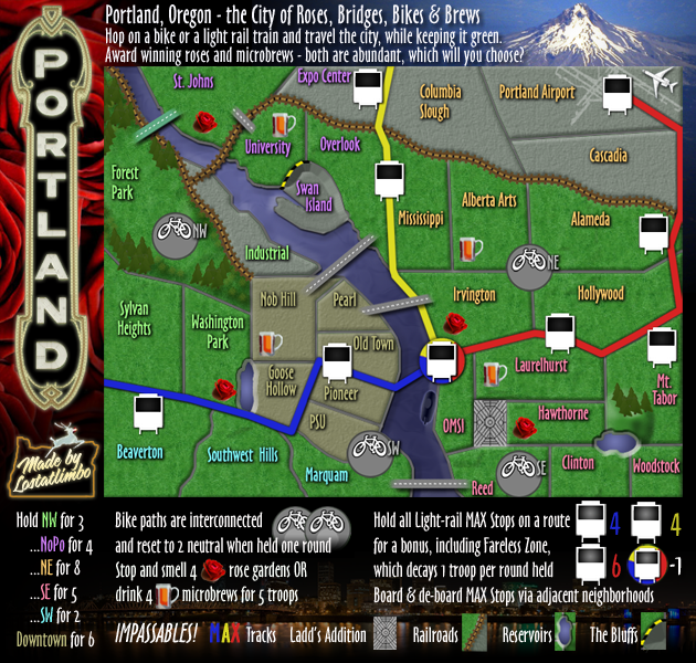
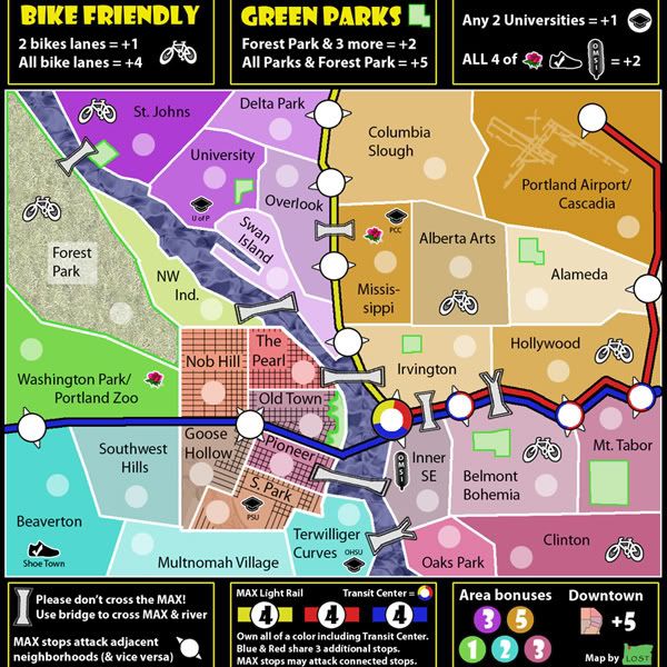
I had hoped to clarify this by requiring Forest Park as part of ANY park bonus - rather than it being a territory with a park. Since Forest Park represents a 5,100 acre stretch of forest, I wanted to represent it as the full territory - hence the pattern of grass, rather than a swatch of color. Initially, I had all of Forest Park outlined with that bright green border, so perhaps that's the way to go? I'll think about this one some more. It needs to be clear from the map that Forest Park is at the center of any Park bonus.ReluctantCynic wrote: 1. It's not clear whether Forest Park includes a park space bonus or not. The green box around the "Forest Park" label is kind of faded and washed out, so I can't tell if it's just highlighting forest park or actually includes park land.
Easy fix. I'll make that change with the next draft.ReluctantCynic wrote: 2. The color for Alberta Arts needs to more closely match the surrounding areas. Right now, I think players could be too easily confused into thinking it's a separate bonus alone or one territory in the surrounding set of NE Portland.
This has been my biggest head-scratcher so far. The notion is that there is one park (Waterfront) that only counts as one park, but can be counted for any of those 3 territories. For example, you could receive a +2 bonus for holding Forest Park, St. Johns, Alameda & Old Town (4 separate parks), but you could not receive a bonus for holding Forest park, St. Johns, Old Town & Pioneer. (only 3 separate parks). Another example would be a player receiving a +5 bonus by holding Forest Park, St. Johns, University, Irvington, Alameda, Mt Tabor, Belmont, & Old Town EVEN IF another player holds Pioneer & South Park, because you are holding 8 separate parks.ReluctantCynic wrote: 3. It's not clear how Waterfront Park figures into the park bonus option. All the other parks are enclosed within territories, so it's pretty easy to see that you need to occupy the territory to get the park bonus. But Waterfront Park borders four territories. That's visually confusing, and the notation that "Old Town, Pioneer, and S. Park share 1 park" doesn't clarify matters. Does that mean I -- as a player -- have to occupy all three territories to get credit for that one park? Or, for example, would I get a +2 bonus for occupying Old Town, Alameda, St. Johns, and Mt. Tabor? 4. And why doesn't Terwilliger Curves also share the Waterfront Park bonus?


