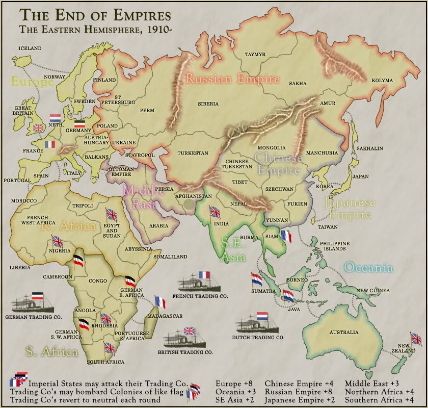
the trading companies are an original twist to gameplay that is in keeping with the times. the resultant asymmetry lets europe project its power in a limited way. this is a good alternative (or addition) to the capital auto-deploy.
i think africa has far too many territories. someone holding the whole of africa will receive more bonuses than for holding any other continent, which is the opposite of reality. at its simplest, africa could be drawn visually smaller and with only four territories: british africa, german africa, french africa and morocco (with egypt & sudan and ottoman tripoli given to the middle east continent). with only four territories on the african continent, a player wouldn't be disadvantaged by the lopsidedness that mibi mentions if he had three african colonial territories from the drop (in fact, it could work in his favour because he'd be only one away from the africa bonus). the very detailed africa that we have at the moment has the potential to be the core of a “scramble for africa” map with new world gameplay.
if we decide not to shrink africa as above, then liberia and somaliland won't be missed if they disappear: there is no influence from the usa and italy respectively to give relevance to their existence. tripoli was an ottoman colony. so was egypt (nominally), though great britain was in control. i'm not sure about a good way to join tripoli to the ottoman empire without egypt, so maybe it just has to be, like the portuguese colonies, orphaned. an alternative is, as mentioned above, to make egypt & sudan and ottoman tripoli part of the middle east continent.
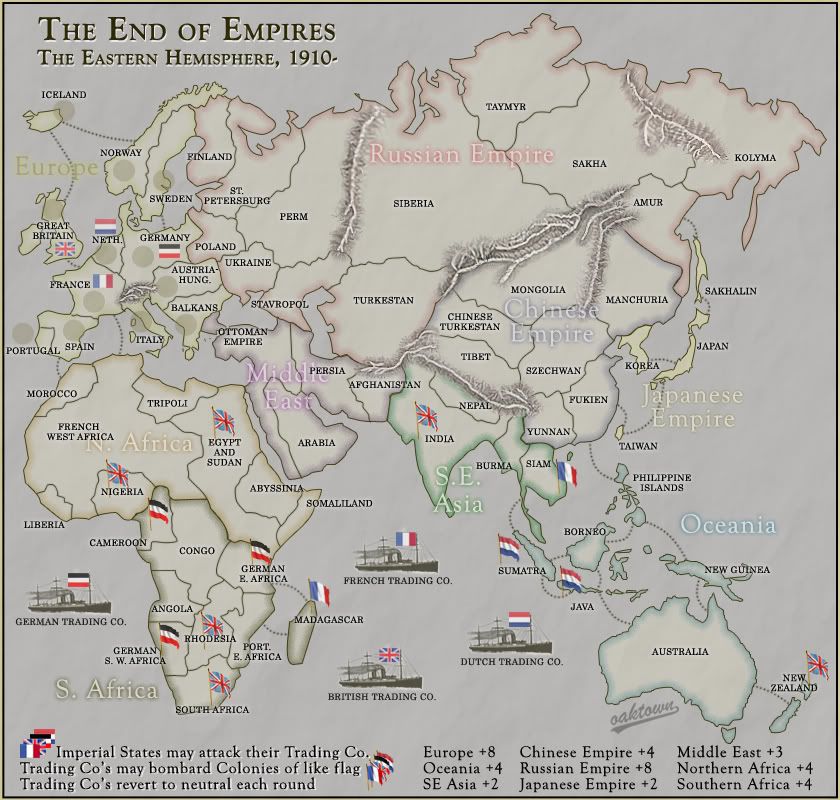
cairnswk wrote:Oaktown...sorry if i have come in late on this one....great looking map....but where are the Dutch.
Are you not going to have Indonesia as being Dutch and some parts of Africa also....or is that after 1910???
cairns makes a very good point. the netherlands was one of the most influential nations in 1910 and two dutch empire territories are already on the board (sumatra and java) without the colonial power being there. a bit of france and germany can be cannibalised to make the netherlands bigger than real size.
iceland looks a bit out of place without its mother country, denmark, although putting in denmark would make that part of europe look very cramped.
it is a pity that europe isn't bigger on the map because many of the most significant territorial changes took place in europe. for example, a bigger europe could show the four major constituent states of germany (prussia, bavaria, wuerttemberg and saxony), the four countries of the united kingdom (including the whole of the island of ireland) and the empire of austria and kingdom of hungary as separate territories rather than a combined one; having said that, perhaps this particular concept best fits a world war one europe map.
ian.


