MrBenn wrote:Visibility of territory names will impede on any gameplay considerations, and is not therefore a purely graphical issue

I actually think that the names being off the territories is alright, as it has been done in many other maps. Reggie, I think that you're going to be fine with this as long as you carefully consider:
1. Army circle placement. Army circles could actually help matters of clarity, in that if you position the army circles on the land in such a way that they are clearly associated with the territory title it will remove some potential for confusion in some, though not all, instances.
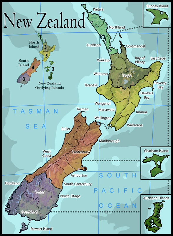
2. Possible pointers? In the areas that aren't entirely clear, you may want to draw a line from the title to the army circle. Wanganui's title, for instance, is really hanging out there, and Wellington is awfully close to looking like it could go with the land to the south, leading to the occasional mis-deployment.
3. Is every title that can fit on the land? It might be worth fudging the borders of Wanganui a bit to fit the title on the land - I promise I won't tell.
Little things...
• Region titles I guess aren't entirely necessary, but we're used to knowing them before we take the region.
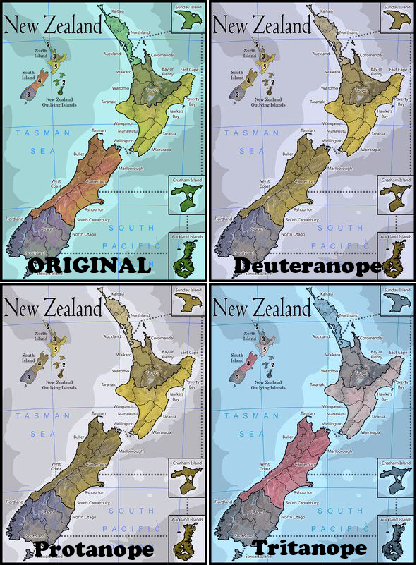
• Colors of North Island "north" and North Island "central" are very close - my bad eyes didn't notice the difference until I saw the two bonuses on the small map.
• I still don't love the representation of the outlying islands. Are they really in a cluster as shown on the small map, and if so can you show them in one box on the main map? As they are I have no sense of what/where they are, if they are to scale, etc. You have some atlas-style info on the map, why not make it look like a proper atlas page, with scale of miles and lat/long lines on the inset island maps as well? Just a thought.