I've just seen this thread for the first time and ... Oh My God... the doodle maps are fantastic. A little light hearted fun is JUST what is needed in CC.
I know the satirical maps are not at issue here but those territory names are hilarious. I do have one question though... Why are the Canadians being associated with mice? ... "Mouseheads"? Are there lots of mice in Canada? ... Any Canadians care to confirm this?
South Park taught me a great deal about Canada, in particular how the heads of Canadians seem to jump when they speak... and how they can't say the word "about". I'm not convinced however, that they look like mice. Still the rest of the territories were funny... laugh-out-loud funny, in fact!
... for the record, I prefer the newest army shadows. Kids may not draw like that but it's a happy medium between a crayon-drawn map and what we expect as part of CC.
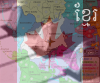
... my only fear is that the map might not be very fun to play because it is so small and everyone will want the same location, Africa. How about a bonus of 1, for controlling all of Russia? I think most kids wouldn't realise that Russia is part of Asia. Hell, not even my mother has realised that, yet...

This suggestion might be even less popular but you could also add 2 more territories... Hobbiton (Right of Aus) and The Arctic (below Aus)... then make a new continent called "Dan Under".
One of the kids I teach thinks that because the world is round, the left side of maps connect to the right and the top of maps connect to the bottom... With this in mind, the arctic could be linked to More Russia, Greenland and Andy's Mountains... thus making the new continent, Dan Under, less defensible.
No worries if you hate my suggestions, I'm going to bed now anyway, with a smile on my face after having found this thread

EDIT, spelling mistake *sighs*