Conquer Club

South America [Quenched]

Care to peruse completed maps? Take a stroll through the Atlas.

Moderator: Cartographers

Forum rules
Please read the Community Guidelines before posting.

Postby reverend_kyle on Tue Jun 26, 2007 3:44 am

Image


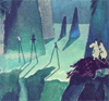
this is the VERY VERY ROUGHLY the direction I'd like to see it go.

I could have made it look better for you if I had the psd.
DANCING MUSTARD FOR POOP IN '08!
User avatar
Sergeant reverend_kyle
 
Posts: 9250
Joined: Tue Mar 21, 2006 4:08 pm
Location: 1000 post club

Postby MR. Nate on Tue Jun 26, 2007 10:43 am

edbeard wrote:the bolded text is for those who only scan words

:oops: sorry.

edbeard wrote:it only addresses visual issues not any gameplay talk
Fair enough. I think, if you keep the rivers, mountains & oceans from the unofficial version, you could keep the brighter colors from v.8.

And reverend, as for your version: :sick:
AAFitz wrote:There will always be cheaters, abusive players, terrible players, and worse. But we have every right to crush them.
MeDeFe wrote:This is a forum on the internet, what do you expect?

End the Flame Wars.
User avatar
Corporal MR. Nate
 
Posts: 951
Joined: Tue Dec 19, 2006 10:59 am
Location: Locked in the warehouse.

Postby edbeard on Tue Jun 26, 2007 6:20 pm

MR. Nate wrote: :oops: sorry.

Fair enough. I think, if you keep the rivers, mountains & oceans from the unofficial version, you could keep the brighter colors from v.8.

no worries man. you're just trying to help. I might try that if I get some time later
User avatar
Lieutenant edbeard
 
Posts: 2501
Joined: Thu Mar 29, 2007 12:41 am

Postby nyuklhed on Tue Jun 26, 2007 6:58 pm

i think the version which is the last post on page 4 looks awesome. the shading around the edges, gives it the brightness still, but with a smooth trasition. i like it a lot, keep it up
ĀæHogie?
User avatar
Cook nyuklhed
 
Posts: 11
Joined: Sat Mar 17, 2007 3:18 pm

Postby Solus on Tue Jun 26, 2007 8:17 pm

nyuklhed wrote:i think the version which is the last post on page 4 looks awesome. the shading around the edges, gives it the brightness still, but with a smooth trasition. i like it a lot, keep it up


couldn't agree more... it's beautiful man (hippie talk) =D>

P.S. the only reason I don't say anything about the game play is because I think it's already as good as it can get without making it worse. :-#
You don't have an income like mine, plus you've never even ridden in my amazing rocket car... Maybe if I get bored I'll bench press it for you.

Click here to get turned into a monster http://s3.bitefight.org/c.php?uid=76785
User avatar
Corporal Solus
 
Posts: 75
Joined: Sat Jun 02, 2007 6:20 pm
Location: Pennsylvania

Postby thegeneralpublic on Tue Jun 26, 2007 10:05 pm

What is the flavor for the one-way attacks in the Andes, if any?
User avatar
Cadet thegeneralpublic
 
Posts: 126
Joined: Fri Mar 09, 2007 9:49 pm
Location: In front of my computer screen.

Postby Unit_2 on Tue Jun 26, 2007 10:18 pm

wow, that is a nice map. about time someone made a map of S.America.
Image
User avatar
Corporal 1st Class Unit_2
 
Posts: 1834
Joined: Sun Jan 14, 2007 12:59 pm
Location: Pennsylvania, U.S.A, North America, Earth, Milky Way, Universe.

Postby gimil on Wed Jun 27, 2007 3:50 am

rather than darkening teh color just put a good texture on top which will keep the colors bright but no to painful to the eyes
What do you know about map making, bitch?

natty_dread wrote:I was wrong


Top Score:2403
User avatar
Corporal 1st Class gimil
 
Posts: 8599
Joined: Sat Mar 03, 2007 12:42 pm
Location: United Kingdom (Scotland)

Postby Optimus Prime on Wed Jun 27, 2007 9:26 pm

I am in love with the idea that someone is finally going to do a South America map. My personal favorite is the second to last version so far with the darker faded colors and shadows. I think that looks pretty sweet.
User avatar
Cadet Optimus Prime
 
Posts: 9665
Joined: Mon Mar 12, 2007 9:33 pm

Postby steveontrial on Fri Jun 29, 2007 8:10 pm

i love maps where countries are seperated by natural obstructions rather than political boundaries. props.
User avatar
Private steveontrial
 
Posts: 4
Joined: Sun Jun 03, 2007 9:34 pm
Location: United States

continent bonus

Postby vjmx 247 on Sat Jun 30, 2007 3:50 am

i think you increase the amount of armies received for holding a continent
maybe increase every continent bonus by 1 army
User avatar
Cook vjmx 247
 
Posts: 5
Joined: Tue Feb 27, 2007 3:34 am
Location: at my computer

Postby RobinJ on Sat Jun 30, 2007 12:01 pm

nyuklhed wrote:i think the version which is the last post on page 4 looks awesome. the shading around the edges, gives it the brightness still, but with a smooth trasition. i like it a lot, keep it up


Exactly right. However, I think you have gone slightly too far the other way as it is too dark in some places. Nevertheless, your fade effect has worked wonders
nmhunate wrote:Speak English... It is the language that God wrote the bible in.


Highest Score: 2437
Highest Place: 84
User avatar
Sergeant 1st Class RobinJ
 
Posts: 1901
Joined: Mon Aug 21, 2006 1:56 pm
Location: Northern Ireland

Postby snufkin on Sat Jun 30, 2007 1:01 pm

just another vote for the last version on page 4..

looking good
The comet cometh!
User avatar
Sergeant 1st Class snufkin
 
Posts: 206
Joined: Sun Apr 22, 2007 7:40 am
Location: borderland of Ranrike

Postby unriggable on Sat Jun 30, 2007 1:23 pm

I like the brightness, however it looks WAY too much like your carribean map.

reverend_kyle wrote:Image


Looks alot like this:

Image
Image
User avatar
Cook unriggable
 
Posts: 8037
Joined: Thu Feb 08, 2007 9:49 pm

Postby Poxsocks on Sat Jun 30, 2007 1:24 pm

Looks pretty good to me :-)
### Poxtops Has Spoken ###

I come in Socks too ! ;D
User avatar
Cook Poxsocks
 
Posts: 3
Joined: Thu Jun 21, 2007 3:57 pm
Location: England / Britain

hmm...

Postby Solus on Thu Jul 19, 2007 11:20 am

Are the dotted lines like harbors or something? (just a question not saying its bad) :-k
You don't have an income like mine, plus you've never even ridden in my amazing rocket car... Maybe if I get bored I'll bench press it for you.

Click here to get turned into a monster http://s3.bitefight.org/c.php?uid=76785
User avatar
Corporal Solus
 
Posts: 75
Joined: Sat Jun 02, 2007 6:20 pm
Location: Pennsylvania

Re: hmm...

Postby edbeard on Thu Jul 19, 2007 5:20 pm

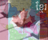
Solus wrote:Are the dotted lines like harbors or something? (just a question not saying its bad) :-k

they're just sea routes.


been busy so I haven't even touched the map in a while. If I remember correctly I was working on the rivers, where they become part of the ocean. And, I think I was having trouble getting something that looked good or blended well. Hopefully I'll get some time this week.
User avatar
Lieutenant edbeard
 
Posts: 2501
Joined: Thu Mar 29, 2007 12:41 am

Postby edbeard on Thu Jul 19, 2007 7:33 pm

Image

here's the latest of what I'm working on


Andy I think you asked about the location of continents. this is the only real setup out there. By that I mean that in terms of natural areas and their names, these vicinities are the only one's I've found. As for specific territories being part of those areas, well those are totally flexible.
User avatar
Lieutenant edbeard
 
Posts: 2501
Joined: Thu Mar 29, 2007 12:41 am

Postby thegeneralpublic on Thu Jul 19, 2007 9:47 pm

That river chunk in Campo Grande looks out of place...perhaps connect it to the nearby river (regardless of actual river placement) and add a bridge?
User avatar
Cadet thegeneralpublic
 
Posts: 126
Joined: Fri Mar 09, 2007 9:49 pm
Location: In front of my computer screen.

Postby Optimus Prime on Thu Jul 19, 2007 10:41 pm

This is going to seem completely random and odd in this thread but not only do I really like the way this map looks, I am extremely eager for it to get quenched sometime in the future because it would fit perfectly into my Battle of the Americas Tournament plan.

:wink: :wink:
User avatar
Cadet Optimus Prime
 
Posts: 9665
Joined: Mon Mar 12, 2007 9:33 pm

Postby Bad Speler on Thu Jul 19, 2007 10:46 pm

Somehow missed this thread for a while, sorry if anything im suggesting are repeats:

The sea routes and the outline looks very thick.

The army shadows are look a bit too white, i suggest making them more transparent.

Also, any chance of including the falkland islands?
Highest Score: 2532
Highest Position: 69 (a long time ago)
User avatar
Sergeant 1st Class Bad Speler
 
Posts: 1027
Joined: Fri Jun 02, 2006 8:16 pm
Location: Ottawa

Postby cairnswk on Fri Jul 20, 2007 12:27 am

edbeard...i haven't seen this map for a while.
It's coming along very nicely...just a touch dark to look at but possibly not a problem. :D I don't know how the rest fo the forum feel?
Image
* Pearl Harbour * Waterloo * Forbidden City * Jamaica * Pot Mosbi
User avatar
Private cairnswk
 
Posts: 11510
Joined: Sat Feb 03, 2007 8:32 pm
Location: Australia

Postby Solus on Fri Jul 20, 2007 1:49 am

thegeneralpublic wrote:That river chunk in Campo Grande looks out of place...perhaps connect it to the nearby river (regardless of actual river placement) and add a bridge?


He's got a point... (just making sure it's heard) :P
You don't have an income like mine, plus you've never even ridden in my amazing rocket car... Maybe if I get bored I'll bench press it for you.

Click here to get turned into a monster http://s3.bitefight.org/c.php?uid=76785
User avatar
Corporal Solus
 
Posts: 75
Joined: Sat Jun 02, 2007 6:20 pm
Location: Pennsylvania

Postby Gilligan on Sat Jul 21, 2007 7:22 pm

Why is Patagonia a +2 when you have 3 borders to defend?
Image
User avatar
Captain Gilligan
 
Posts: 12478
Joined: Thu May 11, 2006 4:59 pm
Location: Providence, RI

Postby edbeard on Sat Jul 21, 2007 7:40 pm

I've been contacted by Marvaddin, who you might know worked on a South America Map before. He's from the region so he's going to give me some advice about country names, and possibly about which territories should go in which continents. Obviously gameplay should be number one priority, but with his knowledge of the area, it would be a mistake to not see what he has to say.

One thing he mentioned specifically was the size of the Amazon. I know it's supposed to be bigger, and I have considered adding Bogota to it even before he contacted me, but I'll see exactly what he has to say about all this when he contacts me again.

As for a few things you've mentioned. I agree that the water routes are quite large, so I'm going to make them with smaller circles.

I like having the outside border of South America Larger than the internal borders. I just think it looks weird when they're all the same size. I will connect the middle river to the part in Cordoba.

I will be lessening the intensity of the army circles.

In my mind, the chances of me adding the Falklands is small. I just don't think it adds to the map and/or the map is detracted from without it. But, if it's something other people think is very important we'll figure something out.

As for the bonuses, here's how they come out with the forumla. Some might be slightly off since I did it all in my head.

South America

Highlands 3
5 3 3 3

Guianas 5.42
8 5 6 4

Plateau 4.25
6 4 5 4

Pampas 3.5
5 3 6 5

Patagonia 2.58
4 3 3 2

Amazon 4.33
6 4 6 4

Andes 5.58
8 5 7 4

I rounded where I thought it was necessary. I just didn't feel that for 4 territories with 3 borders and only 3 territories that can attack it, Patagonia was worth 3.
User avatar
Lieutenant edbeard
 
Posts: 2501
Joined: Thu Mar 29, 2007 12:41 am

PreviousNext

Return to The Atlas

Who is online

Users browsing this forum: No registered users