- Click image to enlarge.
No significant gameplay changes to this version. I was just thinking that the graphics on the regions and rail lines might have been getting in the way of some folks being able to focus on the aspects of this map about which I'd like comments.
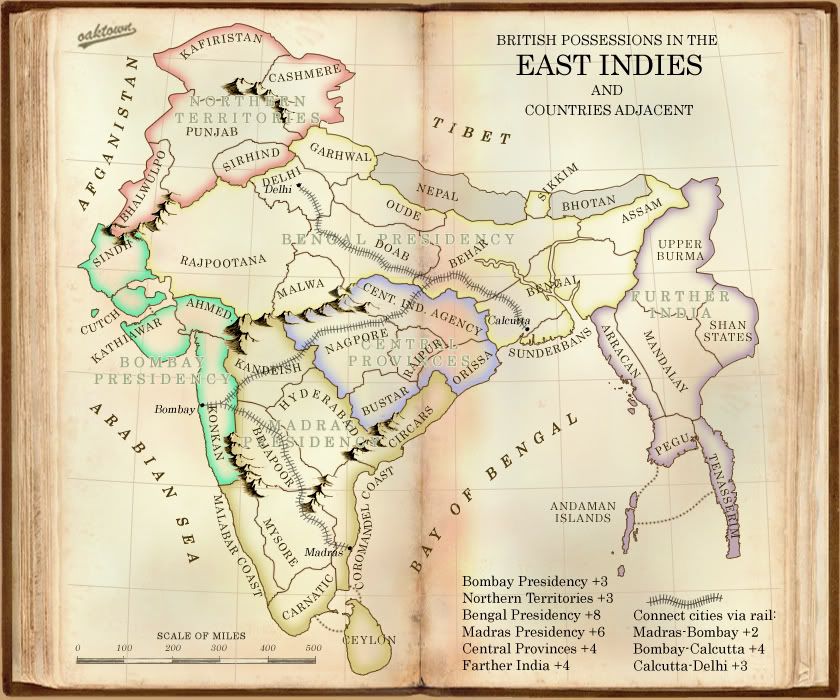
re. the "Big Region," aka Bengal Presidency: some of you are saying to split it up, but nobody is saying why. Yes, it is big. Yes it will be difficult to conquer and even harder to hold, and probably won't be held until the game is all but over anyway. But I'm concerned that splitting it into east and west regions would either give an advantage to an eastern starting player or a western starting player, depending on where it is split. The natural break would be west of Behar and Bengal, which means that a player who manages to start in Further India only has to expand a few territories and he holds a +7/+8 with only two borders.
I would encourage you all to look past the fact that the region is really big and consider how the map will play as is: there are five or six legitimate starts on this map: Further, Northern, Bombay Pres, Central Provinces, and the Delhi-Calcutta and Bombay-Madras rail lines. All are from four to six territories, and the one that is six has fewer borders and a more linear expansion than the others.
Anyway, I'm out the door. Discuss amongst yourselves.