Conquer Club

South Africa Map - Back On Track?

Have an idea for a map? Discuss ideas and concepts here.

Moderator: Cartographers

Forum rules
Please read the Community Guidelines before posting.

What area of the map needs the most work?

 
Total votes : 0

Postby Crowley on Wed Mar 21, 2007 3:45 pm

Ruben Cassar wrote:
Crowley wrote:
Ruben Cassar wrote:I get a feeling of Wordart when I look at them


OH GOD! That will change ASAP then...


Hmm is that sarcasm? I only left feedback because Nikita asked me to via a pm. However out from that long post I sent you this is the only part you decided to reply to.

I hope I did not waste my time writing you that long post and that the feedback is at least appreciated...


No, relax. I was serious. If something reminds you of WordArt, it really needs to be changed immediately.

The rest of the issues I will take into consideration, but that part of your post just caught my eye...
User avatar
Sergeant Crowley
 
Posts: 167
Joined: Sun Feb 18, 2007 5:53 pm
Location: Gauteng, South Africa

Postby Ruben Cassar on Wed Mar 21, 2007 4:20 pm

Ah okay must have misunderstood you. I guess I need to relax a bit! ;)

Btw are you a Boer?
ImageImageImageImageImage
User avatar
Colonel Ruben Cassar
 
Posts: 2160
Joined: Thu Nov 16, 2006 6:04 am
Location: Civitas Invicta, Melita, Evropa

Postby Crowley on Thu Mar 22, 2007 2:10 am

Ruben Cassar wrote:Ah okay must have misunderstood you. I guess I need to relax a bit! ;)

Btw are you a Boer?


Cool.

Yeah, I suppose some people might call me a Boer ;) I am Afrikaans...
It actually means 'farmer' in Afrikaans, but in the Apartheid era it was synonymous with all Afrikaners and became almost a swearword used by the oppressed to describe all Afrikaans white people.
User avatar
Sergeant Crowley
 
Posts: 167
Joined: Sun Feb 18, 2007 5:53 pm
Location: Gauteng, South Africa

Postby terrafutan on Thu Mar 22, 2007 4:51 am

Damn those names just give me a headache. Can I ask you where you got some of them from ? Obviously no Durbs, PE or anything - new south africa and all, but

Nice map - looking forward to playing.

You should give us Kaapies an extra bonus for the fort ne ?
User avatar
Corporal 1st Class terrafutan
 
Posts: 159
Joined: Mon Mar 20, 2006 4:56 pm

Postby Crowley on Thu Mar 22, 2007 5:00 am

Hehe, I didn't even know half of these myself - From my own country!

The map is loosely based on the SA districts:
http://en.wikipedia.org/wiki/Districts_of_South_Africa

I couldn't fit in all the dsitricts in Gauteng and KZN.


You Capies should get an extra bonus if you hold The Winelands...
Image
User avatar
Sergeant Crowley
 
Posts: 167
Joined: Sun Feb 18, 2007 5:53 pm
Location: Gauteng, South Africa

Postby Crowley on Thu Mar 22, 2007 8:24 am

New update on page 1.
Image
User avatar
Sergeant Crowley
 
Posts: 167
Joined: Sun Feb 18, 2007 5:53 pm
Location: Gauteng, South Africa

Postby BulaMatari on Thu Mar 22, 2007 8:46 am

terrafutan wrote:Damn those names just give me a headache. Can I ask you where you got some of them from ?


I like the names :D
Corporal 1st Class BulaMatari
 
Posts: 131
Joined: Thu Feb 01, 2007 6:08 am

Postby Crowley on Fri Mar 23, 2007 12:48 am

Any more feedback or suggestions?
Image
User avatar
Sergeant Crowley
 
Posts: 167
Joined: Sun Feb 18, 2007 5:53 pm
Location: Gauteng, South Africa

Postby Nikita_2006 on Fri Mar 23, 2007 12:55 am

Legend is good, but round corners is better

The flag a little higher and a lttle to the left I think
Private Nikita_2006
 
Posts: 486
Joined: Thu Oct 19, 2006 8:35 am

Postby Crowley on Fri Mar 23, 2007 1:35 am

Minor detail.
I think this layout of the legend is much better, don't you? It's much more readable.
Image
User avatar
Sergeant Crowley
 
Posts: 167
Joined: Sun Feb 18, 2007 5:53 pm
Location: Gauteng, South Africa

Postby Nikita_2006 on Fri Mar 23, 2007 1:41 am

Thats true but I always look at the details, it is more important then you think
Private Nikita_2006
 
Posts: 486
Joined: Thu Oct 19, 2006 8:35 am

Postby Teya on Fri Mar 23, 2007 1:42 am

can you put updates on the current page?
User avatar
Sergeant 1st Class Teya
 
Posts: 411
Joined: Tue Oct 17, 2006 5:25 am

Postby Crowley on Fri Mar 23, 2007 2:00 am

Your wish is my command:

Image
Image
User avatar
Sergeant Crowley
 
Posts: 167
Joined: Sun Feb 18, 2007 5:53 pm
Location: Gauteng, South Africa

Postby Bad Speler on Fri Mar 23, 2007 3:25 pm

Mpumalanga has a good bonus, but when held with Swaziland, it totals to a bonus of 4, with only 3 borders and 4 countries. Consider lowering that continent bonus to 2
Highest Score: 2532
Highest Position: 69 (a long time ago)
User avatar
Sergeant 1st Class Bad Speler
 
Posts: 1027
Joined: Fri Jun 02, 2006 8:16 pm
Location: Ottawa

Postby Qwert on Fri Mar 23, 2007 7:12 pm

I think that these map can be more better, graphic and visual
Image
NEW REVOLUTION-NEW RANKS PRESS THESE LINK viewtopic.php?f=471&t=47578&start=0
User avatar
Major Qwert
SoC Training Adviser
 
Posts: 9262
Joined: Tue Nov 07, 2006 5:07 pm
Location: VOJVODINA

Postby pepperonibread on Fri Mar 23, 2007 7:43 pm

just wondering, why there a south africa map and a south africa war map? anyway, this one looks a lot better so far
Image
User avatar
Corporal pepperonibread
 
Posts: 954
Joined: Sun Jan 28, 2007 4:33 pm
Location: The Former Confederacy

Postby Teya on Fri Mar 23, 2007 7:59 pm

qwert wrote:I think that these map can be more better, graphic and visual

Graphics are visual. But I agree. The pale pink area looks quite empty compared to the rest of the map.
Your anchors seem a bit pixely
The letters in your ocean lables dont look even. It may be the font and that you have them on an angle, but they dont look right. For example, In Indian the second I looks higher than the A. In Atlantic the L looks lower than the T.
Is there a reason you have opted for 2 different fonts for ocean labels and territory labels? The territory labels look a tad boring. Maybe you should mess around with different fonts.

Maybe you should find a different texture for your countries as it is really noticable in some and barely noticable in the pale colours. Either that or maybe work on different colours.
Your mountains seem a little blurry as well.
User avatar
Sergeant 1st Class Teya
 
Posts: 411
Joined: Tue Oct 17, 2006 5:25 am

Postby Bad Speler on Fri Mar 23, 2007 9:51 pm

ok, ive had more time to look at it now.

Holding Limpopo, Mpumalanga, Gauteng, and Swaziland Results in 3 borders, 11 countries and a bonus of 9. This is also easy to accomplish. As i said reduce the bonus of Mpumalanga, by 1, but also Limpopo. Also consider reducing Gauteng to 1 but, i think a bonus of 2 is fine for Gauteng.

The red lines connecting two of the port city names to their territory is not necessary and doesnt look too good. Just remove the red line and move the names closer to the territory. Staying with the port cities, I do not like the anchor you have used. it doesnt fit in with the rest of the map in my opinion.
Try a different anchor.

A minor point, I know you have enlargened Nelson Mandela's borders for simplicity in fitting in the name and army shadow, but dont you think you may of a bit to much?

I do not like the font used for the oceans, it is a fancy one while the rest on the map are simple ones.

Last point, experiment with land textures.
Highest Score: 2532
Highest Position: 69 (a long time ago)
User avatar
Sergeant 1st Class Bad Speler
 
Posts: 1027
Joined: Fri Jun 02, 2006 8:16 pm
Location: Ottawa

Postby Crowley on Sat Mar 24, 2007 11:34 pm

Bad Speler wrote:Holding Limpopo, Mpumalanga, Gauteng, and Swaziland Results in 3 borders, 11 countries and a bonus of 9. This is also easy to accomplish. As i said reduce the bonus of Mpumalanga, by 1, but also Limpopo. Also consider reducing Gauteng to 1 but, i think a bonus of 2 is fine for Gauteng.


Well, something similar happens in most other maps.
Holding Oceania in World 2.1 (not that I'm comparing the two ;)) results in 12 countries, 3 borders, 9 bonus.
I'm not excatly sure about all the other maps, but I'm sure this scenario can be repeated across most maps. If you hold the continents - you should get the bonus...? The more you hold, the more difficult it should be to unseat you.
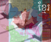
But, on the other hand, you may have a point, so I added another bridge to Limpopo.

The red lines connecting two of the port city names to their territory is not necessary and doesnt look too good. Just remove the red line and move the names closer to the territory. Staying with the port cities, I do not like the anchor you have used. it doesnt fit in with the rest of the map in my opinion.
Try a different anchor.


You're right. Fixed.

A minor point, I know you have enlargened Nelson Mandela's borders for simplicity in fitting in the name and army shadow, but dont you think you may of a bit to much?


I don't see that as a problem. That area is one of our most widespread metropolitan areas and I didn't actually change anything according to accurate game-play, because it's still landlocked by the district Cacadu.

I do not like the font used for the oceans, it is a fancy one while the rest on the map are simple ones.


Right. Fixed.

Last point, experiment with land textures.


I did, please comment on it now... Other posters have also raised this issue, so I give to you, 3 whole hours of not-so-hard work :D


Image


PS. Thanks for giving my map some of your time!
Image
User avatar
Sergeant Crowley
 
Posts: 167
Joined: Sun Feb 18, 2007 5:53 pm
Location: Gauteng, South Africa

Postby Crowley on Sat Mar 24, 2007 11:37 pm

The pale pink area looks quite empty compared to the rest of the map.


That's because NOTHING actually happens there in real live... :P
I needed to convey a sense of desolation - that whole provice is basically half-desert...
Image
User avatar
Sergeant Crowley
 
Posts: 167
Joined: Sun Feb 18, 2007 5:53 pm
Location: Gauteng, South Africa

Postby Teya on Sat Mar 24, 2007 11:42 pm

that may be the case, but it makes the rest of the map looked cramped.
User avatar
Sergeant 1st Class Teya
 
Posts: 411
Joined: Tue Oct 17, 2006 5:25 am

Postby Wisse on Sun Mar 25, 2007 3:57 am

the bridges look bad
Image Image
User avatar
Sergeant Wisse
 
Posts: 4448
Joined: Fri Oct 13, 2006 2:59 pm
Location: The netherlands, gelderland, epe

Postby Skittles! on Sun Mar 25, 2007 5:55 am

I like the colours of this map, the texture. Most stuff.

I don't like the dead territory though, or the bridges.
The river is way to close a texture near FreeState. It looks like there is no river there and you can attack the surrounding 'continents'
Why are there different types of Mountains? Dark and light?
KraphtOne wrote:when you sign up a new account one of the check boxes should be "do you want to foe colton24 (it is highly recommended) "
User avatar
Private Skittles!
 
Posts: 14575
Joined: Wed Jan 03, 2007 2:18 am

Postby Crowley on Sun Mar 25, 2007 7:07 am

I know the bridges look bad, I just want to know if something like them is the right direction, as my 'concrete' bridges were not acceptable to others...
The dead territory is, well, dead. What more do you want?
I've been playing around with the mountain texture, that's why they look different. I would like people to comment on which ones they like best...
Image
User avatar
Sergeant Crowley
 
Posts: 167
Joined: Sun Feb 18, 2007 5:53 pm
Location: Gauteng, South Africa

Postby Skittles! on Sun Mar 25, 2007 7:09 am

Crowley wrote:I know the bridges look bad, I just want to know if something like them is the right direction, as my 'concrete' bridges were not acceptable to others...
The dead territory is, well, dead. What more do you want?
I've been playing around with the mountain texture, that's why they look different. I would like people to comment on which ones they like best...


Dead territory, I don't like the texture..

Mountains: I like the lighter ones better.
KraphtOne wrote:when you sign up a new account one of the check boxes should be "do you want to foe colton24 (it is highly recommended) "
User avatar
Private Skittles!
 
Posts: 14575
Joined: Wed Jan 03, 2007 2:18 am

PreviousNext

Return to Melting Pot: Map Ideas

Who is online

Users browsing this forum: No registered users