This is my first map so would like to hear peoples views on this:
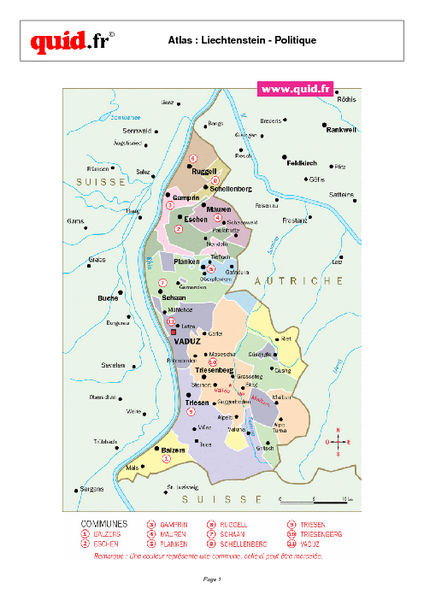
I plan to do a map on Liechtenstein, one of the smallest countries in the world. As it is so small it only has a few towns, so i will include towns just accross the borders aswell.
I Have drawn a basic outline of what i would like to do:
Large:450X750
Version 1.2 With Roads
- Click image to enlarge.

STILL TO DO:
Make with Regions
Bonuses, Touch up roads and name places, Small map.
Version 1.0http://i445.photobucket.com/albums/qq176/Boss_Oss_ss/Map-%20Lichtenstein/Lich.png
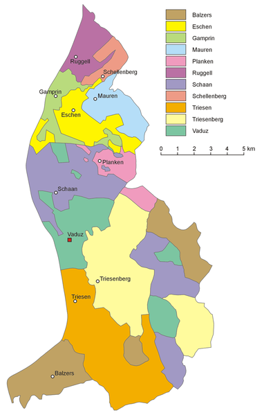
I will use this map as a guide to where to put the places
- Click image to enlarge.

I will have 24 Territories :
I am planning to have the following bonuses:
Austria: +2
Switzerland: +5
Vaduz: +1
Vaduz, Feldkirch and Buchs: +2
Any thaughts?
Boss


