Central America [Quenched]
Moderator: Cartographers
Forum rules
Please read the Community Guidelines before posting.
Please read the Community Guidelines before posting.
-
lgoasklucyl

- Posts: 526
- Joined: Mon Apr 07, 2008 8:49 pm
- Gender: Male
- Location: Somewhere in the 20th century.
Re: Central America [D] Gameplay Poll Up!!!!! (See P. 3)
New problem: fitting the minimap, region names, and a port in that corner will prove difficult. I suppose I could make the entire mini-map smaller, but that's gunna end up pretty tiny in the small version.

-
LED ZEPPELINER
- Posts: 1088
- Joined: Tue Nov 25, 2008 10:09 pm
Re: Central America [D] Gameplay Poll Up!!!!! (See P. 3)
i think that making the minimap smaller wouldn't be so bad if you:lgoasklucyl wrote:New problem: fitting the minimap, region names, and a port in that corner will prove difficult. I suppose I could make the entire mini-map smaller, but that's gunna end up pretty tiny in the small version.
a) got rid of the territ borders in the minimap, and just left the bonus borders
b) made the font of the +_ smaller with the minimap
-
lgoasklucyl
- Posts: 526
- Joined: Mon Apr 07, 2008 8:49 pm
- Gender: Male
- Location: Somewhere in the 20th century.
Re: Central America [D] Version 5 Up !!!!!
Okay, here's version 5.
Issues:
-I'm going with the extra territs and am in desperate need of some advice. I found some modern tankers, took a load of time cropping them out nicely, only to realize they look like crap in this scheme. Anyone got ideas to make them fit better? Making them smaller may help a little, but they become pretty much black-blobs at that point.
-How are the colors on the southern two bonuses now? I took a lot of red out of the southern most bonus to try to help with the colorblind (note: minimap colors not updated yet, until we come to a conclusion on colors).
-Minimap itself: Think it needs borders? I kind of like it free-floating, but people have expressed dis-interest in it.
-The compass may need to be made smaller to work with the boat action.
-Ports will also be made and figured out (another scheme-pain I'm sure)
-Something will be written in pertaining to boats/ports as soon as I can figure them out
-I need to add the attack routes back in for the islands.
-Small version has a bunch of ordeals I'm sure: Minimap font, centering, whatnot.
-What does everyone think about the versions w/o army circles? I personally like it, though it might prove to be even more problems for the color-blind.
I'm sure there's LOADS more, but I'm forgetting as of right now. I've decided that instead of waiting for feedback and doing big updates I'm just going to pour updates out as ideas come in; seems maps get more feedback that way.
Thanks! Off to studying for the Family Law and Social Policy exam
- Click image to enlarge.

- Click image to enlarge.


Re: Central America [D] V5 !!!! (page 1 and 4)
I would not use those Tankers, they look way out of place...
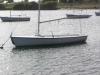
This ship would fit in better if you ask me..

This ship would fit in better if you ask me..
Highest Rank: 26 Highest Score: 3480

-
lgoasklucyl
- Posts: 526
- Joined: Mon Apr 07, 2008 8:49 pm
- Gender: Male
- Location: Somewhere in the 20th century.
Re: Central America [D] V5 !!!! (page 1 and 4)
Hm. I do like the cartoony-approach better (fits the scheme better). Drops the idea of oil as the reason for the extra territs, but I'm sure we could make it work.
Unfortunately, Cairns is working on a Jamaica right now with a similar gameplay asset and it may not fly to have two coming in at the same time. I suppose I'll wait for more feedback.
Unfortunately, Cairns is working on a Jamaica right now with a similar gameplay asset and it may not fly to have two coming in at the same time. I suppose I'll wait for more feedback.
-
lgoasklucyl
- Posts: 526
- Joined: Mon Apr 07, 2008 8:49 pm
- Gender: Male
- Location: Somewhere in the 20th century.
Re: Central America [D] V5 !!!! (page 1 and 4)
Update: I've tried these boats out and do like them better.Bruceswar wrote:I would not use those Tankers, they look way out of place...
This ship would fit in better if you ask me..
I think I'm going to crop them out, plop them in, then hand-draw some ports (unless someone comes up with a more interesting idea for the ports).
-
lgoasklucyl
- Posts: 526
- Joined: Mon Apr 07, 2008 8:49 pm
- Gender: Male
- Location: Somewhere in the 20th century.
Re: Central America [D] V5 New Boats!!! (p1+4)
Okay, here's version 5.
Changes:
-Added attack routes back in on islands.
-Fixed shadows on Cayes
-New boats
-Resized compass
-Messed with the credits font a bit to make it more legible
Issues:
-How are the colors on the southern two bonuses now? I took a lot of red out of the southern most bonus to try to help with the colorblind (note: minimap colors not updated yet, until we come to a conclusion on colors).
-Minimap itself: Think it needs borders? I kind of like it free-floating, but people have expressed dis-interest in it.
-The compass may need to be made smaller to work with the boat action.
-Ports will also be made and figured out (another scheme-pain I'm sure)
-Something will be written in pertaining to boats/ports as soon as I can figure them out
-What does everyone think about the versions w/o army circles? I personally like it, though it might prove to be even more problems for the color-blind.
I'm sure there's LOADS more, but I'm forgetting as of right now. I've decided that instead of waiting for feedback and doing big updates I'm just going to pour updates out as ideas come in; seems maps get more feedback that way.
- Click image to enlarge.

- Click image to enlarge.

-
LED ZEPPELINER
- Posts: 1088
- Joined: Tue Nov 25, 2008 10:09 pm
Re: Central America [D] V5 !!!! (page 1 and 4)
to me, the compass on the large map, and maybe the small map looks a little squished/dememted
-
lgoasklucyl
- Posts: 526
- Joined: Mon Apr 07, 2008 8:49 pm
- Gender: Male
- Location: Somewhere in the 20th century.
Re: Central America [D] V5 !!!! (page 1 and 4)
It's gone through a couple Transforms, it may be off by now. I could reopen the original and down-size on % to see if that helps.LED ZEPPELINER wrote:to me, the compass on the large map, and maybe the small map looks a little squished/dememted
-
LED ZEPPELINER
- Posts: 1088
- Joined: Tue Nov 25, 2008 10:09 pm
Re: Central America [D] V5 !!!! (page 1 and 4)
i would suggest thatlgoasklucyl wrote:It's gone through a couple Transforms, it may be off by now. I could reopen the original and down-size on % to see if that helps.LED ZEPPELINER wrote:to me, the compass on the large map, and maybe the small map looks a little squished/dememted

Re: Central America [D] V5 !!!! (page 1 and 4)
Minor niggle.... the black flags on the ships are blowing in the opposite direction than the wind in the mainsails....

PB: 2661 | He's blue... If he were green he would die | No mod would be stupid enough to do that
-
lgoasklucyl
- Posts: 526
- Joined: Mon Apr 07, 2008 8:49 pm
- Gender: Male
- Location: Somewhere in the 20th century.
Re: Central America [D] V5 !!!! (page 1 and 4)
I could reverse them, but I'm pretty sure it would look weird. Cairns' Jamaica map has similar ships and they're blowing with the same consistency.MrBenn wrote:Minor niggle.... the black flags on the ships are blowing in the opposite direction than the wind in the mainsails....
I feel like the black flags pointing forwards would look strange. Perhaps the main ones are catching the majority of the propulsion and moving the ship forwards which is in turn making the black flags blow backwards? lol
I'll test it out and see how it looks, I just feel it might be strange with them pointing forwards.
Re: Central America [D] V5 !!!! (page 1 and 4)
That works for melgoasklucyl wrote:Perhaps the main ones are catching the majority of the propulsion and moving the ship forwards which is in turn making the black flags blow backwards? lol
PB: 2661 | He's blue... If he were green he would die | No mod would be stupid enough to do that
-
lgoasklucyl
- Posts: 526
- Joined: Mon Apr 07, 2008 8:49 pm
- Gender: Male
- Location: Somewhere in the 20th century.
Re: Central America [D] V5 !!!! (page 1 and 4)
I would like to note I did not fair well in PhysicsMrBenn wrote:That works for melgoasklucyl wrote:Perhaps the main ones are catching the majority of the propulsion and moving the ship forwards which is in turn making the black flags blow backwards? lol

Re: Central America [D] V5 !!!! (page 1 and 4)
the latest ships are alright, but something simpler might fit the map better... I've been busy as of late, but when I get some free time I'll see if I can't be more helpful.

Re: Central America [D] V5 !!!! (page 1 and 4)
Note - Sails don't actually propel a ship by catching the wind and Pushing the boat along...MrBenn wrote:That works for melgoasklucyl wrote:Perhaps the main ones are catching the majority of the propulsion and moving the ship forwards which is in turn making the black flags blow backwards? lol
They act like Aeroplane wings - and Pull a ship along.
I think the new boats are a bit off - and also perhaps a bit disproportioned... - so much so that I prefer the tankers.
C.

Highest score : 2297
-
Incandenza

- Posts: 4949
- Joined: Thu Oct 19, 2006 5:34 pm
- Gender: Male
- Location: Playing Eschaton with a bucket of old tennis balls
Re: Central America [D] V5 !!!! (page 1 and 4)
What if you just aced the boats and had army circles out in the middle of the water?
THOTA: dingdingdingdingdingdingBOOM
Te Occidere Possunt Sed Te Edere Non Possunt Nefas Est
Te Occidere Possunt Sed Te Edere Non Possunt Nefas Est
-
sailorseal
- Posts: 2735
- Joined: Sun May 25, 2008 1:49 pm
- Gender: Male
- Location: conquerclub.com
Re: Central America [D] V5 !!!! (page 1 and 4)
Very good, only suggest that there is an island made in between RAAN and canal
-
the.killing.44

- Posts: 4724
- Joined: Thu Oct 23, 2008 7:43 pm
- Gender: Male
- Location: now tell me what got two gums and knows how to spit rhymes
- Contact:
Re: Central America [D] V5 !!!! (page 1 and 4)
Gameplay has already been done … I thought you figured that out from what Neon explained to you.sailorseal wrote:Very good, only suggest that there is an island made in between RAAN and canal
As for the paths, if you decide to go back to them, here's what I do:
Take your brush, make all the settings correct like you were to hand-draw the paths.
Then go to the pen tool, hit "New Path" from the "Paths" tab, and draw the path from one of the ships to the land.
Hit "B", then select the path from the Paths tab in the layer window, and hit return.
Erase any dots on the land, or ones that look bad.
Repeat for each, in a new path every time.
Works smoothly for me, see Greenland
.44
-
lgoasklucyl
- Posts: 526
- Joined: Mon Apr 07, 2008 8:49 pm
- Gender: Male
- Location: Somewhere in the 20th century.
Re: Central America [D] V5 !!!! (page 1 and 4)
Hm, seems there's a lot of distaste with the new boats.
I could try a couple things:
1)Making them much smaller (rather large now; really just posted to check out the look of them).
2)Eliminating them in favor of:
a. Tankers
b. Some other boat
c. No boat (ie: Simply use army circles as proposed by Incan)
d. Drop the idea and go back to simply attacking from north to south.
-
Incandenza
- Posts: 4949
- Joined: Thu Oct 19, 2006 5:34 pm
- Gender: Male
- Location: Playing Eschaton with a bucket of old tennis balls
Re: Central America [D] V5 !!!! (page 1 and 4)
That's not exactly correct, gameplay is still very much up for discussion.the.killing.44 wrote:Gameplay has already been done … I thought you figured that out from what Neon explained to you.sailorseal wrote:Very good, only suggest that there is an island made in between RAAN and canal
THOTA: dingdingdingdingdingdingBOOM
Te Occidere Possunt Sed Te Edere Non Possunt Nefas Est
Te Occidere Possunt Sed Te Edere Non Possunt Nefas Est

Re: Central America [D] V5 !!!! (page 1 and 4)
The pirate ships match the feel of the map more than the tankers, but I'll agree they are too big. Scaling them down a bit, and then having the south one point to the right (a Transform -> Flip Horizontal should do the trick, no loss of integrity) should look better. The major problem here is the large amounts of Sea compared to the playable part of the map. Populating that without crowding...aye there's the rub.
Re: Central America [D] V5 !!!! (page 1 and 4)
I hope this map isn't stalled because of boats. The map is colorful and contemporary, so the ships should be as well. Colorful pirate ships don't quite work, nor do black and white oil tankers. This may require some handiwork.
Regardless, I suggest you just draw in the attack lines, label the territories (Pacific Shipping Channel & Caribbean Shipping Channel maybe?) and we can sort out what the boats should look like later? There are other things to work out.
Regardless, I suggest you just draw in the attack lines, label the territories (Pacific Shipping Channel & Caribbean Shipping Channel maybe?) and we can sort out what the boats should look like later? There are other things to work out.
-
Incandenza
- Posts: 4949
- Joined: Thu Oct 19, 2006 5:34 pm
- Gender: Male
- Location: Playing Eschaton with a bucket of old tennis balls
Re: Central America [D] V5 !!!! (page 1 and 4)
Very much concur.
THOTA: dingdingdingdingdingdingBOOM
Te Occidere Possunt Sed Te Edere Non Possunt Nefas Est
Te Occidere Possunt Sed Te Edere Non Possunt Nefas Est
-
lgoasklucyl
- Posts: 526
- Joined: Mon Apr 07, 2008 8:49 pm
- Gender: Male
- Location: Somewhere in the 20th century.
Re: Central America [D] V5 !!!! (page 1 and 4)
Okay, I'll try this: Scaling down the boats, naming the territs, drawing in the attack lines, and seeing how that looks.oaktown wrote:I hope this map isn't stalled because of boats. The map is colorful and contemporary, so the ships should be as well. Colorful pirate ships don't quite work, nor do black and white oil tankers. This may require some handiwork.
Regardless, I suggest you just draw in the attack lines, label the territories (Pacific Shipping Channel & Caribbean Shipping Channel maybe?) and we can sort out what the boats should look like later? There are other things to work out.
Perhaps more suggestions will help the process flow better so we can start working out everything else also