but the problem is that 1. I have no experience doing this, whatsoever, 2. I don't even have an illustrator program (the ones on the list are a pain trying to get, I wanted one of the freeware ones, but they all have some sort of insane portal download system I cant figure out, and picassa doesnt actually have anything but picture editing software) 3. I dont know how to code it.
If anyone thinks this map would be cool do they mind helping me out?
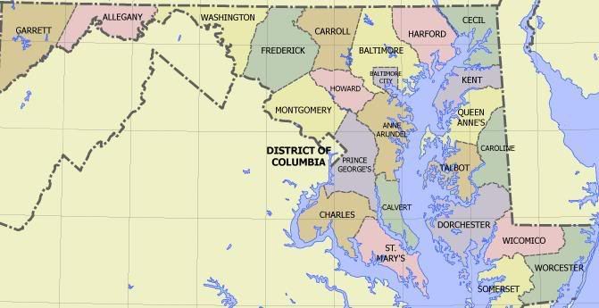
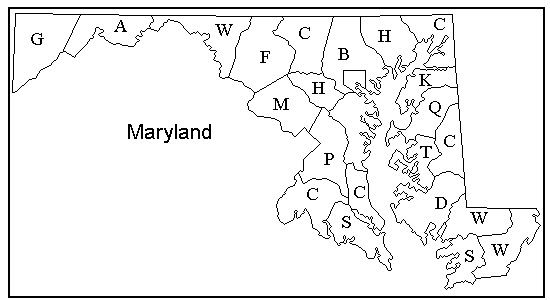
I am going to split the counties up some, there are 24 counties in Maryland I figure if I divided those into two based around relevant large cities it would be a fun map to play.