

Mexico Map
Moderator: Cartographers
Forum rules
Please read the Community Guidelines before posting.
Please read the Community Guidelines before posting.
-
reverend_kyle

- Posts: 9250
- Joined: Tue Mar 21, 2006 4:08 pm
- Location: 1000 post club
- Contact:
-
reverend_kyle
- Posts: 9250
- Joined: Tue Mar 21, 2006 4:08 pm
- Location: 1000 post club
- Contact:


Photobucket shows it at its actual size, 371 pixels by something pixels. You have to make it bigger in a graphics program before sending it to photobucket.
You can download Gimp for free to do graphics stuff like resizing. All the stuff I've been doing with Chariot races has been on Gimp, so it's not bad for a free program. Just google it.
You can download Gimp for free to do graphics stuff like resizing. All the stuff I've been doing with Chariot races has been on Gimp, so it's not bad for a free program. Just google it.

-
AndyDufresne

- Posts: 24932
- Joined: Fri Mar 03, 2006 8:22 pm
- Location: A Banana Palm in Zihuatanejo
- Contact:

-
AndyDufresne
- Posts: 24932
- Joined: Fri Mar 03, 2006 8:22 pm
- Location: A Banana Palm in Zihuatanejo
- Contact:
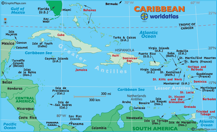
If you are doing a caribbean map...the area in the nap above seems like too much of the areas around the caribbean. I would think a map of such an area would be similar to this.
--Andy
--Andy
-
la estampida

- Posts: 6
- Joined: Thu May 04, 2006 5:04 pm
- Location: Behind You with a knife
- Contact:
-
la estampida
- Posts: 6
- Joined: Thu May 04, 2006 5:04 pm
- Location: Behind You with a knife
- Contact:
-
la estampida
- Posts: 6
- Joined: Thu May 04, 2006 5:04 pm
- Location: Behind You with a knife
- Contact:
 ([/img])[/list]
-
la estampida
- Posts: 6
- Joined: Thu May 04, 2006 5:04 pm
- Location: Behind You with a knife
- Contact:
well the mqp is small the brown part are mountains which help the map to make it more of strategy and it separates some parts I cant seem to get a big map I could get some help on format because the size is okay. well a unique part of the map is the petroleum towers it may sound stupid each 1 of the states in this case gives 1 extra unit. we need more variety of maps. sorry i cant do it now i am in europe. the final map i plan to do is something like this i dont have any of those fancy programs i dont care about how the map looks i care more about how fun and/or hard it is
(this was made in paint)[/code]
(this was made in paint)[/code]
AlL YOuR bAsE ARe beLOng tO US

hey, this map seems like a great idea!!
i'll be posting with an idea about the territories... right now i'm busy so i can't give a map or a complete list right now, but i'll be doing so this week maybe...
you could have five continents:
- United States (only south-eastern US)
- Mexico
- Central America
- South America (only north-western SA)
- Caribbean
the less "powerful" ones would be US and SA because they would only be connected to two continents (US to Mexico, Caribbean & SA to CA, Caribbean)
the intermediate ones woud be Mexico and CA, because they would be connected to three continents (Mexico to CA, US, Caribbean and CA to Mexico, SA, Caribbean)
the most "powerful" continent woud be the Caribbean because it would be connected to all other continents
i'll be posting soon with a complete list of territories and later with a map... just give me time to make it
i'm really looking forward to this map....
-
wcaclimbing

- Posts: 5598
- Joined: Fri May 12, 2006 10:09 pm
- Location: In your quantum box....Maybe.
- Contact:

-
AndyDufresne
- Posts: 24932
- Joined: Fri Mar 03, 2006 8:22 pm
- Location: A Banana Palm in Zihuatanejo
- Contact:

ok, maybe i do have some time.... 
here's a map for central america

NOTES:
here's a map for central america
NOTES:
- i divided Guatemala, Nicaragua and Panama in two territories for the map to be more playable (if i didn't, central america would be a "chain" of territories you'd have to be conquering one by one, missing none)
- the names i gave this divisions are tentative: instead of Guatemala/Peten it could be S.Guatemala/N.Guatemala; instead of Managua/Zelaya it could be E.Nicaragua/W.Nicaragua; instead of Colon/Panama it could be E.Panama/W.Panama
- i tweaked the El Salvador/Honduras/"Managua" border in order to enhance its playability. i connected El Salvador to Managua so Honduras doesn't become a "must have" territory
