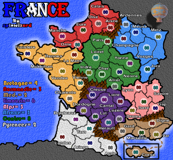
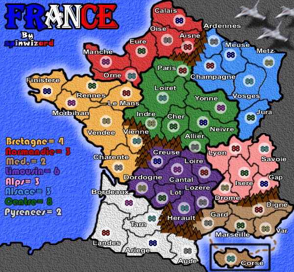
It might just be me, but I'm not a fan of the bright lime green continent you have at the bottom of the map. It stands out quite a lot in relation to the other continent colours.
Partly to do with your choice of colours, partly to do with texture... I don't like how the textures look on this map. It appears as if you have a uniform texture across the map, but it is hard to tell because it is quite strong in some areas and not visible in others. I'd look at toning down the texture so it appears more consistent across the whole map. Unless you have some sort of attachment to the water texture, I'd look into a new one there was well.
Your font is quite large, which is a good thing, it makes it easier to read. You could probably get away with a smaller size font though, especially considering this is the smaller map (I presume). This would free up some space and reduce some of the overlapping.
I'm going to have to say that your continent borders are a mess. Your territory borders seem fine, but the continent borders are of various thickness all over the map. Just look at Paris/Eure for an example.
I have other things to comment on, but I don't want to overwhelm you... or write a novel.
Last thing I will mention for now is the scope of the map itself. I agree with some of the others that Corse is out of place. I think you could solve this by "zooming out" and giving yourself enough room to have the island in its actual geographical location. If this is too much to ask, I would much prefer to see the island in it's correct orientation.