
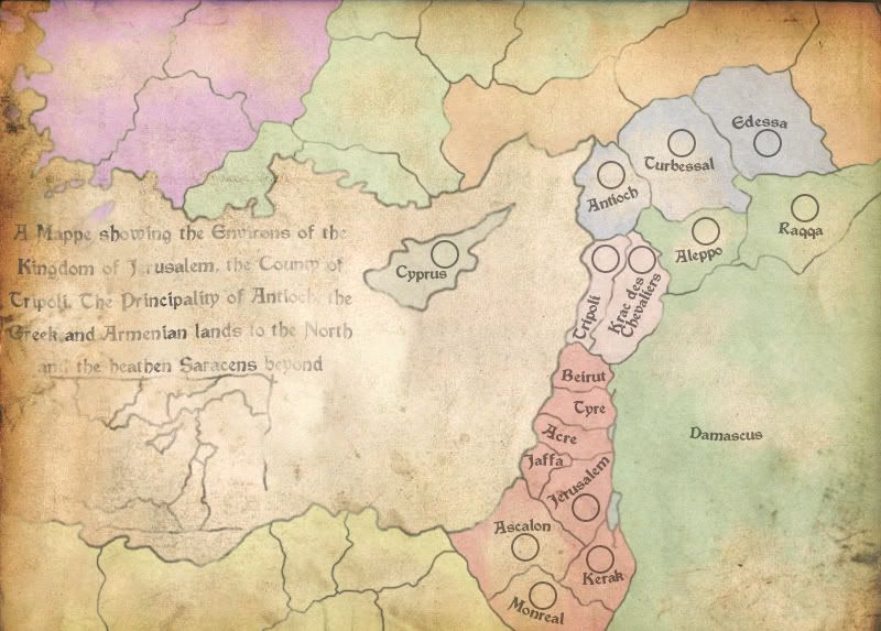
Borders in the area at the time were in no way marked out, unless they corresponded with a river, and so they territory demarcation is fairly arbitrary. There is certainly room for splitting territories / merging them and the eastern Muslim lands (darker green) haven't been split yet because there generally wasn't much there. The river Jordan (in the centre of the map) should be impassable, and at some point I'll make that more obvious. There is scope for more impassables in the North, and the sea connections to and dfrom Cyprus also need to be defined.
So... First impressions?