Pork,
I'd be more than happy to work with you on this, since as I told you, Romania is a subject very close to my heart.
I like to work fast and I agree that there is no reason to do complicated drafts. Please find below links to maps which will show you where things are and will tell you everything you need to know. Of course, some items will be judgement calls which we can decide together.
I look forward to working with you on this one! Thank you!
Raskholnikov.
This is more or less how the map should look in terms of bonus regions.
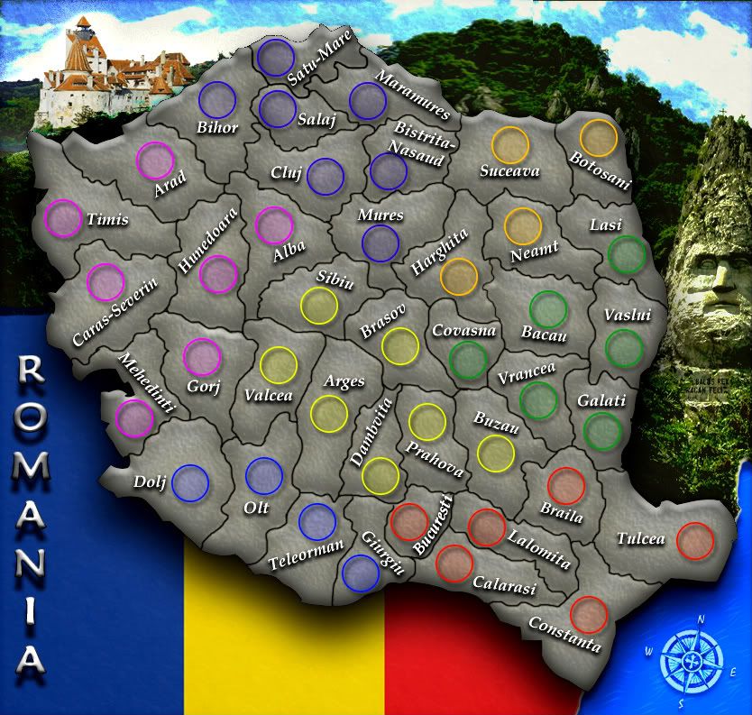
The regional division is essentally correct. But the map should be called: Romania Between the Two World Wars: 1918-1940. Otherwise we might annoy a lot of Bulgarians, Ukrainians, Russians and Moldovans hahahaha

For the actual Judete, check this map it's quite cool. I think there are 72 Judete in all. If you think that's too many, we can use the 41 that exist today (and which you have on your map) and add 12: 1 in Bucovina, 9 in Basarabia, 2 in Dobrogea. It wouldn't be historically accurate, but you may prefer 53 instead of 72. Personally, I prefer the historically accurate version but it's your call
 http://romaniainterbelica.memoria.ro/
This is a site with a lot of very useful maps. They could prove helpful:
http://mapsromania.celendo.eu/These are the rivers and mountains we should put in:

Once we decide exactly the final shape of the regions and the number of Judete, we can decide together where to put the mountain passes and bridges.
Oh, if you absolutely hate the idea of doing the historical map of 1918-1940 and want to stick to today's Romania, we can use the map below and have as bonuses Romania's 8 Euro-regions (in fact, 7 plus Bucharest). Personally I prefer the historical map (lol surprise!), but it's your map and I want you to choose what corresponds closest to your vision. I'll be happy to assist either way.
http://www.celendo.ro/HartiJudete/EuroZ ... elendo.jpg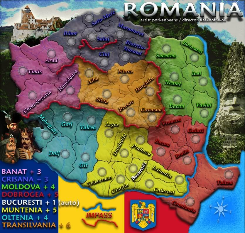


