150 After Hijrah: The Battle for God
Moderator: Cartographers
Forum rules
Please read the Community Guidelines before posting.
Please read the Community Guidelines before posting.
Re: 150 After Hijrah: The Battle for God
Speaking as a relatively rare poster, the parchment version is much much better than the space. Really liking the direction you're headed, theme seems very appropriate now.
-
Raskholnikov
- Posts: 638
- Joined: Fri Sep 11, 2009 3:40 pm
Re: 150 After Hijrah: The Battle for God
Hey Pork,
It seems you've hit bulls-eye! Good job, my friend! Let's make this a great map now and move it upwards and onwards!
R
It seems you've hit bulls-eye! Good job, my friend! Let's make this a great map now and move it upwards and onwards!
R
Re: 150 After Hijrah: The Battle for God
This is what everyone was talking about PB!! Great job and let's continue down this trail shall we?
I agree with natty here ...
I agree with natty here ...
And with what rask mentioned about the Black Sea port, do it so the Black Sea is connected with the Mediterranean Sea. Otherwise keep up the good work you two!!natty_dread wrote:I think you should decrease the colour saturation a bit. Making it look a bit more "faded" would give it more of that ancient look... and make it easier on the eyes.
-
porkenbeans

- Posts: 2546
- Joined: Mon Sep 10, 2007 4:06 pm
Re: 150 After Hijrah: The Battle for God
Thanks for the kind words WM.WidowMakers wrote:MUCH better. Looks great pork.
Suggestions:Anotehr question. How can K2 attack the otehr ports? It is not connected to them by water.
- 1) Delete the roads behind the city army circles. That way they don't interfere with the 88's.
2) Maybe use a smoother brush to draw the roads, they are a bit pixelly
3) Explain somewhere how the naming works (FK=Frankish Kingdom, etc) maybe?
4) Maybe come up with a better Jerusalem icon since it is so close to the regular star.
Overall 100% improvement IMO. Good work.
I LOVE the crossing line throughout the map. I ddi not notice them at first but they really help with the ancient feel.
WM
1.) That is a good idea. Will do.
2.) I did a lot of experimenting to try and find a way to simulate a quill pen. I ended up using a soft pencil at 5 pix. then threw on an outside bevel, then an inside stroke with 0% opacity. I managed to get the variation in width of the line that I was looking for, but I am sure that there is an easier and/or better way to do this. I am not a photoshop master by any means. I have never read a tutorial, or photoshop manual, and the only things I know have come from just experimenting. When it comes to "suggestions", I am always most anxious to hear any pointers.
3.) Yes, I think this is a good idea also.
4.) Yes, this is also a good idea. as a matter of fact, I think that all of the icons could be changed to more appropriate ones. I would love to see any images that people might want to offer up. Right off the top, I think that ships would work much better than ships wheels for the ports.
About K2. I think you mean K3, and I was pondering this situation myself. If you notice the old map that I posted, it shows that body of water actually connected to the Med. I could connect it if Rask thinks it is kosher.

-
porkenbeans
- Posts: 2546
- Joined: Mon Sep 10, 2007 4:06 pm
Re: 150 After Hijrah: The Battle for God
Thanks partner.Raskholnikov wrote:Wow! |Idrisi's map meets Conan the Barbarian!!!
Hey I love it, I think it's great and the initial reaction to it seems positive, so let's go for it!
A few comments:
1. I'd like to see the roads and icons come out a bit clearer from the map background. They tend to blend in and almost fade away right now.
2. After (or underneath) each Dynasty name write its short form: Al Andalus Caliphate (AN). Also please make sure its Al Andalus, not Ai Andalus.
3. In the legend, please use same font and size for Jerusalem as for all others. Also, don't switch fonts between icon names and the bonus numbers. Use one font consistently for everything. It's easier on the eye IMHO.
4. In regular bonuses, please add the battle site symbol and write Battle Site: +1.
5. On the right-hand side legend, either capitalise all Ports, Capitals, Religious Sites and Cities or none at all. That way we stay consistent.
6. In Regular Bonuses, the bracket after Includes should be moved all the way down, after sites.
7. You wrote Al Andalus over a battle site and connected two cities directly instead on connecting each to that battle site.
8. I noticed you worked on renumbering the cities, and skipped the number 2 for Dynasties without Religious sites. Therefore, as I said, all Capitals should be "1", all Ports "2", all Religious sites "3", regular cities for smaller Dynasties should go from "4" to "6", for larger Dynasties from "3" to "11".
9. 5. All Ports Can Attack Each Other covers a city name. So does Abbasid Caliphate.
10. I love the color and script of the text at the top left-hand side, but I think we need a font that is a bit easier to read. Espacially on a small map, I think people will have a hard time deschiphering that font.
11. Because in that text we refer to Religious Shrines, we should be consistent and use Religious Shrines in the legend too, not Religious Sites.
12. Question: Do you think we should add the flags of each Dynasty, or leave it as is?
That's all I have for now. Great change of direction, huge amount of work - let's see what people think now. My main concern overall is making the icons and roads stand out more from a very rich, colorful, relatively dark background.
Thank you Pork for all this hard work. You did really great!
R
About the font. I had to switch font for the bonus numbers because that font does not have numbers. I will try to find a font that matches it better.
About the flags. I think that they may act to clutter it up. I don't know. Maybe we can find a way to have them included. I have an idea on that, and I will do some experimenting to see what I can come up with.
I am exited about this map once again, and I am finding it hard to go back to work on the space version. I would like to spend my time on something that will advance this version, rather than on something that has not garnered very much support. Let me know, you are the director. I can't work on anything today, so I will be back on something tomorrow. I can work on which ever project that you direct me too. Romania, Paradise, God space, God parch., or ?
Everything else that you mentioned, ...Will do.
Last edited by porkenbeans on Tue Dec 01, 2009 1:17 pm, edited 1 time in total.
-
Raskholnikov
- Posts: 638
- Joined: Fri Sep 11, 2009 3:40 pm
Re: 150 After Hijrah: The Battle for God
Hi Pork,
I'm ok with any changes you want to make - artistically, icons, etc. You are the artistic director and I totally trust you on this.
Re: map outline, you will note that what you are using is a very approximate and sometimes distorted map. I'm ok with it if you think it necessary to portray the feel of an "ancient" map, but if you look at my draft above, you will see the accurate version. In it, there is a clear connection between the Black Sea and the Mediterranean, and Constantinople, the Capital of the Eastern Roman Empire, in a port on the European Side of the Bosphorus ( the sea connecting the two). It would be a good idea to bring our map in line with that,
I for one am in favour of using the more accurate contours of my draft map rather than the very distorted ones of yours, but that's your call: it doesnt affect gameplay in any way.
Re: Flags, again, your call. If you feel they don't belong on this map, I am ok with that.
I totally agree re: God's view map. The chance of that making it here is pretty much zero. Let it sleep...
As to projects, we have three very good ones: 150, Jamaica, Romania. I suggest we now focus on 150 until we get a solid draft people can comment on, then put it aside for two weeks, do the same for Jamaica, then the same for Romania. By then we can come back to 150 and refine it enough to hopefully get it to the Foundry.
In short, I really think we should take advantage of the momentum and good will I think I see for this new version and focus on it as much as possible first. Once we have a pretty good draft (like the Napoleon 1812 one Kab and I have), we can set it aside for a few weeks for comments and focus on the other two.
R
- Click image to enlarge.

-
AndyDufresne

- Posts: 24919
- Joined: Fri Mar 03, 2006 8:22 pm
- Location: A Banana Palm in Zihuatanejo
- Contact:
Re: 150 After Hijrah: The Battle for God
Agreed. Some legibility and light/darkness issues, but those will work themselves out I think.danryan wrote:Speaking as a relatively rare poster, the parchment version is much much better than the space. Really liking the direction you're headed, theme seems very appropriate now.
--ANdy
-
wcaclimbing
- Posts: 5598
- Joined: Fri May 12, 2006 10:09 pm
- Location: In your quantum box....Maybe.
- Contact:
Re: 150 After Hijrah: The Battle for God
This new version is very good.
Of course, the graphics still need some fixing up, as others have suggested, but the new style works really well with the rest of the theme and looks good overall.
Nicely done.
Of course, the graphics still need some fixing up, as others have suggested, but the new style works really well with the rest of the theme and looks good overall.
Nicely done.

-
Kabanellas
- Posts: 1482
- Joined: Fri Feb 27, 2009 12:21 pm
- Gender: Male
- Location: Porto, Portugal
Re: 150 After Hijrah: The Battle for God
Great work there! This new map is a tremendous improvement; it goes along with the story and the concept of the map perfectly.
WM is right, the roads seem a bit pixelated. As for the roads behind the army circles, I like them, as well as the cities represented by their junction, maybe they don’t interfere that much with the numbers.
I just have a thing about that Cyan in the legend, it doesn’t go well with the map. It still gives that ‘space’ feeling you had in the first version rather than helping with the parchment look. What about a gold or a silver tone.
Also, shouldn’t you open the Black Sea to the Mediterranean?
Great work guys!

-
eigenvector
- Posts: 95
- Joined: Tue Jul 24, 2007 4:27 am
Re: 150 After Hijrah: The Battle for God
I second this.natty_dread wrote:I think you should decrease the colour saturation a bit. Making it look a bit more "faded" would give it more of that ancient look... and make it easier on the eyes.
Great work! I really like this. The unusual map projection is cool.

Re: 150 After Hijrah: The Battle for God
As long as we're talking about water connections, I'd like to suggest that the strip of water connecting the Red and Mediterranean Seas be replaced with land. Though I'm not entirely sure of the date, I'm 95% confident that the Suez Canal did not exist A.H. 150.
Re: 150 After Hijrah: The Battle for God
large parts of this map is NOT 150 AH but several centuries later so why not add a little 19th century to it as well?cubfanpgh wrote:As long as we're talking about water connections, I'd like to suggest that the strip of water connecting the Red and Mediterranean Seas be replaced with land. Though I'm not entirely sure of the date, I'm 95% confident that the Suez Canal did not exist A.H. 150.
oh well he did remove Moscow..
The comet cometh!
-
Raskholnikov
- Posts: 638
- Joined: Fri Sep 11, 2009 3:40 pm
Re: 150 After Hijrah: The Battle for God
Yes I did take off Moscow. Thanks for your help with that.
-
Raskholnikov
- Posts: 638
- Joined: Fri Sep 11, 2009 3:40 pm
Re: 150 After Hijrah: The Battle for God
Pork has been kind enough to offer to re-think this project and come up with a new picture. I look forward to work with him again and bring this project back to life.
-
Industrial Helix

- Posts: 3462
- Joined: Mon Jul 14, 2008 6:49 pm
- Gender: Female
- Location: Ohio
Re: 150 After Hijrah: The Battle for God
I'd highly recommend focusing you're energies on Central Asia first.
Sketchblog [Update 07/25/11]: http://indyhelixsketch.blogspot.com/
Living in Japan [Update 07/17/11]: http://mirrorcountryih.blogspot.com/
Russian Revolution map for ConquerClub [07/20/11]: http://www.conquerclub.com/forum/viewto ... 1&t=116575
Living in Japan [Update 07/17/11]: http://mirrorcountryih.blogspot.com/
Russian Revolution map for ConquerClub [07/20/11]: http://www.conquerclub.com/forum/viewto ... 1&t=116575
-
Raskholnikov
- Posts: 638
- Joined: Fri Sep 11, 2009 3:40 pm
Re: 150 After Hijrah: The Battle for God
Yes, of course. But pamoa is working on that picture, and while he is doing so, i had a chat with pork about how we might revamp this one. Both pictures will take some time to be developed by the two cartographers, so there is no conflict between them.
-
theBastard
- Posts: 994
- Joined: Sat Jan 09, 2010 9:05 am
Re: 150 After Hijrah: The Battle for God
I see this map first time. hm, where I was before? 
I like it, the idea, gameplay and ofcourse pork´s graphics. just some notices/questions:
1, I can not see in legend explaintation what the swords are mean.
2, names of territories are a little peliculiar. it sounds as chess... when you can use colours you can also use normal names for cities, ports...
you can do coloured borders around symbols (the same colour for kingdom´s symbols). or you can draw borders of kingdoms on the map - I can see roads, so why not borders?
-
Raskholnikov
- Posts: 638
- Joined: Fri Sep 11, 2009 3:40 pm
Re: 150 After Hijrah: The Battle for God
We're reworking the picture. Stay tuned.
Swords are battle sites and act as neutral territories.
We have the names of all cities in XML - they just wont't fit in full on the map. See World War II Europe.
There are no fixed borders, just cities belonging to the same Prince. Historically, borders were fluid and a sovereign's control centered around cities. Same thing here - therefore no fixed boundaries for individual territories or kingdoms.
-
theBastard
- Posts: 994
- Joined: Sat Jan 09, 2010 9:05 am
Re: 150 After Hijrah: The Battle for God
good luck. I wait for it.Raskholnikov wrote:We're reworking the picture. Stay tuned.
but this is not explain in the map´s legend. if my eyes are good...Raskholnikov wrote: Swords are battle sites and act as neutral territories.
yes, but with full names map will look perfect (as old fashioned)... the names are not so long, I think.Raskholnikov wrote: We have the names of all cities in XML - they just wont't fit in full on the map. See World War II Europe.
but you have kingdoms (continents) on the map. and I do not see that any town belongs to two or more kingdoms. so coloured border around cities, ports which belongs to the same Prince could be good...Raskholnikov wrote: There are no fixed borders, just cities belonging to the same Prince. Historically, borders were fluid and a sovereign's control centered around cities. Same thing here - therefore no fixed boundaries for individual territories or kingdoms.
I not see place in legend for explain this:
Spoiler
Samanid Sultanate
SC: Bukhara
SP: Daybul
S1: Samarkand
S2: Balkh
S3: Kandahar
S4: Kabul
S5: Urgench
S6: Nishapur
S7: Herat
S8: Zarang
S9: Ormuz
Abbasid Caliphate
AC:Bagdad
AP: Basra
AR: Karbala
A1: Tiflis
A2: Mosul
A3:Isfahan
Ummayad Caliphate
UC: Damascus
UP: Beirut
UR: Mecca
U1: Aleppo
U2: Medina
U3: Muscat
Fatimid Caliphate
FCC:Fustat
FCP: El-iskandaryia
FC1: Ghazza
FC2: Barqa
FC3: Siwa
FC4: Asyut
FC5: Aydhab
FC6: Aswan
F7: Dunqulah
F8: Meruwah
FC9:Aksum
Idrisid Sultanate
IC: Fez
IP: Tangiers
I1: Balharm (Palermo)
I2: Tunis
I3: Al-Mahdyia
I4: Tarabulus
I5: Al Qayrawan
I6: Tlemcen
I7: Marrakesh
I8: Sijilmasa
I9: Ghat
Al-Andalus Caliphate
AAC: Tulyatulah
AAP: Balanciya
AAR: Qurtuba
AA1: Isbilia
AA2: al-Ishbunah
AA3: Barcino
Frankish Kingdom
FC: Paris
FP: Marseilles
F1: Strasbourg
F2: Lyon
F3: Augsbourg
F4: Mayence
F5: Cologne
F6: Rennes
F7: Nantes
F8: Tours
F9: Bordeaux
Lombard Kingdom
LC: Pavia
LP: Genoa
LR: Roma
L1: Napoli
L2: Milano
L3: Venezia
Eastern Roman Empire
RC: Constantinopolis
RP: Ephesos
RR: Hagion Oros Athos
R1: Adrianopolis
R2: Athina
R3: Ancyra
Kievan Rus
KC: Kyiv
KP: Tmutarakan
K1: Pereyslavl
K2: Galish
K3: Vladimir Volynsky
K4: Minsk
K5: Veliky Novgorod
K6: Yaroslavl
K7: Ryazan
K8:Chernihiv
K9: Azov
Holy Land
HR:al=Quds/Yerushalayim
HP: Sur/Tyre
Battle Sites:
B1: Guadalete 711
B2: Poitiers 732
B3: Mazara 827
B4: Ravenna 751
B5 Verona 774
B6: Demmin 798
B7: Raab 790
B8: Pliska 811
B9: Bolghar, 700s
B10: Mtskheta 735
B11: Theodosiopolis 752
B12: Akroinon 740
B13: Zab 750
B14: Merv 748
B15: Ar-rur (Nawabshah) 710
B16: Tihamah, 820
B17: Al-Aqsa 705
B18: Al-Askar 750
B19: Fakhkh 787
-
Raskholnikov
- Posts: 638
- Joined: Fri Sep 11, 2009 3:40 pm
Re: 150 After Hijrah: The Battle for God
theBastard wrote:good luck. I wait for it.Raskholnikov wrote:We're reworking the picture. Stay tuned.
but this is not explain in the map´s legend. if my eyes are good...Raskholnikov wrote: Swords are battle sites and act as neutral territories.
No. it will be on the new picture.
yes, but with full names map will look perfect (as old fashioned)... the names are not so long, I think.Raskholnikov wrote: We have the names of all cities in XML - they just wont't fit in full on the map. See World War II Europe.
I'd love to, but space will be tight. Let's see how the new picture looks when its ready.
but you have kingdoms (continents) on the map. and I do not see that any town belongs to two or more kingdoms. so coloured border around cities, ports which belongs to the same Prince could be good...Raskholnikov wrote: There are no fixed borders, just cities belonging to the same Prince. Historically, borders were fluid and a sovereign's control centered around cities. Same thing here - therefore no fixed boundaries for individual territories or kingdoms.
Yes, I agree, We may do that. Thanks.
I not see place in legend for explain this:
These are the names of each city. The full names will appear in XML, next to the code corresponding to each city as it appears on the map. Same thing with the name and year of the battles, corresponding to the swords.
The name of each kingdom will appear on the map.
are you sure that this will be clear for players?Spoiler
Samanid Sultanate
SC: Bukhara
SP: Daybul
S1: Samarkand
S2: Balkh
S3: Kandahar
S4: Kabul
S5: Urgench
S6: Nishapur
S7: Herat
S8: Zarang
S9: Ormuz
Abbasid Caliphate
AC:Bagdad
AP: Basra
AR: Karbala
A1: Tiflis
A2: Mosul
A3:Isfahan
Ummayad Caliphate
UC: Damascus
UP: Beirut
UR: Mecca
U1: Aleppo
U2: Medina
U3: Muscat
Fatimid Caliphate
FCC:Fustat
FCP: El-iskandaryia
FC1: Ghazza
FC2: Barqa
FC3: Siwa
FC4: Asyut
FC5: Aydhab
FC6: Aswan
F7: Dunqulah
F8: Meruwah
FC9:Aksum
Idrisid Sultanate
IC: Fez
IP: Tangiers
I1: Balharm (Palermo)
I2: Tunis
I3: Al-Mahdyia
I4: Tarabulus
I5: Al Qayrawan
I6: Tlemcen
I7: Marrakesh
I8: Sijilmasa
I9: Ghat
Al-Andalus Caliphate
AAC: Tulyatulah
AAP: Balanciya
AAR: Qurtuba
AA1: Isbilia
AA2: al-Ishbunah
AA3: Barcino
Frankish Kingdom
FC: Paris
FP: Marseilles
F1: Strasbourg
F2: Lyon
F3: Augsbourg
F4: Mayence
F5: Cologne
F6: Rennes
F7: Nantes
F8: Tours
F9: Bordeaux
Lombard Kingdom
LC: Pavia
LP: Genoa
LR: Roma
L1: Napoli
L2: Milano
L3: Venezia
Eastern Roman Empire
RC: Constantinopolis
RP: Ephesos
RR: Hagion Oros Athos
R1: Adrianopolis
R2: Athina
R3: Ancyra
Kievan Rus
KC: Kyiv
KP: Tmutarakan
K1: Pereyslavl
K2: Galish
K3: Vladimir Volynsky
K4: Minsk
K5: Veliky Novgorod
K6: Yaroslavl
K7: Ryazan
K8:Chernihiv
K9: Azov
Holy Land
HR:al=Quds/Yerushalayim
HP: Sur/Tyre
Battle Sites:
B1: Guadalete 711
B2: Poitiers 732
B3: Mazara 827
B4: Ravenna 751
B5 Verona 774
B6: Demmin 798
B7: Raab 790
B8: Pliska 811
B9: Bolghar, 700s
B10: Mtskheta 735
B11: Theodosiopolis 752
B12: Akroinon 740
B13: Zab 750
B14: Merv 748
B15: Ar-rur (Nawabshah) 710
B16: Tihamah, 820
B17: Al-Aqsa 705
B18: Al-Askar 750
B19: Fakhkh 787
-
theBastard
- Posts: 994
- Joined: Sat Jan 09, 2010 9:05 am
Re: 150 After Hijrah: The Battle for God
not at all. I realy like this map and can helpRaskholnikov wrote: Yes, I agree, We may do that. Thanks.
here I did not meant problem with names, but how player will understand (easy and quickly) which city, port belong to which kingdoms.Raskholnikov wrote: These are the names of each city. The full names will appear in XML, next to the code corresponding to each city as it appears on the map. Same thing with the name and year of the battles, corresponding to the swords.
The name of each kingdom will appear on the map.
-
Raskholnikov
- Posts: 638
- Joined: Fri Sep 11, 2009 3:40 pm
Re: 150 After Hijrah: The Battle for God
Great! Many thanks for your help. We'll see what pork will come up with.
-
porkenbeans
- Posts: 2546
- Joined: Mon Sep 10, 2007 4:06 pm
Re: 150 After Hijrah: The Battle for God
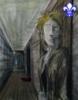
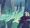
While searching maps from the era, I found that they did not really know the correct lay of the land very well. As a matter of fact, their idea of the world is not anything close to what we would recognize. I had to skip ahead a few centuries to the 1500's before I found anything that comes close to reality, and is recognizable to us as the planet Earth. Here is a map that I used to make something that I think we might be able to use.
- Click image to enlarge.

- Click image to enlarge.

- Click image to enlarge.

Last edited by porkenbeans on Mon Jul 05, 2010 1:02 am, edited 1 time in total.
-
Raskholnikov
- Posts: 638
- Joined: Fri Sep 11, 2009 3:40 pm
Re: 150 After Hijrah: The Battle for God
I TOTALLY love it! You're great, pork! Just amazing!! We need to enlarge it a bit to the left of the Caspian sea to fit the Samanids, otherwise i think it will work amazingly well.
-
porkenbeans
- Posts: 2546
- Joined: Mon Sep 10, 2007 4:06 pm
Re: 150 After Hijrah: The Battle for God
OK, but that means that I will have to squeeze the width in a bit, which means that it will be distorted from this view. How far do you think that I need to bring it in.