The Persian Empire (Last On 1st Post of P12)
Moderator: Cartographers
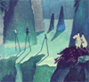
![]() by RobinJ on Thu Jun 07, 2007 4:51 pm
by RobinJ on Thu Jun 07, 2007 4:51 pm
Brilliant map yes but I still think that the legend on the small map needs to be a bit larger, even if it has to cover a bit of Bactra and Gandhara
nmhunate wrote:Speak English... It is the language that God wrote the bible in.
Highest Score: 2437
Highest Place: 84
-

 RobinJ
- Posts: 1901
- Joined: Mon Aug 21, 2006 1:56 pm
- Location: Northern Ireland


![]() by KEYOGI on Thu Jun 07, 2007 5:02 pm
by KEYOGI on Thu Jun 07, 2007 5:02 pm
I've had a good look over the map and found a few areas that could perhaps use some improvement, the first area being the dead territory. Such a strong use of images is something different, but the thing that's bothering me is not the images. I'm not sure what it is, perhaps the inner shadow that seems to be applied to it, but it looks like the seas are sitting above the dead territory. Perhaps it's just me that feels this way, but it's something to consider.
Along the top of the map, you have some shadow coming into the picture on the left. On the right you have shadow and just near the legend there's some pixelated blue line there. I wonder if you could perhaps crop the top part of the image out of the map and remove these?
I find some of the continent borders a little strange. Aria appears to be sitting over/on top of Elam. Elam over Pasargade, Sardis over Armenia and Sidon. You might want to consider doing something with the borders in Dahae as well, the black on dark blue is very hard to see.
My last little concern is the rivers and bridges. I'm not particularly fond of the bridges in the first place, but there are so many of them. Could you maybe look into the option of a smaller, less obtrusive bridge graphic or see if you can reduce the number of them? I guess you've got all the major river networks presented or something, but I think you can omit a few. The one in Armenia for example serves no purpose. Same goes for Sardis. Lastly, maybe you could try and blend the rivers into the sea a little better. It's no biggie, but the blue into the white could be improved.
Having said all that, looks like you've got yourself a nice map Night2. I particularly like the title, don't know why but I think it's neat.
-
KEYOGI
- Posts: 1632
- Joined: Tue Oct 10, 2006 6:09 am


![]() by Ruben Cassar on Thu Jun 07, 2007 5:16 pm
by Ruben Cassar on Thu Jun 07, 2007 5:16 pm
I think adding some opacity to the background images might make the map look better. Perhaps you could show us a version with that change so that we could compare them?


-

Ruben Cassar
- Posts: 2160
- Joined: Thu Nov 16, 2006 6:04 am
- Location: Civitas Invicta, Melita, Evropa


![]() by Night2 on Thu Jun 07, 2007 5:35 pm
by Night2 on Thu Jun 07, 2007 5:35 pm
KEYOGI wrote:I've had a good look over the map and found a few areas that could perhaps use some improvement, the first area being the dead territory. Such a strong use of images is something different, but the thing that's bothering me is not the images. I'm not sure what it is, perhaps the inner shadow that seems to be applied to it, but it looks like the seas are sitting above the dead territory. Perhaps it's just me that feels this way, but it's something to consider.
Along the top of the map, you have some shadow coming into the picture on the left. On the right you have shadow and just near the legend there's some pixelated blue line there. I wonder if you could perhaps crop the top part of the image out of the map and remove these?
I find some of the continent borders a little strange. Aria appears to be sitting over/on top of Elam. Elam over Pasargade, Sardis over Armenia and Sidon. You might want to consider doing something with the borders in Dahae as well, the black on dark blue is very hard to see.
My last little concern is the rivers and bridges. I'm not particularly fond of the bridges in the first place, but there are so many of them. Could you maybe look into the option of a smaller, less obtrusive bridge graphic or see if you can reduce the number of them? I guess you've got all the major river networks presented or something, but I think you can omit a few. The one in Armenia for example serves no purpose. Same goes for Sardis. Lastly, maybe you could try and blend the rivers into the sea a little better. It's no biggie, but the blue into the white could be improved.
Having said all that, looks like you've got yourself a nice map Night2. I particularly like the title, don't know why but I think it's neat.
Thanks a lot KEYOGI, all of your sentences are correct and I will use them in map ...
And @Ruben Cassar: Sure I will post two version with 2 color light tomorrow to compare ...
Thanks again ...
-

Night2
- Posts: 206
- Joined: Sun May 27, 2007 5:24 am
- Location: Darkness


![]() by snufkin on Fri Jun 08, 2007 4:25 am
by snufkin on Fri Jun 08, 2007 4:25 am
Ruben Cassar wrote:Night2 wrote:Fireside Poet wrote:Is it really Eqypt and not Egypt?
In many maps I see there was both of them ...
Eqypt and Egypt!!!
I don't know really which is correct, but if any one knows please let us know to which is correct!?
Egypt.
none of them! Hwt-ka-Ptah!
The name Egypt came later from the greeks.. but it should of course be ok to use the greek/english name even if the word didn´t exist yet.
-
snufkin
- Posts: 206
- Joined: Sun Apr 22, 2007 7:40 am
- Location: borderland of Ranrike


![]() by samuelanonymous on Fri Jun 08, 2007 6:02 am
by samuelanonymous on Fri Jun 08, 2007 6:02 am
this map is looking good; i have only 1 suggestion: make the country names more visible by enlarging the text or letting the white glow be slightly brighter.
btw what font are u using?
btw what font are u using?
-

samuelanonymous
- Posts: 23
- Joined: Tue Feb 27, 2007 7:30 am
![]() by Night2 on Fri Jun 08, 2007 6:48 am
by Night2 on Fri Jun 08, 2007 6:48 am
samuelanonymous wrote:this map is looking good; i have only 1 suggestion: make the country names more visible by enlarging the text or letting the white glow be slightly brighter.
btw what font are u using?
Ringbearer font! Font of The Lord Of The Rings!
-
Night2
- Posts: 206
- Joined: Sun May 27, 2007 5:24 am
- Location: Darkness


![]() by Ruben Cassar on Fri Jun 15, 2007 11:43 am
by Ruben Cassar on Fri Jun 15, 2007 11:43 am
I think you need Andy's feedback on this one at this stage to see what needs to be amended since you aren't getting much feedback by the other users.
-
Ruben Cassar
- Posts: 2160
- Joined: Thu Nov 16, 2006 6:04 am
- Location: Civitas Invicta, Melita, Evropa
![]() by unriggable on Fri Jun 15, 2007 11:08 pm
by unriggable on Fri Jun 15, 2007 11:08 pm
Good map. Can't say that there's anything blatantly wrong with it.

-

unriggable
- Posts: 8037
- Joined: Thu Feb 08, 2007 9:49 pm


![]() by pancakemix on Fri Jun 15, 2007 11:29 pm
by pancakemix on Fri Jun 15, 2007 11:29 pm
Personally, I think all you need is an XML (The thing that adds the numbers) and you're set.
Epic Win
"Always tell the truth. It's the easiest thing to remember." - Richard Roma, Glengarry Glen Ross
"Always tell the truth. It's the easiest thing to remember." - Richard Roma, Glengarry Glen Ross
aage wrote:Never trust CYOC or pancake.
-

pancakemix
- Posts: 7973
- Joined: Wed Jan 31, 2007 3:39 pm
- Location: The Grim Guzzler


![]() by Ruben Cassar on Sat Jun 16, 2007 6:16 am
by Ruben Cassar on Sat Jun 16, 2007 6:16 am
Better put up an image with the numbers in the army circles I think. And remove needs to test and put waiting for feedback in the title maybe that would help?
-
Ruben Cassar
- Posts: 2160
- Joined: Thu Nov 16, 2006 6:04 am
- Location: Civitas Invicta, Melita, Evropa

![]() by gimil on Sat Jun 16, 2007 7:23 am
by gimil on Sat Jun 16, 2007 7:23 am
The JPEG compression looks fucked, i think you need to increase the quality or change to a PNG (my preference)
Also alot of teh army circles are a little of have a read at widowmakers thread onhow to make army circles
http://www.conquerclub.com/forum/viewtopic.php?t=21353[/url]
Also alot of teh army circles are a little of have a read at widowmakers thread onhow to make army circles
http://www.conquerclub.com/forum/viewtopic.php?t=21353[/url]
What do you know about map making, bitch?
Top Score:2403
natty_dread wrote:I was wrong
Top Score:2403
-

gimil
- Posts: 8599
- Joined: Sat Mar 03, 2007 12:42 pm
- Location: United Kingdom (Scotland)


![]() by DiM on Sat Jun 16, 2007 8:26 am
by DiM on Sat Jun 16, 2007 8:26 am
yes the army numbers are not centered.
i'm curious, the forest and the mountains are images or did you draw them?
i'm curious, the forest and the mountains are images or did you draw them?
“In the beginning God said, the four-dimensional divergence of an antisymmetric, second rank tensor equals zero, and there was light, and it was good. And on the seventh day he rested.”- Michio Kaku
-

DiM
- Posts: 10415
- Joined: Wed Feb 14, 2007 6:20 pm
- Location: making maps for scooby snacks


![]() by Night2 on Sat Jun 16, 2007 8:48 am
by Night2 on Sat Jun 16, 2007 8:48 am
ok, I'm going to change the armies circles and positions ...
They are images, I saved before them from a strategy game that I don't know what game was it ...
Edit: an interesting thing! look at the number of this post! this is 511000th post of forums!
DiM wrote:i'm curious, the forest and the mountains are images or did you draw them?
They are images, I saved before them from a strategy game that I don't know what game was it ...
Edit: an interesting thing! look at the number of this post! this is 511000th post of forums!
-
Night2
- Posts: 206
- Joined: Sun May 27, 2007 5:24 am
- Location: Darkness
![]() by DiM on Sat Jun 16, 2007 8:51 am
by DiM on Sat Jun 16, 2007 8:51 am
Night2 wrote:ok, I'm going to change the armies circles and positions ...DiM wrote:i'm curious, the forest and the mountains are images or did you draw them?
They are images, I saved before them from a strategy game that I don't know what game was it ...
Edit: an interesting thing! look at the number of this post! this is 511000th post of forums!
k thanks.
indeed 511000. i never bothered to look at the url
“In the beginning God said, the four-dimensional divergence of an antisymmetric, second rank tensor equals zero, and there was light, and it was good. And on the seventh day he rested.”- Michio Kaku
-
DiM
- Posts: 10415
- Joined: Wed Feb 14, 2007 6:20 pm
- Location: making maps for scooby snacks
![]() by Night2 on Sat Jun 16, 2007 10:23 am
by Night2 on Sat Jun 16, 2007 10:23 am
Here is the last version:
-> Small Map:

-> Small Map With Armies:

-> Large Map:

-> Large Map With Armies:

Note: Click on small images to see the real size ...
-> Also here is a full package that have:
Small Map + Small Map With Armies + Large Map + Large Map With Armies + XML File
Size: 1.00 MB (Mega Byte)
-> Small Map:

-> Small Map With Armies:

-> Large Map:

-> Large Map With Armies:

Note: Click on small images to see the real size ...
-> Also here is a full package that have:
Small Map + Small Map With Armies + Large Map + Large Map With Armies + XML File
Size: 1.00 MB (Mega Byte)
-
Night2
- Posts: 206
- Joined: Sun May 27, 2007 5:24 am
- Location: Darkness
![]() by DiM on Sat Jun 16, 2007 12:50 pm
by DiM on Sat Jun 16, 2007 12:50 pm
just 1 mega??
my large map alone is 1 mega. what quality do your jpgs have?
my large map alone is 1 mega. what quality do your jpgs have?
“In the beginning God said, the four-dimensional divergence of an antisymmetric, second rank tensor equals zero, and there was light, and it was good. And on the seventh day he rested.”- Michio Kaku
-
DiM
- Posts: 10415
- Joined: Wed Feb 14, 2007 6:20 pm
- Location: making maps for scooby snacks
![]() by Night2 on Sat Jun 16, 2007 1:43 pm
by Night2 on Sat Jun 16, 2007 1:43 pm
DiM wrote:just 1 mega??
my large map alone is 1 mega. what quality do your jpgs have?
lol, that's important!? I use 10 in quality in photoshop (form 1-12) ...
Also Another Interesting Thing: Look at topic number, this topic is 20080th topic in forums!
REALLY LOL
-
Night2
- Posts: 206
- Joined: Sun May 27, 2007 5:24 am
- Location: Darkness
Return to Melting Pot: Map Ideas
Who is online
Users browsing this forum: No registered users
|
|||||||
| Conquer Club is not associated with RISK online in any way. Copyright © 2006-2025 by Big Wham LLC | |||||||