cairnswk wrote:* Remove the rivers that aren't borders of territories
every river is a border somewhere. are you guys wanting me to not let the river have a "mouth" to the ocean, and just
appear as if from no where?
cairnswk wrote:* the mountains at the bottom of Oregon Country don't seem to fulfill a purpose; are there mountains that can be made into borders between territories in that region
well, i was just experimenting w/ some hand drawn mountains, and forgot to take them off, can easily be removed.
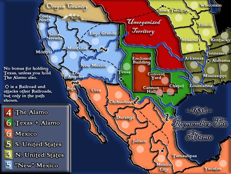
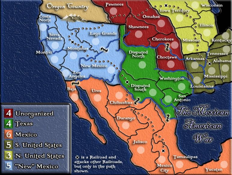
cairnswk wrote:* i like the idea of having the Alamo in there, but some design work needs to be included in texas if it is to exist there; perhaps it could have bonuses for holding it
well, in the first version, it has bonus for holding texas AND the alamo, but i actually think it is just too much to have the Alamo building take up pretty much all of Texas-which it would have to do, to make it worth having on the map.
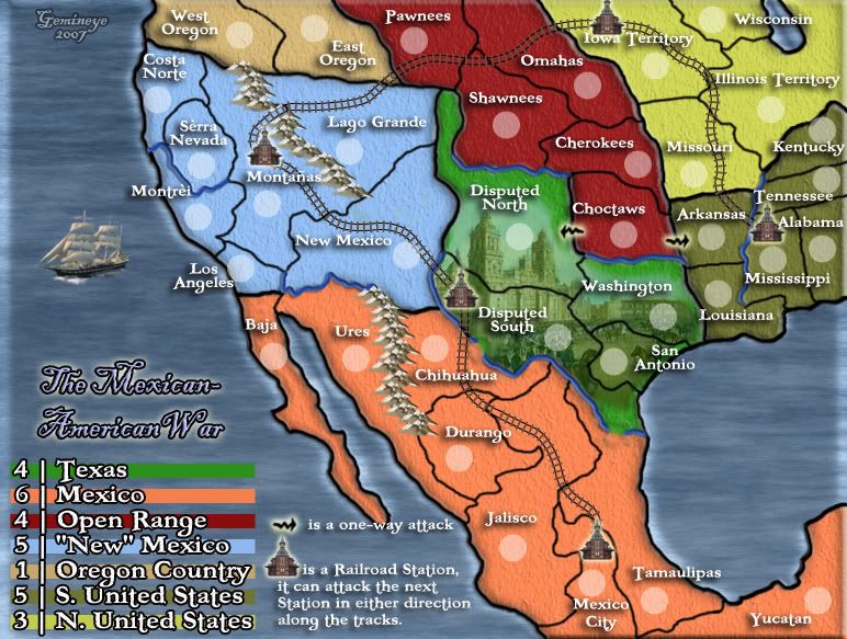
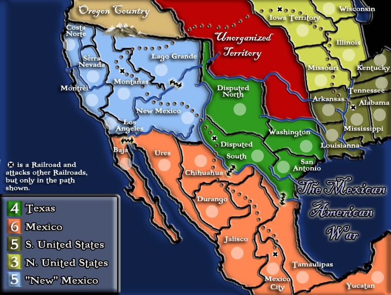
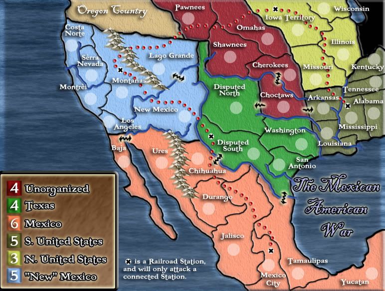
cairnswk wrote:* are the dotted lines actually rail lines or just links between railheads? If they are just railheads, then perhaps the dotted line can be removed to clear up the map a bit and bonuses notated for holding the railheads. If the dotted lines are rail lines, then perhaps explore ways to express that in a manner that doesn't clutter the map; i think the idea of rail-lines would give your map some definite graphic enhancement to make it appealing, but rail-lines would have to be expressed unobtrusively and not in cflict with the territory borders - do explore that however.
i dont plan on putting bonus on the railways. they are simply a connection between
un-bordering territories, and give an added strategy to this map. they only connect through the railway line. i.e. the rail "station" in Montanas only connects to the one in Texas and Iowa Territory, not to Louisiana or Mexico City. if the brown dots dont work well for the railway, what would? i know that Samus suggested actual railroad tracks, but i thought THAT would be very obtrusive...ideas?
cairnswk wrote:* is this the large map at 772 pixels wide? if this is the large map then any enhancements need to be accommodated comfortably in the small map, I have discovered that many players prefer to use a small map. * I think perhaps the territory border line will be too thick.
this is, in fact, the large map. as far as the borders being too thick-i have looked at the 600 version, and they dont seem too big-in the big map the region borders are 6px, and the territory are 4px. so, the small map makes them significantly smaller. if they are too large, i will gladly change them.
cairnswk wrote:* perhaps try a pattern on the ocean to see what that looks like also
i will happily start some textures once we work out the other details.
the feedback is much appreciated, hopefully my first map will be a decent one.